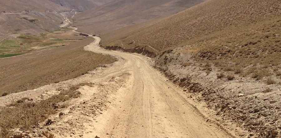
The road to Hajigak Pass is not for timid drivers
Kotal e Hajigak is a high mountain pass at an elevation of 3504m (11,496ft) above sea level, located on the boundary between Maidan Wardak and Bamyan provinces of Afghanistan.

Is the road to Hajigak Pass paved?
The road to the summit is mostly paved. It’s called Kabul-Hajigak-Bamyan Highway. It’s one of the two main routes from Kabul to Bamiyan. Along the way, there are numerous villages in this scarcely populated, rugged area. Road safety is poor throughout the country. Drivers often drive at excessive speeds, and they are aggressive and reckless. Drivers do not respect traffic laws, and Afghan police do not enforce them. Accidents causing fatalities are common.
How long is the road to Hajigak Pass?
The pass is 54.6 km (34 miles) long, running north-south from Tupchi to Zarkharid. The road gives access to the Hajigak Mine, the largest iron oxide deposit in Afghanistan and Asia’s biggest untapped iron ore deposit.
Is the road to Hajigak Pass open in winter?
Set high in the central part of the country, because of the harsh climate of the area, the pass remains covered with snow during most of the year. Due to the heavy snowfalls, the residents have to take their patients to the hospital on donkeys.
Is it safe to travel to Hajigak Pass?
Travel to Afghanistan is strongly advised against due to the volatile security situation, ongoing armed conflict, terrorist attacks, kidnapping risks, arbitrary arrests, and a high crime rate. The situation is unpredictable, with extremist groups planning attacks on various targets. Foreign nationals, including journalists, are at an extreme risk of kidnapping for ransom, with some victims having been killed. If you are already in Afghanistan, stay in a safe place and move cautiously, as you are responsible for your own safety.
Pic: wasiqtaheer