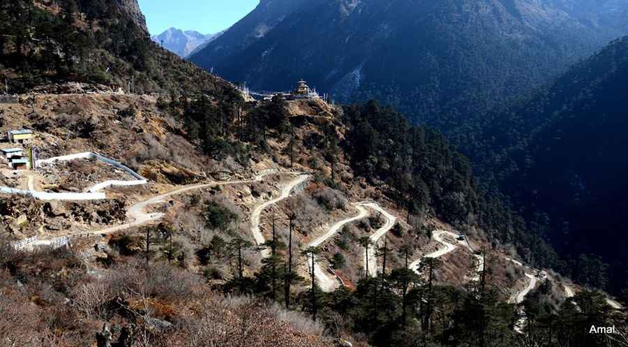
Explore the Roads with the Most Hairpin Turns: How Many Can You Handle?
Many roads around the world are known for their hairpin turns, sharp curves that require drivers to almost double back on their path. These turns, also known as switchbacks, help vehicles navigate steep terrains safely by allowing gradual ascent or descent.

What Are Hairpin Turns?
A hairpin turn is a sharp curve in the road, resembling the angle of a bobby pin. These turns are designed to help vehicles manage steep inclines and descents by providing a way to navigate the terrain without overly steep grades.
Famous Hairpin Roads
Some of the most famous hairpin roads include:
- Alpe d'Huez in the French Alps: Known for its 21 distinctive hairpin turns.
- Lysevegen in Norway: Features 27 iconic bends.
- Trollstigen Road in Norway: Renowned for its 11 characteristic loops.
Lesser-Known Hairpin Roads
While roads like Alpe d'Huez, Lysevegen, and Trollstigen are well-known, many other roads around the world also feature numerous hairpin turns. These lesser-explored roads offer similar driving challenges and scenic views.
This article explores some of these iconic and lesser-known serpentine roads, highlighting the unique driving experiences they offer.
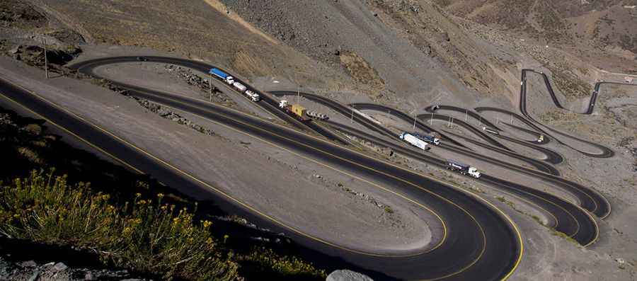
The most spectacular and important pass between Chile and Argentina is Paso de los Libertadores, also known as the Paso del Cristo Redentor, in particular, the stretch that locals call it, rightly, Los Caracoles (Snails Pass). It's one of the most scenic drives in the world. The pass reaches an elevation of 3,200 m (10,499 ft) above the sea level. The Argentina side turns out to be a gentle ascent, up relaxed through rugged mountain scenery of the area until the hole in the tunnel entrance.
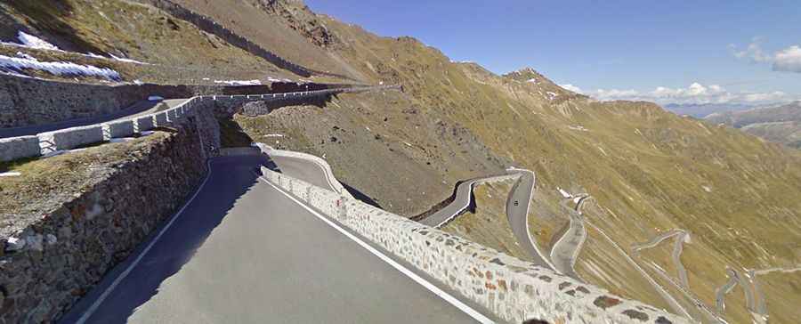
The Stelvio Pass (in German Stilfser Joch) is a high mountain pass at an elevation of 2.757 m (9,045 feet) above sea level, located in the Ortler Alps in Italy between Stilfs in South Tyrol and Bormio in the province of Sondrio. It's one of the highest roads inEurope. The road itself is a marvel of engineering skill; the exhilarating serpentine sections ask to be driven by experienced drivers for their own sakes. The road over the pass s particularly challenging to drive due to the presence of 48 hairpin bends, with the road becoming exceedingly narrow at some points, and some very steep inclines. Featuring hair-raising 180-degree corners, just one wrong move and you could find yourself going over the low concrete barrier and down the side of the Alps.
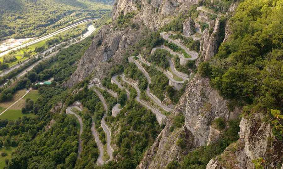
Col du Chaussy is a high mountain pass, at an elevation of 1,533m above sea level, in the D77B road, located in the Savoie department in the Rhône-Alpes region in south-eastern France. The Lacets de Montvernier – or Hairpins of Montvernier – are an astonishing piece of mountain road engineering. It climbs sharply via 17 hairpins tightly stacked one on top of another in just 3km. It's an improbable road clinging to the edge of the cliff. It's one of the most scenic drives in the world.
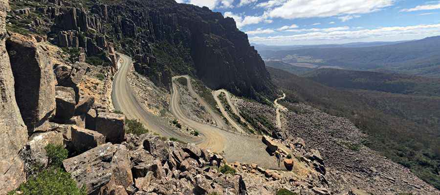
Jacob’s Ladder is the name of the sharply winding and precipitous ascent in a a steep and narrow zig-zag road in Ben Lomond Ranges, Tasmania. The road climbs up to Ben Lomond Mountain, at an elevation of 1.570 meters (5,150 ft) above sea level. The road is unsealed and the final climb up Jacob’s Ladder to the plateau is steep. The turn off to Ben Lomond is 42 kilometres from Launceston via St Leonards on the Blessington Road. 14 kilometres along a well made gravel road, Jacobs Ladder is reached under towering dolerite cliffs. A spectacular drive then ascends Jacobs Ladder. And it’s in these kinds of environments that your vehicle is susceptible to all kinds of damage.
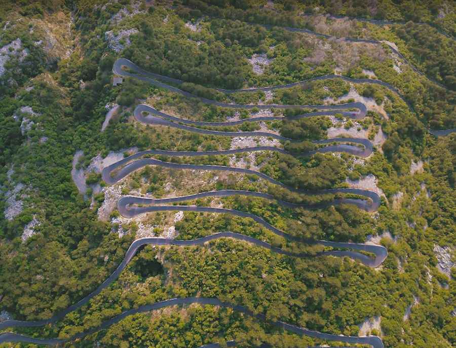
Dangerous curvy mountainous road which rarely permit speeds over 30km/h., located in Montenegro, with a total length of 38km, between the cities of Cetinje and Kotor. The road fis mostly a narrow one-lane road offering stunning views of Kotor from above. The most famous part of the road is a stretch of 8.3km long, pretty steep, with 16 hairpin turns. Along this section, the road starts at an elevation of 458m above sea level, and ends at 881m. Over this distance, the elevation gain is 423 meters. The average percentage is 5,09%.
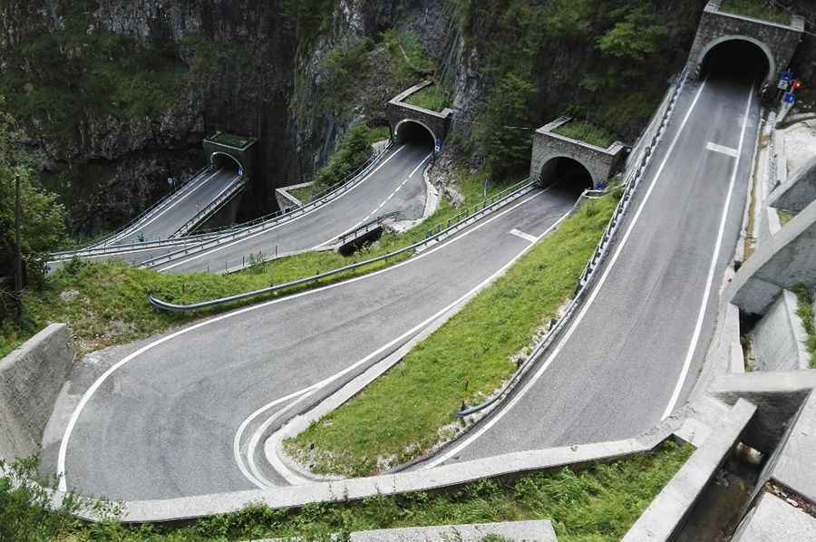
Passo San Boldo is a mountain pass located between the cities of Trichiana and Tovena (Cison di Valmarino) in Veneto, Italy, at an elevation of 706 m (2,316 ft) above sea level, that lies in the northern reaches of the Italian Alps. The most famous part of the climb is a short stretch of 700m including 7 hairpin turns.
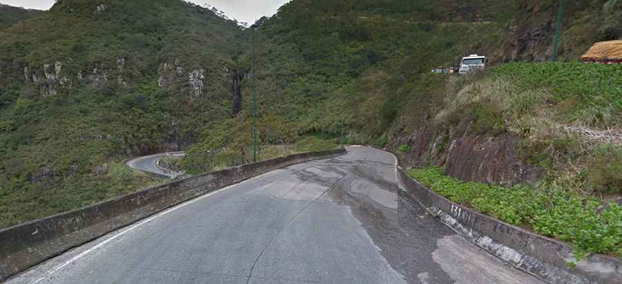
SC-438 is the name of the sharply winding and precipitous ascent in a a steep and narrow zig-zag road in Serra do Rio do Rastro, a mountain range located in Lauro Müller, in the southeast of the state of Santa Catarina, Southern Brazil. The road has remarkable landscapes and deep crags. It's a ludicrously zigzagged route that tumbles past waterfalls, through canyons and past spectacular scenery from start to finish. The road climbs up at an elevation of 1,460 metres (4,790 feet) above sea level. In the highest areas of this place, the Atlantic Ocean, located about 100 km (62 mi) away, can be spotted on clear days.
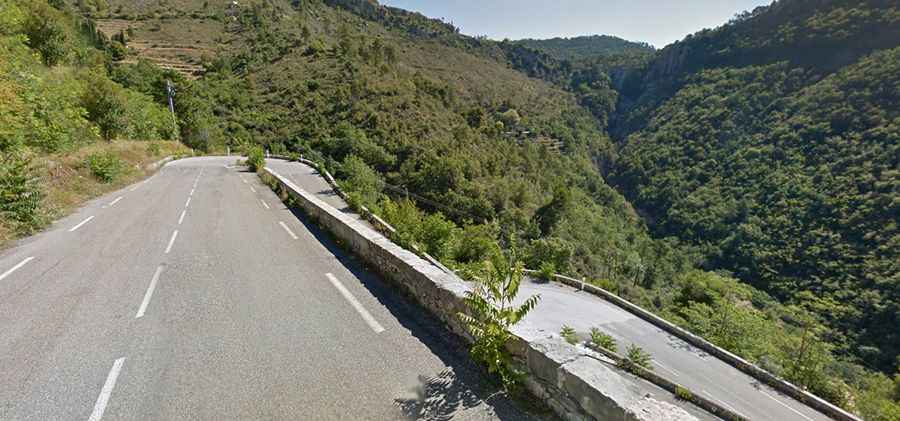
Col de Braus is a mountain pass at an elevation of 1.002m (3,287ft) above sea level, located in the Alpes-Maritimes department in southeastern France. The wide road to reach the summit, called D2204, has a good surface, plenty of hairpins and 180 degrees turns and includes some beautifully engineered stacked hairpins with some amazing views.This col is the main gate to Col de Turini, the famous stage of the Monte Carlo Rally. The road is famous because there are several walled switch backs neatly stacked up on one another, and held in place by walls that could double as medieval fortifications.
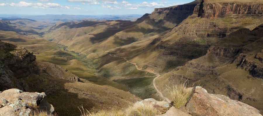
Sani Pass is a high mountain pass at an elevation of 2,876m (9,400ft) above sea level, located in the western end of Kwa Zulu-Natal province of South Africa on the road between Underberg and Mokhotlong, Lesotho. It is a notoriously dangerous road, which requires the use of a 4x4 vehicle. It’s a series of winding twists, hairpins, plunging drops and mind-blowing scenery. Sani Pass pass was built in 1950’s and remains a challenging drive in 4x4 vehicles with all the drama, scenery, bad weather and treacherous conditions expected of a pass with this altitude
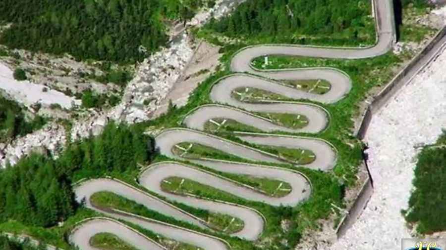
Forcella Lavardet is a high mountain pass in the Dolomites-Alps range, at an elevation of 1.542m (5,000 ft) above sea level, located on the municipality of Vigo di Cadore (Italy). The road has 14 sharp turns that seem to lie on one another, gradually climbing up to the top of the pass. The road, with some unpaved and gravel sections, and connecting Canale di Gorto and Campolongo, is closed to vehicles after some streams and detachments, but is passable by bike, and includes some of the most incredible hairpins in the Carnic Alps. It's called Strada statale 465 della Forcella Lavardet e di Valle San Canciano 465 and it was an old military road.
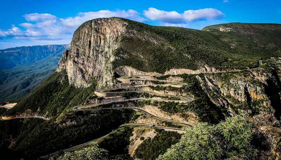
Serra da Leba is a high mountain pass at an elevation of 1.845m (6,053ft) above sea level, located in the province of Huíla, in Angola. The road to the top is asphalted and pretty steep. The most famous part of the climb is a short section of 1.7km, with 7 hairpin turns. The surface of the road is asphalted, and chains or snow tyres can be required throughout the year- Located near the city of Lubango, Serra da Leba is famous for its altitude, for its beauty and also for the road over the pass.
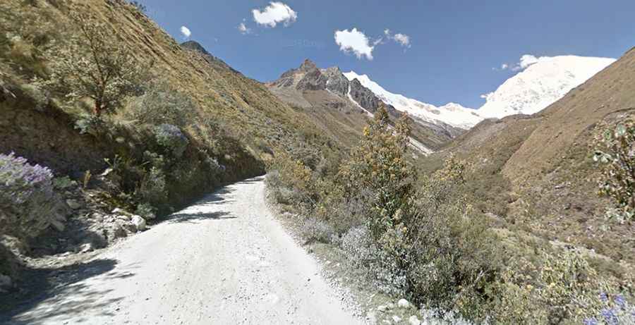
Portachuelo Llanganuco Pass, at an elevation of 4.767m (15.639') above sea level, is perhaps the most significant gateway of the Huascaran National Park, Peru. The most famous section of the road up to the pass is a 8.5km long section. Over this distance, the road includes 28 hairpin turns and the elevation gain is 527 meters. The average percentage is 6.2%.
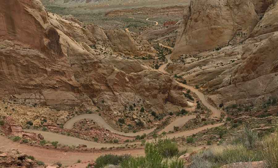
The Burr Trail is a dirt track located in the Us state of Utah, with a length of 68-mile (109 km), winding through dramatic portions of the Grand Staircase Escalante National Monument, Capitol Reef National Park and Glen Canyon National Recreation Area. Although in dry weather it's easily accessible to passenger cars, wet weather may make the road impassable even for 4WD vehicles.
The Sangetsar Lake is a high mountain lake at an elevation of 3.708m above sea level located in the Tawang district, in the northwestern part of Arunachal Pradesh in India. It’s one of the remotest high altitude lakes in India. Often known as Madhuri lake, the road is terrible. Only 4x4. Expect a narrow gravel road, unprotected by guardrails. One requires a special permit from the District Commissioner's (DC) office located at Tawang to visit this lake. Only Indian nationals are allowed here. This lake was formed during the earthquake of 1973. Starting in Zemithang, the road has 52 hairpin turns.
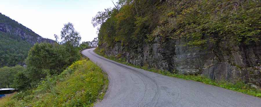
With a length of 1,7km and a gradient of 20%, Stalheimskleiva is one of the steepest roads in Northern Europe. Located in Norway, this one-lane road has 13 hairpin bends and was built by manual labour between 1842 and 1846. The Stalheimskleiva road runs up a ridge between two cascading waterfalls that can both be seen from the road. It’s open except from winter-season. It’s incredibly narrow, so speeds are often reduced as cars make the hairpin turns.
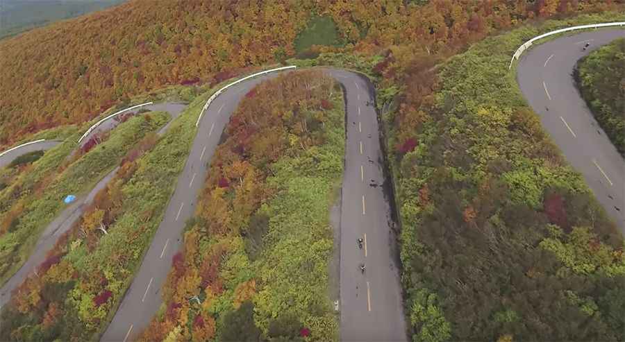
The Tsugaru Iwaki Skyline is one of the most challenging drives on Earth. Located in Japan, this road with 66 hairpin turns will make you carsick just looking at it. This scenic toll road goes from the foot of Mt. Iwaki up to the eighth station, at 1,247 meters (4,091 feet) above sea level. The zig-zagging road is open from Mid April to late October and not recommended if your passengers are prone to car sickness. The gate is open from 8:00 a.m. to 4:30 p.m. (Road closed from 5:00 p.m.). Bicycles aren’t allowed access even when the road is open. The average gradient is 8.66% with sections up to 10%.
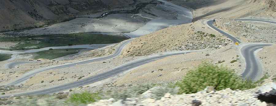
Nestled in the Western Himalayas in the Ladakh region of the Indian state of Jammu and Kashmir, Gata Loops roller coaster ride is a series of 22 hairpin bends that takes you to the top of Nakeela La. These loops are said to be haunted by the ghost of a dead trucker. The loops are 10.3 km and each loop is between 300-600 meters. The longest loops are the last two ones being 800 meters and a kilometer and a half respectively. The angularly elevated roads facilitate passage by loaded trucks. There are shortcuts across the loops but only small vehicles can pass through them.
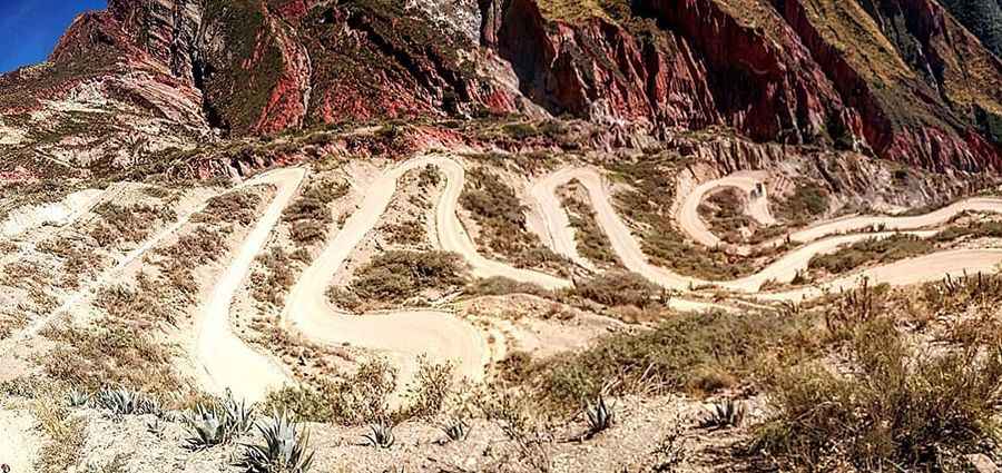
Located in Peru, the road is gravel and pretty narrow. The most challenging part of the road is a collection of 52 hairpin turns in just 10.4km, climbing from 3.075m to 3.894m above the sea level. The average gradient is 7.87%, with some parts up to 15%.
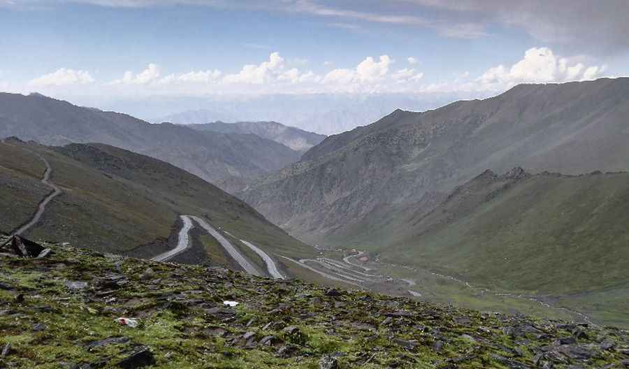
Babusar Pass is a high mountain pass at an elevation of 4.173 m (13,691 ft) above sea level. The pass is the highest point in the Kaghan Valley, Pakistan. The pass connects the Kaghan Valley via the Thak Nala with Chilas on the Karakoram Highway (KKH). From the middle of July up to the end of September the road beyond Naran is open right up to Babusar Pass. However, movement is restricted during the monsoon and winter seasons, but it can be closed anytime when the access is not cleared of snow.
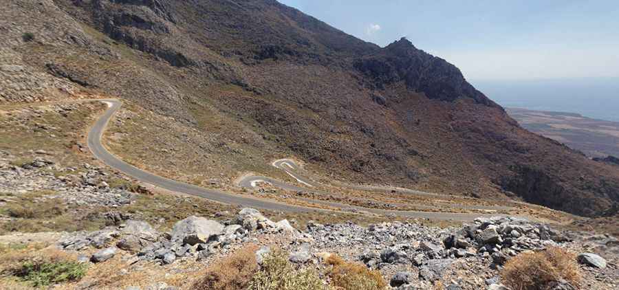
The road between Kallikratis and Kapsodasos is a sharply winding and precipitous ascent in a a steep and narrow zig-zag road in southwest Crete, Greece. The road includes a famous section (2.1km) with 7 hairpin turns and pretty steep (8.95%). This curvy mountainous road which rarely permits speeds over 30km/h, is 11km long and the expected time to drive the whole route is around 24 minutes, with 27 hairpin turns that will take you from the sea level to 800 meter high.
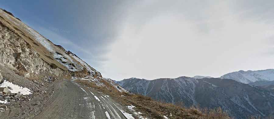
Moldo-Ashuu is a high mountain pass at an elevation of 3,346 m above sea level, located in the Tian Shan mountains of Naryn province, in Kyrgyzstan. It’s said to be one of the most beautiful passes in the country. The road to the summit is gravel. Only 4wd cars. The road runs along the Kurtka river canyon. It’s usually closed from November to March.
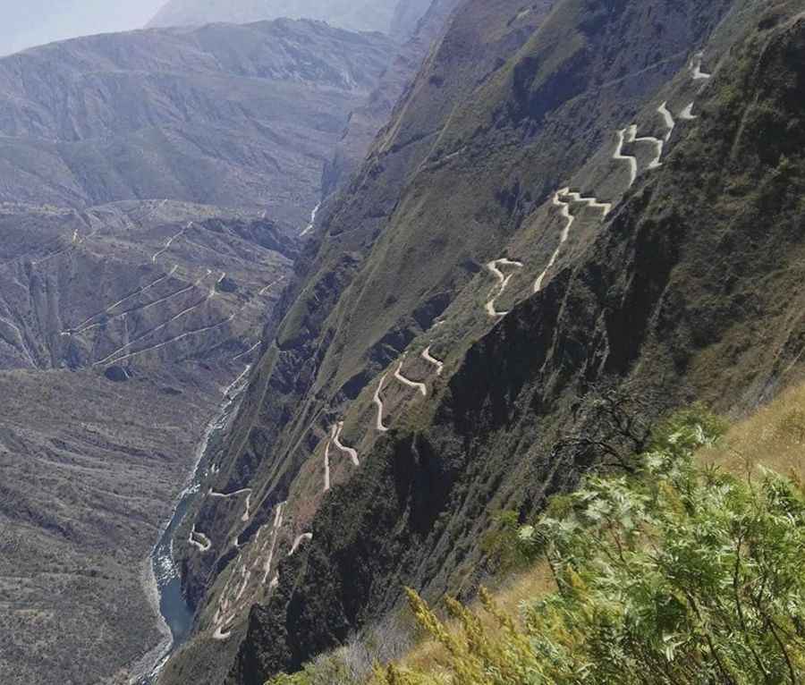
Curvas de Huanchaca is a collection of 24 hairpin turns in the graveled Route 3SF, in southeastern Peru, near the Urubamba Valley of the Andes mountain range. This stretch of road, with a length of 9.8km, starts at 2.261m above sea level, and climbs up to 2.900m. The Curvas de Huanchaca ascent is 9.8 km long. Over this distance, the elevation gain is 639 meters. The average percentage is 6.5 %. The surface of the road is gravel and sand.
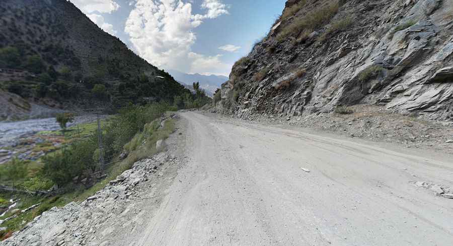
Lowari Pass is a high mountain pass at an elevation of 3.118 m (10,230 ft) above sea level, located in Khyber-Pakhtunkhwa, Pakistan. The road over the pass is called N45 and links Dir and Chitral, and winds its way through the tribal regions bordering Afghanistan. The road is known among locals as Hell's Road. It was built by the British and is a road where even the slightest error can be fatal. The pass is closed by snow from late November to late May every year.
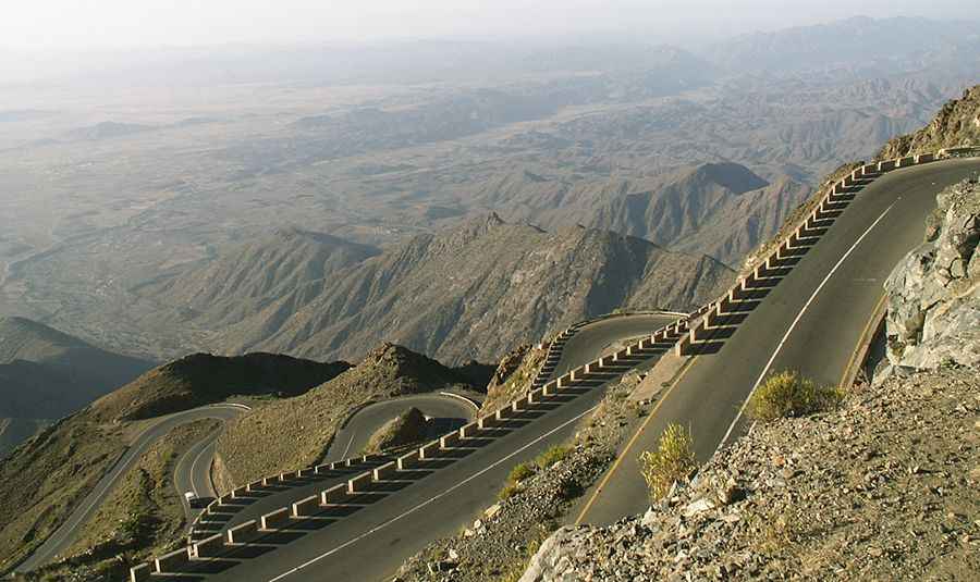
N6 is a paved road located in central Yemen, with a length of 52,1km. The road (also called R4234) tops out by Aqabat Thirah at an elevation of 2.283m (7,490ft) above sea level. The road has 34 switchbacks. The pass is 50km (31.06 miles) long, running from Owen Al-Down to Al Ayn.
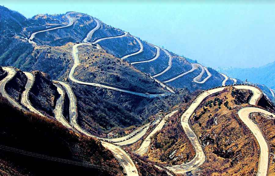
Three Level Zigzag roads is probably the most dizzying road in the world. Located in the Sikkim Indian state, in the Himalayan mountains, the road includes more than 100 hairpins in just 30km. It's one of the most scenic drives in the world. This spiral road is located near Zuluk or Dzuluk, a small village located in the historic Old Silk Route from Tibet to India, on the rugged terrain of the lower Himalayas in East Sikkim. There are sheer drops virtually along the entire route and enough hairpins to make a whirling dervish dizzy.
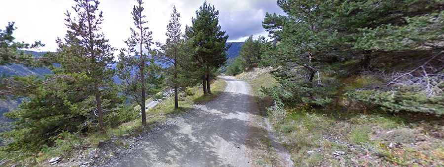
Col de Tende (or Colle di Tenda) is a high mountain pass at an elevation of 1.870m (6,135ft) above sea level, located in the Alps, on the border between France and Italy. In 7km this terrific road includes more than 48 hairpin turns. There are forts along the ridge line in both directions.The first part of the road is asphalted, but then turns into gravel and sand in a bumpy section full of hairpins half-way up. The pass separates the Maritime Alps from the Ligurian Alps. It connects Nice and Tende in Alpes-Maritimes with Cuneo in Piedmont. At the wheel of your hire car, this route will see you negotiate a quite thrilling route through a series of tunnels and cuttings across the Maritime Alps and into France.
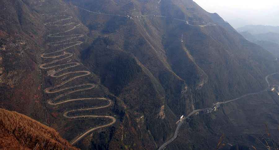
The 24-Zig Road is one of the most spectacular roads in China. This winding mountain road is located near Qinglong town in Guizhou Province, in the southwest of the country. The road is gravel. It was built during WW-II, and played an important role in the supply of China during the war to help resist the Japanese invasion. At present the road is no longer in active use but is still used as a shortcut by motorbikes and three-wheelers.
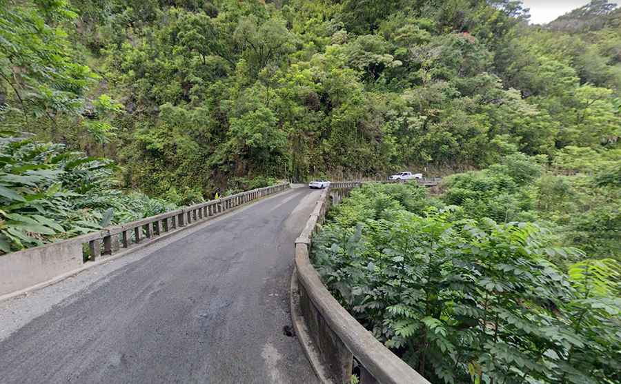
The Hana Highway is one of the most scenic drives in the world. Located in Maui, the second-largest of the Hawaiian Islands, the road is 52 miles (84 km) long. You will pass 617 white-knuckle switchbacks, 56 one-lane bridges, and tons of waterfalls as you travel away from civilization. This snake-like hairpin bends on a warped narrow road links Kahulu i with the town of Hāna. This serpentine coastal route offers a perfect antidote to the vagaries of mainland winters—and a complete escape from daily life. You’ll have to navigate through and around 600 hairpin turns, 54 one-lane bridges, steep cliff drops, falling rocks, and even some confusing mile markers that reset. Plus it rains often. Winding its way past waterfalls, beaches, bridges and spectacular ocean views, the 600 hairpin turns and 54 bridges make it one of the most demanding.
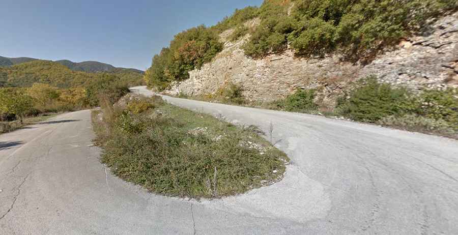
Aristi-Papingo road is a very scenic drive in the Ioannina regional unit, Epirus, Greece, running through the Pindos Mountains. On the drive down you are rewarded with views of a mountainous landscape blanketed in forest as far as the eye can see. The road links the towns of Aristi and Papingo. It is a steep and winding road that takes you slowly past the Voidomatis river. The road encompasses miles of stunning views through twisty hair pin corners, high elevations and steep grades. It’s asphalted and includes 23 hairpin turns. The views are breathtaking, but these subtle hints on every turn remind you to keep your eyes on the road.
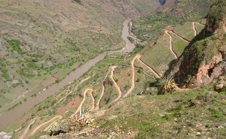
Road 663 is one of the scariest roads in the world. Located near the Llata town, in Huanuco region of Peru, the road is only wide enough for one vehicle, and in many places bordered by a drop of 300 meters unprotected by guardrails. The road is 12.3km long. It’s gravel. Words can’t describe the road and pictures don’t do it justice. Carretera 663 follows the Marañon river. The road is in dreadful condition and requires strong nerves to negotiate it.
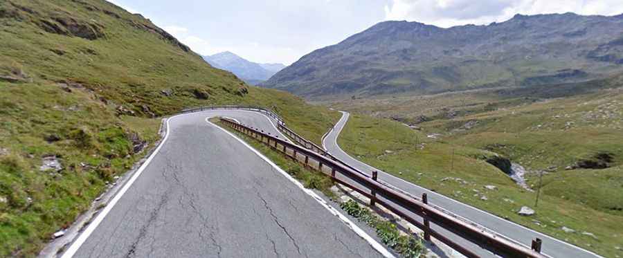
Passo dello Spluga is an international igh mountain pass, at an elevation of 2.115 m (6,939 ft) above sea level, on the border between Switzerland and Italy. A series of hairpins and great views make this one to see and drive. The pass links the Swiss Hinterrhein valley and Splügen in the canton of Graubünden with the Valle Spluga and Chiavenna in the Italian province of Sondrio. The road traversing the pass, the SS36, continues to Lake Como. Near the top, some incredible views of the distant snow covered peaks and valleys become visible. The pass was already in use in the Roman era. This pass has a high regard among cyclists, mostly because of the difficult and exciting south side. There are water and restaurants on the south side, if you need to stop.
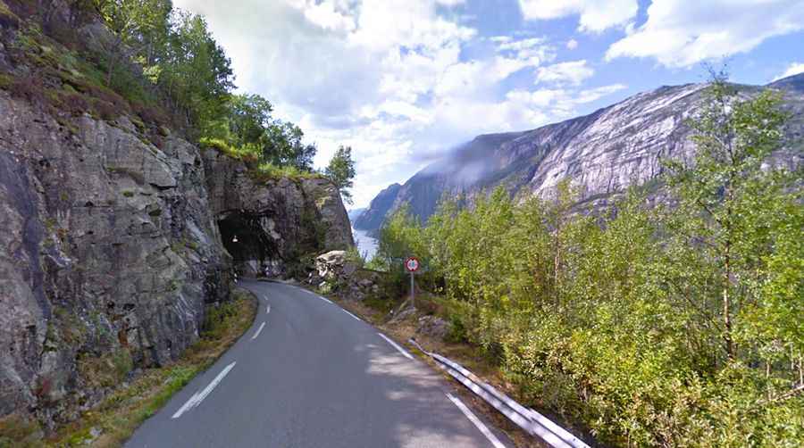
The popular tourist road Lysevegen in Forsand in Ryfylke (FV500) is a curvy mountainous road going from Lysebotn innermost in the Lysefjord to Sirdal, with a length of 29 km (18 mi.) This is an impressive road in the high mountains of Rogaland and Vest Agder some of it single carriageway with passing places - with impressive scenery and weather. This road, located in Rogaland county in the southwest of Norway, has its highest point in the Andersvatn lake, at an elevation of 932 m (3057 ft.) above sea level. At the top of the turns is Øygardstølen that has a parking lot, service building for trips to Kjerag, and food services.
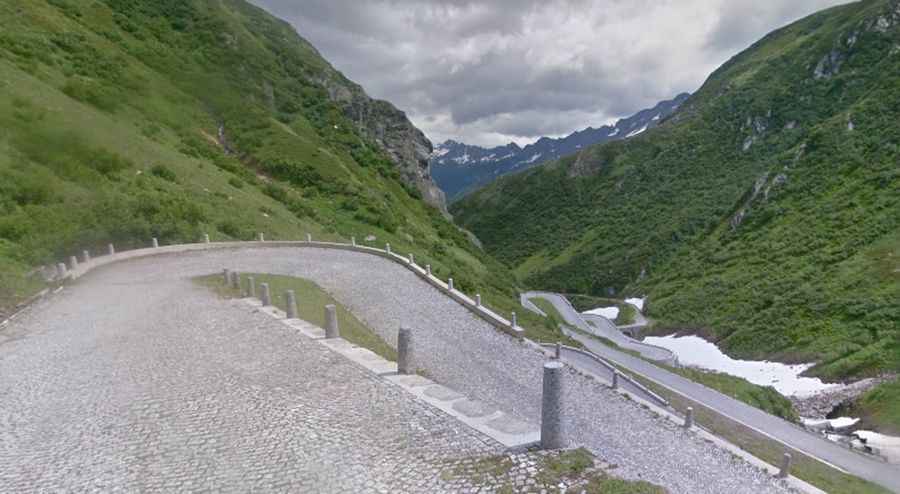
Saint Gotthard Pass is a high mountain pass located in central Switzerland, at an elevation of 2.091m (6,860 feet) above sea level. The first road over the pass was opened in 1830 and connects Airolo in the canton of Ticino, and Göschenen in the canton of Uri. A quick glance at the map, at its sheer drops and serpentine twists and turns, confirms that this is no hype. As the road flattens out at the top of the pass, signs will direct you to the National Gotthard Museum, which will teach you the history of the pass and the efforts to make it more easily passable over the years. The old hospice beside the road now houses the engaging Museo Nazionale del San Gottardo (May–Oct daily 9am–6pm; Fr.8; SMP), which outlines the history of the pass with models, reliefs, paintings and audiovisual slide-shows.
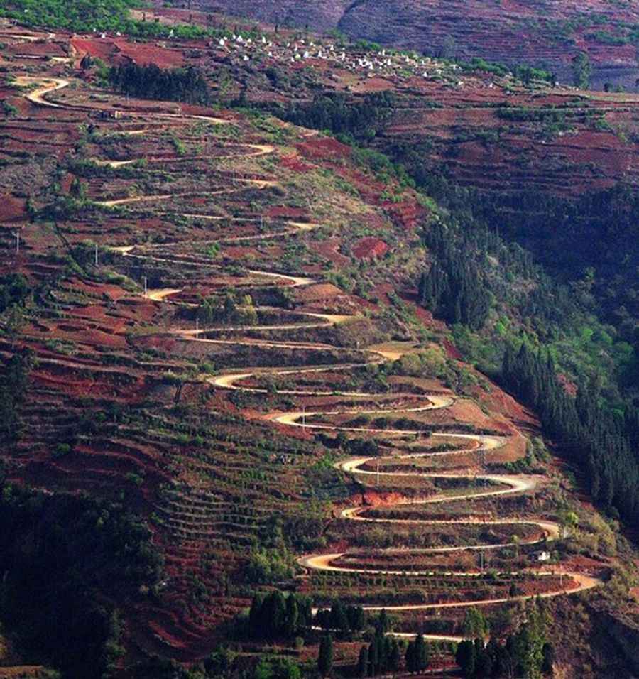
The Old Kunyi Road is one of the most challenging drives in China. It has 26 hairpin turns in just over 2.1 km long. Located in the Yunnan Province, this gravel road is really awesome. There is a sharp turn every few meters. It’s one of most crooked roads in the country. Many locals even do not know it. The road is pretty steep. It’s 2.1km long and the elevation gain is 139m. The average gradient is 6.6%.
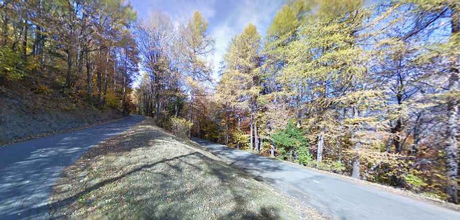
Located in the Savoie department in the Auvergne-Rhône-Alpes region in south-eastern France, the D80 road is 10.3km long and links the towns of Villargondran, at 700m above the sea level and Albiez-le-Jeune, at 1.367 masl on a 38 hairpin turns section. It’s pretty narrow and steep, with an average gradient of 7%, with several ramps over the 10%.
