What are the most spectacular roads in France?
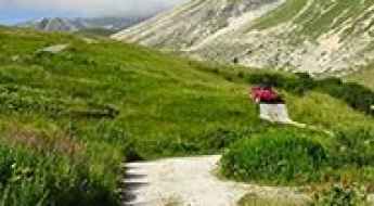
France is a true paradise for those wishing to experience the most spectacular roads, and it provides endless experiences for each driver. From stunning balcony roads, mountain passes, and coastal drives, to roads disappearing with the tides, it hosts more than 750 roads listed as the most spectacular in the world.
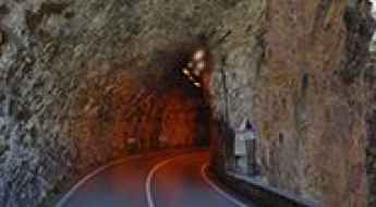
Located in the western part of Europe, France covers an area of 551,695 square kilometers and shares borders with 7 countries: Belgium, Luxembourg, Germany, Switzerland, Italy, Spain, and Andorra. With high mountains in the Alps and the Pyrenees, the roads of the country are famous worldwide because of the Tour de France, the most important cycling race. When traveling to the country, be sure to experience a drive through the best balcony roads. Dramatically carved out of rock on the side of mountains, the balcony roads are a unique experience for any rider.
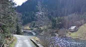
The country also hosts iconic roads, known worldwide, including Col du Chaussy, a mountain pass at 1,533m (5,029ft) above sea level, famous for the “Lacets de Montvernier,” a special 3 km stretch with 17 hairpins as the road virtually climbs a cliff, or Col de Turini, a treacherous Alpine road with a legendary driving history, as one of the most dangerous and challenging stages of the Monte Carlo Rally and one of the most scenic drives in the world. For those preferring another kind of experience, don’t forget to drive Passage du Gois, the tide-covered road. It’s a natural passage flooded twice a day by the high tide leading to the island of Noirmoutier.
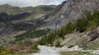
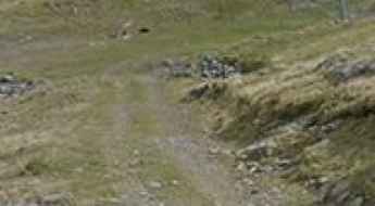
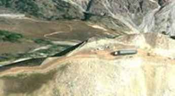
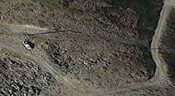
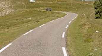
Fort superieur de Saint-Ours
Fort superieur de Saint-Ours is a military fortress, part of the Maginot Line's Alpine extension, at an elevation of 1.874m (6,148ft) above the sea level, located in the Alpes-de-Haute-Provence department in southeastern France.
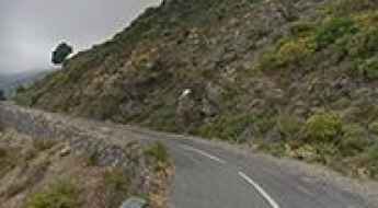
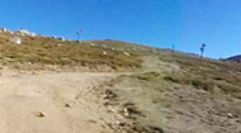
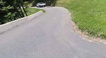
Take the Scenic Route and Discover Bigorno Pass in Corsica
Col de Bigorno is a mountain pass at an elevation of 888m (2,913ft) above the sea level, located in the Haute-Corse department of France on the island of Corsica.
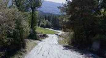
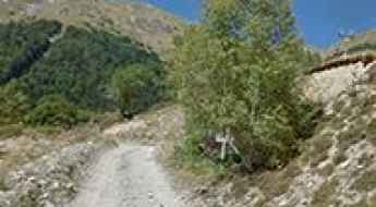
An old military road to Fort de Dormillouse
Fort de Dormillouse is a military fortress at an elevation of 2.480m (8,136ft) above the sea level, located in the Alpes-de-Haute-Provence department in the Provence-Alpes-Côte d'Azur region of France.
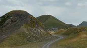
Col des Grands Vans
Col des Grands Vans is a high mountain pass at an elevation of 2.198m (7,211ft) above the sea level, located in the Haute-Savoie department in the Rhône-Alpes region in south-eastern France.
Taking on the Twists and Turns of Gorges de la Mescla
Gorges de la Mescla is a very scenic canyon located in the Alpes-Maritimes department, in the Provence-Alpes-Côte d'Azur region of France.
Ultimate 4wd destination: Cima di Tombue
Cima di Tombue is a mountain pass at an elevation of 1.200m (3,937ft) above the sea level, located in the Haute-Corse department of France on the island of Corsica. It’s one of the highest roads of Corsica.
Crete du Lys
Crete du Lys is a high mountain peak at an elevation of 2.421m (7,942ft) above the sea level, located in the Hautes-Pyrénées department and the region of Occitanie in south-western France.
Lago d'Arpon
Lago d'Arpon is a high mountain lake at an elevation of 1.830m (6,003ft) above the sea level located on the border of France and Italy.

Sommet du Becoin
Sommet du Becoin is a high mountain peak at an elevation of 2.311m (7,582ft) above the sea level, located in the Savoie département in the Auvergne-Rhône-Alpes region in south-eastern France.

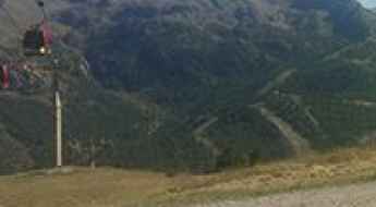
Pointe des Mossettes
Pointe des Mossettes is an international high mountain pass on the French-Swiss border atop the ski slopes above Avoriaz at an elevation of 2.252m (7,388ft) above the sea level.
Hospice de Rioumajou
Hospice de Rioumajou is a high mountain refuge&restaurant at an elevation of 1.559m (5,114ft) above the sea level, located in the Hautes-Pyrénées department, in the Occitanie region of France.
Travel guide to the top of Le Collu in the Alps
Le Collu is a high mountain peak at an elevation of 1.988m (6,522ft) above the sea level, located in the Haute-Savoie department in the Auvergne-Rhône-Alpes region in south-eastern France.
Coume Lounque
Coume Lounque is a high mountain peak at an elevation of 2.362m (7,749ft) above the sea level, located in the Hautes-Pyrénées department, in south-western France.
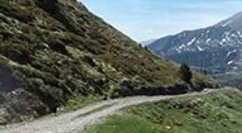
Driving the narrow road to Pla de las Peyres in the Pyrenees
Pla de las Peyres is a high mountain plateau at an elevation of 1,707m (5,600ft) above sea level, located in the Ariège department of France.
Col de Muraton
Col de Muraton/ Passo del Muratone is an international mountain pass at an elevation of 1.163m (3,815ft) above the sea level, located on the border of France and Italy.
Col de Chaudun
Col de Chaudun is a high mountain pass at an elevation of 1.693m (5,554ft) above the sea level, located in the Hautes-Alpes department, in southeastern France.
Corna Pass
Pas de la Corne (Passo della Corna) is an international high mountain pass at an elevation of 1.046m (3,431ft) above the sea level, located on the Italian-Franch border.
Colle de Carsene
Colle de Carsene is a high mountain pass at an elevation of 2.221m (7,286ft) above the sea level, located in the Cottian Alps, between France and Italy.
Travel Guide to Col de Mahourat in the Pyrenees
Col de Mahourat is a high mountain pass at an elevation of 1.740m (5,708ft) above the sea level, located in the Pyrénées-Atlantiques department in south-western France.
Travel guide to the top of Mont Rond
Mont Rond is a high mountain peak at an elevation of 1.540m (5,052ft) above the sea level, located in the Ain department in eastern France.
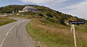
An iconic road to Col du Grand Ballon in the Vosges Mountains
Col du Grand Ballon is a mountain pass at an elevation of 1.343m (4,406ft) above the sea level, located in the Haut-Rhin department of the Grand Est region, in France.
Col du Couvercle
Col du Couvercle is a high mountain pass at an elevation of 2.282m (7,486ft) above the sea level, located in the Savoie department in the Auvergne-Rhône-Alpes region in south-eastern France.
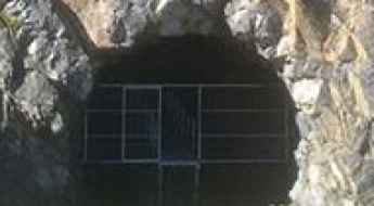
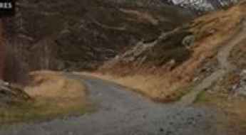
The unfinished Port de Rat Tunnel
Located in the Pyrenees mountain range, the Port de Rat tunnel is an unfinished high mountain tunnel, which had to connect Andorra and France.
Col de la Replanette
Col de la Replanette is a high mountain pass at an elevation of 2.328m (7,637ft) above the sea level, located in the Savoie department in the Auvergne-Rhône-Alpes region in south-eastern France. The average gradient is 13.35%.
Las Donnas
Las Donnas is a high mountain peak at an elevation of 2.260m (7,414ft) above the sea level, located in the French alps, in the Alpes-Maritimes department in southeastern France.
Take the Scenic Route and Discover Col de la Croix
Bocca à Croce is a mountain pass at an elevation of 929m (3,047ft) above the sea level, located in the Haute-Corse department of France on the island of Corsica.
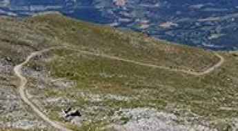
Driving the 8 highest roads of Corsica
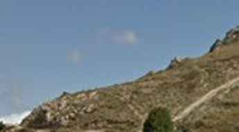
Surrounded by rugged and rocky coasts, Corsica is a Mediterranean island located southeast of France and west of Italy. The island represents a large variety of morphological landscapes, and for the most part, the terrain of Corsica is mountainous: Mont Cinto is the highest peak, reaching to 2706m, while more than 30 summits surpass 2000m. It one of 18 French regions, with Ajaccio as its capital. It is the fourth largest island in the Mediterranean, behind Sicily, Sardinia and Cyprus.
Crete de la Serre Thibaud
Crete de la Serre Thibaud is a high mountain peak at an elevation of 2.517m (8,257ft) above the sea level, located in the Hautes-Alpes department in southeastern France.
Le Chalvet
Le Chalvet is a high mountain peak at an elevation of 2.583m (8,474ft) above the sea level, located in the Hautes-Alpes department in southeastern France, near the Italian border.
Cima Becco Rosso
Becco Rosso pass is a high mountain pass at an elevation of 2.261m (7,417ft) above the sea level, located in the Alps, on the border of France and Italy.
Coll dels Isards
Coll dels Isards is an international high mountain pass at an elevation of 2.590m (8,497ft) above the sea level, located on the border of France and Andorra.

Refuge des Camporells
Refuge des Camporells is a high mountain refuge at an elevation of 2.252m (7,388ft) above the sea level, located in the Pyrénées-Orientales department in southern France, near the Spanish border.
Le Petit Cordeil
Le Petit Cordeil is a high mountain peak at an elevation of 1.768m (5,800ft) above the sea level, located in the Alpes-de-Haute-Provence department in southeastern France. The average gradient is 8.98%.
Col de la Roubine
Col de la Roubine is a high mountain pass at an elevation of 2.304m (7,559ft) above the sea level, located in the Alpes-Maritimes department in southeastern France.
Travel guide to the top of Roc d'Aude
Roc d'Aude (Roc d'Auda) is a high mountain peak at an elevation of 2.361m (7,746ft) above the sea level, located in the Pyrénées-Orientales department in southern France.

Col de l’Alpet
Col de l’Alpet is a high mountain peak at an elevation of 2.447m (8,028ft) above the sea level, located in the Hautes-Alpes department in southeastern France.
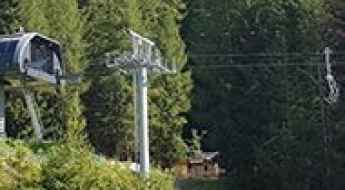
La Marquise
La Marquise is a high mountain lift at an elevation of 2.440m (8,005ft) above the sea level, located in the Savoie department in the Auvergne-Rhône-Alpes region in south-eastern France.
Pic Mercader
Pic Mercader, also known as Tossal Mercader, is a high mountain peak atn an elevation of 2.468m (8,097ft) above the sea level, located on the border of Ariège and Pyrénées-Orientales departments in southern France.
Coll de Pradelles
Coll de Pradelles is a high mountain pass at an elevation of 1.995m (6,545ft) above the sea level, located in the Pyrénées-Orientales department in southern France, near the Spanish border.
Lac du Lou
Lac du Lou is a high mountain lake at an elevation of 2.059m (6,755ft) above the sea level, in the Savoie department in the Auvergne-Rhône-Alpes region in south-eastern France.
Road D25C
D25C is a very challenging mountain road located on the border of Aude department and Ariège department in southwestern France.
Col de l’Ours
Col de l’Ours is a high mountain pass at an elevation of 1.936m (6,351ft) above the sea level, located in the Pyrénées-Atlantiques department in south-western France.
Col du Tra: a curvy steep road only for experienced drivers
Col du Tra is a high mountain pass at an elevation of 1.312m (4,304ft) above the sea level, located in the Savoie department in the Auvergne-Rhône-Alpes region in south-eastern France. Overall this road is a goody for motorbike drivers – but be careful – it could be your last.
Serre Doumenge
Serre Doumenge is a high mountain peak at an elevation of 2.232m (7,322ft) above the sea level, located on the border of Haute-Garonne and Hautes-Pyrénées departments, in south-western France.
Col de la Vallette
Col de la Vallette is a high mountain pass at an elevation of 2.349m (7,706ft) above the sea level, located in the Alpes-Maritimes department in southeastern France.