What are the most spectacular roads in France?
France is a true paradise for those wishing to experience the most spectacular roads, and it provides endless experiences for each driver. From stunning balcony roads, mountain passes, and coastal drives, to roads disappearing with the tides, it hosts more than 750 roads listed as the most spectacular in the world.
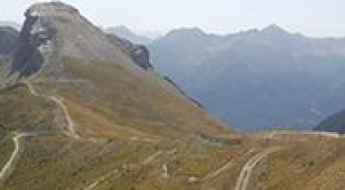
Located in the western part of Europe, France covers an area of 551,695 square kilometers and shares borders with 7 countries: Belgium, Luxembourg, Germany, Switzerland, Italy, Spain, and Andorra. With high mountains in the Alps and the Pyrenees, the roads of the country are famous worldwide because of the Tour de France, the most important cycling race. When traveling to the country, be sure to experience a drive through the best balcony roads. Dramatically carved out of rock on the side of mountains, the balcony roads are a unique experience for any rider.
The country also hosts iconic roads, known worldwide, including Col du Chaussy, a mountain pass at 1,533m (5,029ft) above sea level, famous for the “Lacets de Montvernier,” a special 3 km stretch with 17 hairpins as the road virtually climbs a cliff, or Col de Turini, a treacherous Alpine road with a legendary driving history, as one of the most dangerous and challenging stages of the Monte Carlo Rally and one of the most scenic drives in the world. For those preferring another kind of experience, don’t forget to drive Passage du Gois, the tide-covered road. It’s a natural passage flooded twice a day by the high tide leading to the island of Noirmoutier.
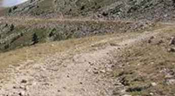
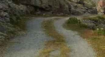
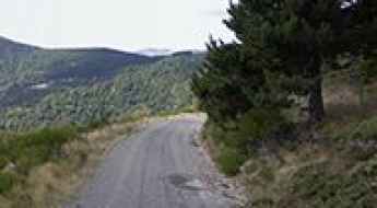
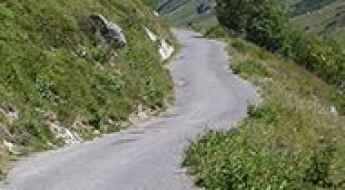
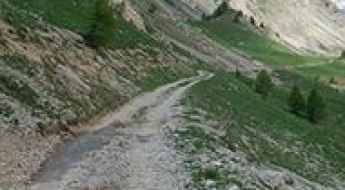
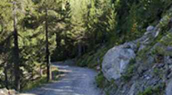
Bocca di Verdia, winding road in Corsica
Bocca di Verdi, also known as Col de Verde, is a mountain pass at an elevation of 1.289m (4,229ft) above the sea level, located on the border of the Corse-du-Sud and Haute-Corse departments of France on the island of Corsica.
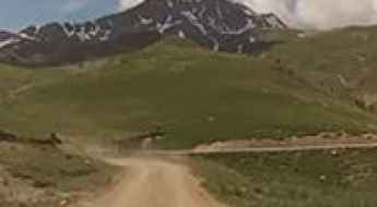
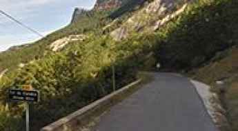
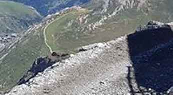
A memorable road trip to Coll des Molles
Coll des Molles is a high mountain pass at an elevation of 2.089m (6,853ft) above the sea level, located in the Pyrénées-Orientales department in southern France, near the border with Spain and the Autonomous Community of Catalonia.
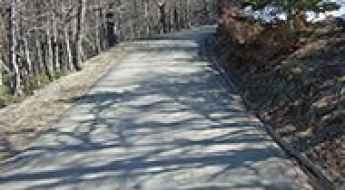
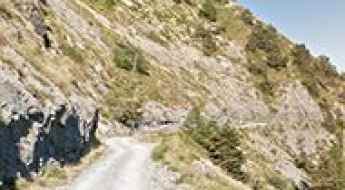
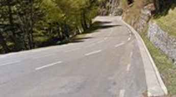
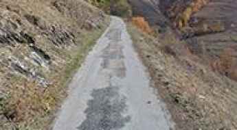
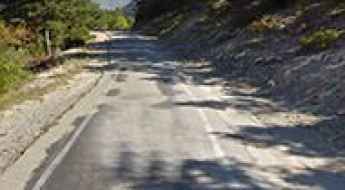
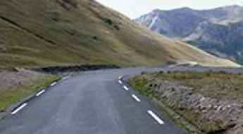
The narrow D102 is a dangerous balcony road
D102 is a short mountain road located in the Alpes-de-Haute-Provence department, in the region of Provence-Alpes-Côte d'Azur in southeastern France. It’s one of the most scenic French balcony roads.
Col de la Quillane
Col de la Quillane is a high mountain pass at an elevation of 1.714m (5,623ft) above the sea level, located in the Pyrénées-Orientales, in southern France.
Col Bagargui
Col Bagargui is a mountain pass at an elevation of 1.327m (4,353ft) above the sea level, located in the Pyrénées-Atlantiques department in south-western France.
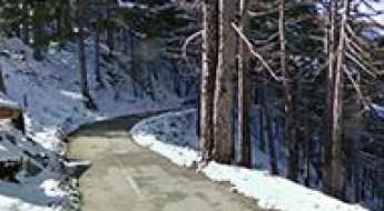
A nice paved road to Col de Solaison
Col de Solaison is a mountain pass at an elevation of 1.500m (4,921ft) above the sea level, located in Haute-Savoie, in the Rhône-Alpes region of eastern France, bordering both Switzerland and Italy.
Col de la Bataille
Col de la Bataille is a mountain pass at an elevation of 1.313m (4,307ft) above the sea level, located in the Drôme department in southeastern France.
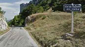
The Ultimate Guide to Traveling the Col de Tourniol
Col de Tourniol is a mountain pass at an elevation of 1.145m (3,756ft) above the sea level, located in the Drôme department in Auvergne-Rhône-Alpes region, in southeast-central France.
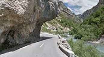
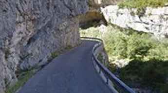
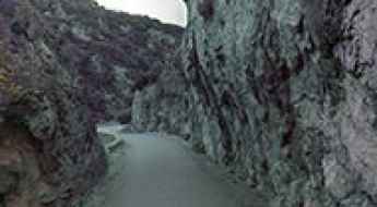
Clue de Chasteuil, a balcony road in France
Clue de Chasteuil is a very scenic drive located in the Alpes-de-Haute-Provence department in southeastern France. It’s one of the famous French balcony roads. Driving on this narrow road between walls of cliffs and gorges is a delight.
The Wild Road to Mont Chiran
Mont Chiran is a high mountain peak at an elevation of 1.905m (6,250ft) above the sea level, located in the Alpes-de-Haute-Provence department in the south of France.
Road trip guide: Conquering Col du Lisey
Col du Lisey is a high mountain pass at an elevation of 2.086m (6,843ft) above the sea level, located in the Hautes-Pyrénées department, in the Midi-Pyrénées.
An epic enthralling road to Signale de Lure
Signale de Lure is a high mountain pass at an elevation of 1.826m (5,991ft) above the sea level, located in the department of Alpes-de-Haute-Provence, in France.
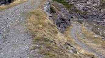
A winding road to Bocca di Sorba in Corsica
Bocca di Sorba is a mountain pass at an elevation of 1.311m (4,301ft) above the sea level, located in the Haute-Corse department of France on the island of Corsica. The road to the summit is awesome, with sections up to 10.7%. Tight bends and faster sweepers. It’s one of the highest roads of Corsica.
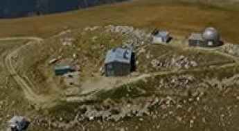
Road trip guide: Conquering Refuge Drayères
Refuge Drayères is a high mountain refuge at an elevation of 2.189m (7,181ft) above the sea level, located in the Hautes-Alpes department in southeastern France.
Travel guide to the top of Col des Embrasures
Col des Embrasures is a high mountain pass at an elevation of 2.305m (7,562ft) above the sea level, located in the Savoie department in the Auvergne-Rhône-Alpes region in south-eastern France, near the Italian border.
An old military road to the summit of Monte Grai
Monte Grai is an international high mountain peak at an elevation of 1,920m (6,299ft) above sea level, located on the French-Italian border.
Col de la Clin
Col de la Clin is a mountain pass at an elevation of 1.250m (4,101ft) above the sea level located in the Haute-Garonne department in southwestern France.
An awe-inspiring road to Col des Basses
Col des Basses is a high mountain pass at an elevation of 1.786m (5,859ft) above the sea level, located in the Pyrénées-Orientales department in southern France, near the border with Spain and the Autonomous Community of Catalonia.
Cirque de Cilaos
Cirque de Cilaos is a large rock amphitheater, at an elevation of 1.586m (5,203ft) above the sea level, located on the French island of Réunion in the Indian Ocean. The sometimes nail-biting drive is well worth it!
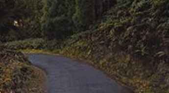
Gorges de Padern, a balcony road in France
The scenic Gorges de Padern are located in the Aude department in southern France. It’s one of the French balcony roads.
Chalet-Refuge des Mottets
Chalet-Refuge des Mottets is a high mountain refuge at an elevation of 1.872m (6,1414ft) above the sea level located in the Savoie department in the Rhône-Alpes region in south-eastern France.
The road to Col Nazie, pure adventure
Col Nazie is a high mountain pass at an elevation of 1.902m (6,240ft) above the sea level, located in the Isère department in the Auvergne-Rhône-Alpes region in southeastern France.
A defiant road to Col des Cortalets
Col des Cortalets is a high mountain pass at an elevation of 2.050m (6,725ft) above the sea level, located in the Pyrénées-Orientales department in southern France.
The steep narrow road to Lac des Gloriettes
Barrage des Gloriettes is a high mountain lake in the Hautes-Pyrénées department in south-western France.
The Road to Col de Cannelle is Not for the Faint of Heart
Col de Cannelle is an international high mountain pass at an elevation of 1,882 meters (6,174 feet) above sea level, located on the border between France and Italy.
Semnoz
Semnoz, also known as Crêt de Chatillon, is a high mountain pass at an elevation of 1.660m (5,446ft) above the sea level, located in the Bauges range, in Haute-Savoie, France.
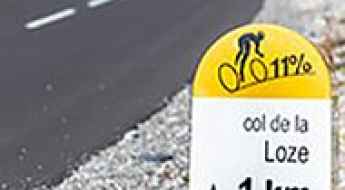
A new paved road to Col de la Loze
Col de la Loze is a high mountain pass at an elevation of 2.308m (7,572ft) above the sea level, located in the Savoie department in the Auvergne-Rhône-Alpes region in south-eastern France.
A narrow road to the top of Col de Carabes
Col de Carabes is a mountain pass at an elevation of 1.261m (4,137ft) above the sea level, located in southeastern France.
Road trip guide: Conquering Col de Valbelle
Col de Valbelle is a high mountain pass at an elevation of 2.372m (7,782ft) above the sea level, located in the Hautes-Alpes department in southeastern France.
The breathtaking road to Col du Mottet oú de Roche Blanche
Col du Mottet is a high mountain pass at an elevation of 2.374m (7,788ft) above the sea level, located in the Massif de la Vanoise range, in Savoie department, in the Auvergne-Rhône-Alpes region of the French Alps.
Lac de l’Ouillette
Lac de l’Ouillette is a high mountain lake at an elevation of 2.521m (8,270ft) above the sea level, situated in the department of Savoie, in France, near the border with Italy.
Tete de Veret: this drive is not for timid drivers
Tete de Veret is a high mountain peak at an elevation of 2.309m (7,575ft) above the sea level, located in the Haute-Savoie department in the Rhône-Alpes region in south-eastern France.
Col du Lauzet
Col du Lauzet is a high mountain pass at an elevation of 2.225m (7,299ft) above the sea level, located in the Hautes-Alpes department in southeastern France.
Fort de Pattacreuse
Fort de Pattacreuse is a high mountain fortress at an elevation of 2.385m (7,824ft) above the sea level, located in the Savoie department in the Rhône-Alpes region in south-eastern France.
Travel guide to the top of Col du Grand Renard
Col du Grand Renard is a high mountain pass at an elevation of 2.455m (8,054ft) above the sea level, located in the Savoie department in the Rhône-Alpes region in south-eastern France.
Col de Vaumale
Col de Vaumale is a mountain pass at an elevation of 1.202m (3,943ft) above the sea level, located in the Var department in the Provence-Alpes-Côte d'Azur region in southeastern France.
Don’t glance down at your phone on Ravin de la Platte
Ravin de la Platte is a high mountain ravine at an elevation of 1.853m (6,079ft) above the sea level, located in the Hautes-Alpes department in the Provence-Alpes-Côte d'Azur region of France. It’s definitely not for anyone suffering from vertigo.
Col de Corobin
Col de Corobin is a mountain pass at an elevation of 1.230m (4,035ft) above the sea level, located in the Alpes-de-Haute-Provence department in southeastern France.
Col du Buis
Col du Buis is a mountain pass at an elevation of 1.196m (3,923ft) above the sea level, located in the Alpes-Maritimes department in the Provence-Alpes-Côte d'Azur region of South-eastern France.
Sommet de la Saulire, one of the highest roads of France
Sommet de la Saulire is a high mountain pass at an elevation of 2.697m (8,848ft) above the sea level, located in the Massif de la Vanoise range, in Savoie department, in the Auvergne-Rhône-Alpes region of the French Alps.
Col des Fourches
Col des Fourches is a high mountain pass at an elevation of 2.258m (7,408ft) above the sea level located in the Maritime Alps, in the French region of Provence-Alpes-Côte-d'Azur
Fort de Lenlon
Fort de Lenlon is a military fortress at an elevation of 2.508m (8,228ft) above the sea level, located in the Dauphiné region of southeastern France.
A Most Tricky Scenic Drive to Lac de la Glère
Lac de la Glère is a high mountain lake at an elevation of 2.152m (7,060ft) above the sea level, located in the Hautes-Pyrénées department in the Occitanie region of south-western France.
Road trip guide: Conquering Col de l’Eychauda
Col de l’Eychauda is a high mountain pass at an elevation of 2.433m (7,982ft) above the sea level, located in the Hautes-Alpes department in southeastern France.
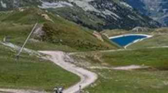
Grande Motte
Grande Motte is a high mountain peak at an elevation of 3.030m (9,940ft) above the sea level, located in Savoie department in the Auvergne-Rhône-Alpes region, France. It’s one of the highest roads of Europe.