What are the most spectacular roads in France?
France is a true paradise for those wishing to experience the most spectacular roads, and it provides endless experiences for each driver. From stunning balcony roads, mountain passes, and coastal drives, to roads disappearing with the tides, it hosts more than 750 roads listed as the most spectacular in the world.
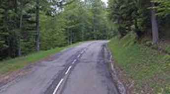
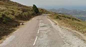
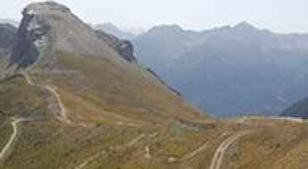
Located in the western part of Europe, France covers an area of 551,695 square kilometers and shares borders with 7 countries: Belgium, Luxembourg, Germany, Switzerland, Italy, Spain, and Andorra. With high mountains in the Alps and the Pyrenees, the roads of the country are famous worldwide because of the Tour de France, the most important cycling race. When traveling to the country, be sure to experience a drive through the best balcony roads. Dramatically carved out of rock on the side of mountains, the balcony roads are a unique experience for any rider.
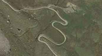
The country also hosts iconic roads, known worldwide, including Col du Chaussy, a mountain pass at 1,533m (5,029ft) above sea level, famous for the “Lacets de Montvernier,” a special 3 km stretch with 17 hairpins as the road virtually climbs a cliff, or Col de Turini, a treacherous Alpine road with a legendary driving history, as one of the most dangerous and challenging stages of the Monte Carlo Rally and one of the most scenic drives in the world. For those preferring another kind of experience, don’t forget to drive Passage du Gois, the tide-covered road. It’s a natural passage flooded twice a day by the high tide leading to the island of Noirmoutier.
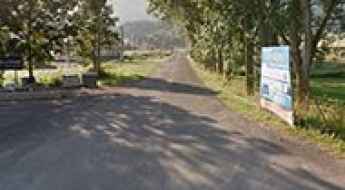
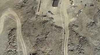
Fort de la Grande Maye
Fort de la Grande Maye is a high mountain fort at an elevation of 2.401m (7,877ft) above the sea level, located in the Hautes-Alpes department in southeastern France.
Col de la Lit
Col de la Lit is a high mountain pass at an elevation of 1.664m (5,459ft) above the sea level, located in the Hautes-Pyrénées department in south-western France.
Col d’Entre les Tetes
Col d’Entre les Tetes is a high mountain peak at an elevation of 2.760m (9,055ft) above the sea level, located in Rhone-Alpes in the French Isère département. It’s one of the highest roads of Europe.
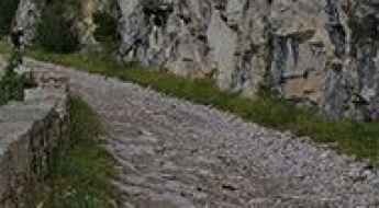
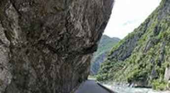
Gorges du Terme Inférieur, a stunning balcony road
Gorges du Terme Inférieur is the name of a very challenging canyon located in the Pyrénées-Orientales department of the region of Occitanie, in Southern France. It’s one of the most scenic French balcony roads.
Col du Teil
Col du Teil is a high mountain pass at an elevation of 1.628m (5,341ft) above the sea level, located in the Aude department of southern France.
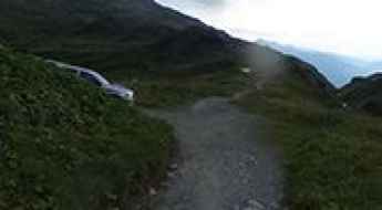
Here's How To Have The Ultimate Road Trip To Refuge de Moede Anterne
Refuge de Moëde Anterne is a high mountain refuge at an elevation of 1.984m (6,509ft) above the sea level, located on the Fiz mountains, in the Savoie department in the Auvergne-Rhône-Alpes region in south-eastern France.
Pointe du Dzonfié
Pointe du Dzonfié is a high mountain peak at an elevation of 2.185m (7,168ft) above the sea level, located in the Savoie department in the Auvergne-Rhône-Alpes region in south-eastern France.
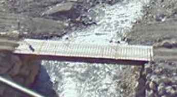
Le Beoux Bridge
Le Beoux pont is located in the Hautes-Alpes department in southeastern France. It’s one of the most spectacular bridges in the world.
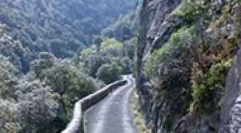
Route de Duranus is an Absolute Must for Scenic Road Lovers
Route de Duranus is a breathtaking drive located in the Alpes-Maritimes department of France. It’s one of the most scenic French balcony roads.
Collada del Vent
Collada del Vent is a high mountain pass at an elevation of 2.301m (7,549ft) above the sea level, located in the Pyrénées-Orientales department in southern France, near the border with Spain and the Autonomous Community of Catalonia.
Tête de la Sallaz
Tête de la Sallaz is a high mountain peak at an elevation of 1.992m (6,535ft) above the sea level, located in the Haute-Savoie department in the Auvergne-Rhône-Alpes region in south-eastern France. The average gradient is 14.74% with some sections up to 20%.
Lac Long Supérieur
Lac Long Supérieur is a high mountain lake at an elevation of 2.126m (6,975ft) located in the Mercantour Massif, in the Alpes-Maritimes department in southeastern France.
Llac Amagat
Llac Amagat is a high mountain lake at an elevation of 2.303m (7,555ft) above the sea level, located in the Pyrénées-Orientales department in southern France.
Collet des Michels
Collet des Michels is a mountain pass at an elevation of 920m (3,018ft) above the sea level, located in the Hautes-Alpes department in southeastern France.

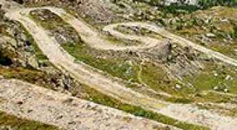
Les Tourniquets d'Astoin
Les Tourniquets d'Astoin is the name of the sharply winding and precipitous ascent in a steep and narrow zig-zag road in the Alpes-de-Haute-Provence department in southeastern France.
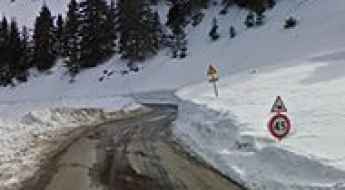
Station de Camurac
Station de Camurac is a ski station at an elevation of 1.630m (5,347ft) above the sea level, located in the Aude department of southern France.
Driving the curvy roads of Corsica
I spent 3 weeks on Corsica and I can say that the title of "Island of the Beauty" is simple correct. There is only 1 highway existing south of Bastia with a length of about 15 km.
Lac des Estaris
Lac des Estaris is a high mountain lake at an elevation of 2.578m (8,458ft) above the sea level, located in the Hautes-Alpes department in southeastern France.
Col de Lachau
Col de Lachau is a mountain pass at an elevation of 1.332m (4,370ft) above the sea level, located in the Drôme department in southeastern France.
A very bumpy, grueling road to Bocca di Battaglia
Bocca di Battaglia is a mountain pass at an elevation of 1.104m (3,622ft) above the sea level, located in the Haute-Corse department of France on the island of Corsica. The road to the summit is awesome, with sections up to 12%. Tight bends and faster sweepers.
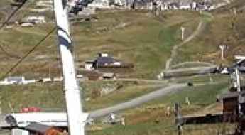
Piau-Engaly
Piau-Engaly is a ski resort at an elevation of 1.870m (6,135ft) above the sea level, located in the Hautes-Pyrénées department in southwestern France.
Sommet de la Reynière
Sommet de la Reynière is a high mountain peak at an elevation of 1.717m (5,633ft) above the sea level, located in the Alpes-de-Haute-Provence department in southeastern France.
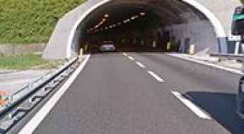
Autostrada dei Fiori, a stunning coastal road from Genoa to Nice
Autostrada A10 is one of the most challenging yet scenic highways in northern Italy. You’ll find yourself constantly distracted by the beautiful coastal views.
A wild unpaved road to Palet
Palet is a high mountain peak at an elevation of 2.749m (9,019ft) above the sea level, located in the Savoie department in the Auvergne-Rhône-Alpes region in southeastern France. It’s one of the highest roads of Europe.

A steep road to Crêt de l'Oeillon
Crêt de l'Oeillon is a high mountain peak at an elevation of 1.364m (4,475ft) above the sea level, located in the Loire department in central France.
M6202 is a Most Tricky Scenic Road on the French Riviera
Located in the Alpes-Maritimes department, in the Provence-Alpes-Côte d'Azur region of France, M6202 is the name of a very scenic road. It’s one of the French balcony roads.
Pas de Saint-Anne
Pas de Saint-Anne is a high mountain pass at an elevation of 2.301m (7,549ft) above the sea level, located in the Maritime Alps, on the French-Italian border.
Col de Scaldasole is the highest road of Corsica
Col de Scaldasole is a high mountain pass at an elevation of 1.938m (6,358ft) above the sea level, located in the Corse-du-Sud department of France on the island of Corsica. It’s one of the highest roads of Corsica.
Road trip guide: Conquering Gorges de la Spelunca
Gorges de la Spelunca is a very scenic canyon located in the Corse-du-Sud department of France on the island of Corsica. If you don't like winding roads this may be a problem.
Col des Gourses
Col des Gourses is a high mountain pass at an elevation of 2.565m (8,415ft) above the sea level, located in Rhone-Alpes in the French Isère département.
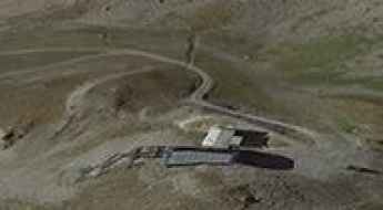
Ouvrage La Déa
Ouvrage La Déa is a military fortress, part of the Maginot Line's Alpine extension, at an elevation of 1.753m (5,751ft) above the sea level, located in the Alpes-Maritimes department in southeastern France.
Pic de Montferrat
Pic de Montferrat is a high mountain pass at an elevation of 2.497m (8,192ft) above the sea level, located in the Hautes-Pyrénées department in southwestern France.
Driving the wild road to Col de Caralps in the Pyrenees
Col de Caralps is an international high mountain pass at an elevation of 2,501m (8,205ft) above sea level, located on the French-Spanish border.
The breathtaking road to Couillade de Llerbès
Couillade de Llerbès is a high mountain peak at an elevation of 2.299m (7,542ft) above the sea level, located in the Ariège department in the Occitanie region of south-western France.
Col d’Anglas
Col d’Anglas is a high mountain pass at an elevation of 2.453m (8,047ft) above the sea level, located in the département of Pyrénées-Atlantiques, in south-western France.
Col du Fouet
Col du Fouet is a high mountain pass at an elevation of 2.435m (7,988ft) above the sea level, located in the Haute-Savoie department in the Auvergne-Rhône-Alpes region in south-eastern France.
Col de la Cucumelle
Col de la Cucumelle is a high mountain pass at an elevation of 2.511m (8,238ft) above the sea level, located in the Hautes-Alpes department in southeastern France.
Road D76
The D76 road is a very exciting journey in the Alpes-Maritimes department in southeastern France. Located at the gateway to the National Mercantour Park, the road is asphalted but very narrow.
Take the Scenic Route and Discover Gorges d'Aulan
Gorges d'Aulan is the name of a spectacular canyon carved into the limestone by the Toulourenc river in the Drôme department of Auvergne-Rhône-Alpes region, in France. It’s one of the French balcony roads.
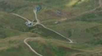
Boismint lift
Boismint lift is a high mountain lift at an elevation of 2.671m (8,763ft) above the sea level, located in the Savoie department in the Auvergne-Rhône-Alpes region in south-eastern France. It’s one of the highest roads of the country.
Cheval Noir
Cheval Noir is a high mountain pass at an elevation of 2.166m (7,106ft) above the sea level, located in the Massif de la Vanoise range, in Savoie department, in the Auvergne-Rhône-Alpes region of the French Alps.
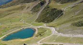
Lac d'Allos
Lac d'Allos is a high mountain lake at an elevation of 2.248m (7,375ft) above the sea level, located in the Alpes-de-Haute-Provence department in the Provence-Alpes-Côte d'Azur region of southeastern France.
Driving the wild road to Col de Balme
Col de Balme is an international high mountain pass at an elevation of 2.209m (7,247ft) above the sea level, located on the frontier between France and Switzerland.
Col de Mea
Col de Mea is a high mountain pass at an elevation of 2.486m (8,156ft) above the sea level, located in the Hautes-Alpes department in southeastern France.
Adventure along Breche du Grand Creux
Breche du Grand Creux is a high mountain peak at an elevation of 2.830m (9,284ft) above the sea level, located in Rhone-Alpes in the Isère département, France. It's one of the highest roads of Europe.