What are the most spectacular roads in France?
France is a true paradise for those wishing to experience the most spectacular roads, and it provides endless experiences for each driver. From stunning balcony roads, mountain passes, and coastal drives, to roads disappearing with the tides, it hosts more than 750 roads listed as the most spectacular in the world.
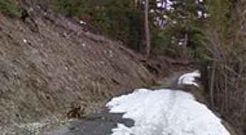
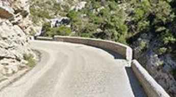
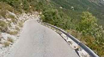
Located in the western part of Europe, France covers an area of 551,695 square kilometers and shares borders with 7 countries: Belgium, Luxembourg, Germany, Switzerland, Italy, Spain, and Andorra. With high mountains in the Alps and the Pyrenees, the roads of the country are famous worldwide because of the Tour de France, the most important cycling race. When traveling to the country, be sure to experience a drive through the best balcony roads. Dramatically carved out of rock on the side of mountains, the balcony roads are a unique experience for any rider.
The country also hosts iconic roads, known worldwide, including Col du Chaussy, a mountain pass at 1,533m (5,029ft) above sea level, famous for the “Lacets de Montvernier,” a special 3 km stretch with 17 hairpins as the road virtually climbs a cliff, or Col de Turini, a treacherous Alpine road with a legendary driving history, as one of the most dangerous and challenging stages of the Monte Carlo Rally and one of the most scenic drives in the world. For those preferring another kind of experience, don’t forget to drive Passage du Gois, the tide-covered road. It’s a natural passage flooded twice a day by the high tide leading to the island of Noirmoutier.
Lac de Bious-Artigues
Lac de Bious-Artigues is a high mountain lake at an elevation of 1.416m (4,646ft) above the sea level, located in Pyrénées-Atlantiques, Pyrénées, southwestern France.
Col de Muse
Col de Muse is a mountain pass at an elevation of 932m (3,057ft) above the sea level, located in the Drôme department in the Rhône-Alpes region in southeastern France.
Lac de Bise
Lac de Bise is a high mountain lake at an elevation of 1.502m (4,928ft) above the sea level, located in the Haute-Savoie department in the Rhône-Alpes region in south-eastern France.
Col de Sarraut
Col de Sarraut is a mountain pass at an elevation of 980m (3,215ft) above the sea level, located in the Alpes-de-Haute-Provence department in southeastern France.
Col de Gembre
Col de Gembre is a high mountain pass at an elevation of 1.635m (5,364ft) above the sea level, located in the Hautes-Pyrénées department in south-western France.
Col des Garcinets
Col des Garcinets is a mountain pass at an elevation of 1.185m (3,887ft) above the sea level, located in the Hautes-Alpes department in southeastern France.
Col des Iris
Col des Iris is a high mountain pass at an elevation of 2.030m (6,660ft) above the sea level, located in the Hautes-Pyrénées department, in south-western France.
Mont Agnelet
Mont Agnelet is a high mountain pass at an elevation of 2.201m (7,221ft) above the sea level, located in the Mercantour massif of the Maritime Alps, in southern France.
Fortin du Restefond
Fortin du Restefond is an old military building at an elevation of 2.558m (8,392ft) above the sea level, located in the French Alps, within the Mercantour National Park in the department of Alpes-de-Haute-Provence.
Road D218
The Route Départementale D218 (RD218) is a very scenic road located in the Isère department in southeastern France.
Col de la Joux Verte
Col de la Joux Verte is a high mountain pass at an elevation of 1.760m (5,774ft) above the sea level, located n the Alps in France.
Col des Rochilles
Col des Rochilles is a high mountain pass at an elevation of 2.496m (8,188ft) above the sea level, located in the Savoie department in the Rhône-Alpes region in south-eastern France.
Croix de Toulouse
Croix de Toulouse is a high mountain pass at an elevation of 1.962m (6,437ft) above the sea level, located in the Hautes-Alpes department in the Provence-Alpes-Côte d'Azur region in southeastern France.
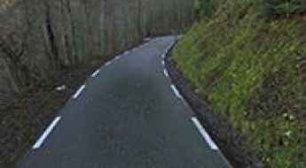
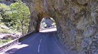
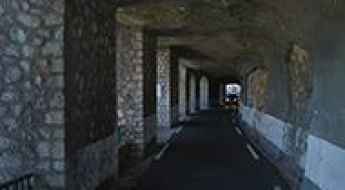
Driving through Gorges de la Cadière, a French balcony road
Gorges de la Cadière is a canyon formed by the Argentesse river, located in the Gard department, in Occitanie region of southern France. It’s one of the famous French balcony roads.
Col de Pinpinier
Col de Pinpinier is a mountain pass at an elevation of 1.130m (3,707ft) above the sea level, located in the Alpes-Maritimes department in the Provence-Alpes-Côte d'Azur region of South-eastern France.

Col des Encombres
Col des Encombres is a high mountain pass at an elevation of 2.367m (7,765ft) above the sea level, located in the Savoie department in the Auvergne-Rhône-Alpes region in south-eastern France.
Porte de Cristol is an awe-inspiring track in the Alps
Porte de Cristol is a high mountain peak at an elevation of 2.483m (8,146ft) above the sea level located in the Hautes-Alpes department in the Provence-Alpes-Côte d'Azur region in southeastern France.
Col de Chalais
Col de Chalais is a mountain pass at an elevation of 930m (3,051ft) above the sea level, located in the Isère department in southeastern France. The road to the summit is very steep.
Sainte-Anne-la-Condamine
Sainte-Anne-la-Condamine is a ski station at an elevation of 1.827m (5,994ft) above the sea level, located in the Alpes-de-Haute-Provence department in southeastern France.
Pas de l'Âne
Pas de l'Âne is a high mountain pass at an elevation of 2.475m (8,120ft) above the sea level, located in the Hautes-Alpes department in southeastern France.
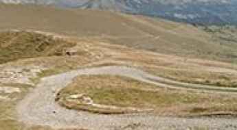
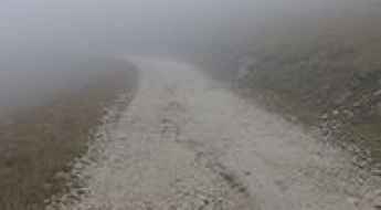
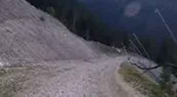
Driving the unpaved road to Col de la Lariée
Col de la Lariée is an international high mountain pass at an elevation of 1.964m (6,443ft) above the sea level, located on the French-Italian border between Liguria, Piemonte and Provence-Alpes-Côte d'Azur.
Col du Clergeon
Col du Clergeon is a mountain pass at an elevation of 979m (3,211ft) above the sea level, located in the Jura Mountains, in France.
Col du Cucheron
Col du Cucheron is a mountain pass at an elevation of 1.139m (3,737ft) above the sea level, located at the heart of the Chartreuse massif, in the Rhône-Alpes region of southeastern France. The climb is terrible, with sections up to 17.9%. It’s a small pass very pleasant with the passage through the beautiful village of Saint-Pierre-de-Chartreuse.
Pas du Serpaton
Pas du Serpaton is a high mountain pass at an elevation of 1.581m (5,187ft) above the sea level, located in the Isère department in southeastern France.
Col du Farguet
Col du Farguet is a mountain pass at an elevation of 1.084m (3,556ft) above the sea level, located in the Alpes Maritimes department in southeastern France.
A balcony road through the Gorges de Trente-Pas
Gorges de Trente-Pas is a spectacular canyon carved into the limestone by Ruisseau de Trente-Pas river in the Drôme department in southeastern France. It’s one of the French balcony roads.
Col du Fort
Col du Fort is a high mountain pass at an elevation of 1.787m (5,862ft) above the sea level, located in the Alpes-Maritimes department in southeastern France
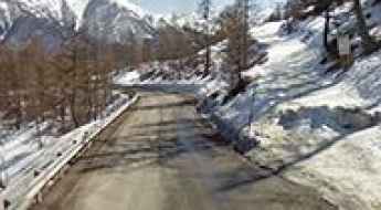
Travel guide to the top of Vallon de la Fournache
Vallon de la Fournache is a high mountain peak at an elevation of 2.703m (8,868ft) above the sea level, located in the Savoie department in the Auvergne-Rhône-Alpes region in south-eastern France. It’s one of the highest roads of Europe.
Col d'Arrondaz
Col d'Arrondaz is a high mountain pass at an elevation of 2.507m (8,225ft) above the sea level, located on the Plateau des Glieres area in Haute-Savoie department of France.
Col des Frettes
Col des Frettes is a high mountain pass at an elevation of 2.386m (7,828ft) above the sea level, located in the Savoie department in the Rhône-Alpes region in south-eastern France.
Le Taoulet
Le Taoulet is a high mountain pass at an elevation of 2.341m (7,680ft) above the sea level, located in the Hautes-Pyrénées department, in south-western France.
Road D71
Located in the Var department in the Provence-Alpes-Côte d'Azur region in southeastern France, the D71 road is a very exciting journey. This is definitely not a Sunday drive. Steep drops and loads of tourists in summer. Visit outside busy periods.
Colle di Perla
Colle di Perla is an international high mountain pass at an elevation of 2.215m (7,267ft) above the sea level, located in the Cottian Alps, on the border between France and Italy.
Col de la Coche
Col de la Coche is a high mountain pass at an elevation of 1.783m (5,849ft) above the sea level, located in the Hautes-Alpes department in southeastern France. The road to the summit is extreme. One mistake and it's a free fall to your death. It’s one of the most dangerous roads on Earth.
Gorges of Terminet, a balcony road in France
Clue du Terminet is a spectacular canyon formed by Le Sou river in the Aude department in southern France. It’s one of the French balcony roads.
Driving the unpaved road to Col de Gimont
Col de Gimont is an international high mountain pass at an elevation of 2.332m (7,650ft) above sea level, located on the border of France and Italy.
Col des Trabesses
Col des Trabesses is a high mountain pass at an elevation of 1.916m (6,286ft) above the sea level, located in the Ariège department of the French Pyrenees.
Col de Mens
Col de Mens is a mountain pass at an elevation of 1.111m (3,645ft) above the sea level, located in the Isère department in southeastern France.
Col du Liorin
Col du Liorin is a mountain pass at an elevation of 1.226m (4,022ft) above the sea level, located in the Isère department in southeastern France.
Fort du Mont
Fort du Mont is a military fortress at an elevation of 981m (3,218ft) above the sea level, located in the Savoie department in the Rhône-Alpes region in south-eastern France.
Col du Laux
Col du Laux is a mountain pass at an elevation of 883m (2,896ft) above the sea level, located in the Drôme department in southeastern France.
Col de Ste-Anne
Col de Ste-Anne is a high mountain pass at an elevation of 1.551m (5,088ft) above the sea level, located in the Mercantour National Park.
Col de Cloze
Col de Cloze is a high mountain peak at an elevation of 2.483m (8,146ft) above the sea level, located in the Hautes-Pyrénées department in south-western France.
Col des Verniers
Col des Verniers is a mountain pass at an elevation of 1.042m (3,418ft) above the sea level, located in the Hautes-Alpes department in southeastern France.
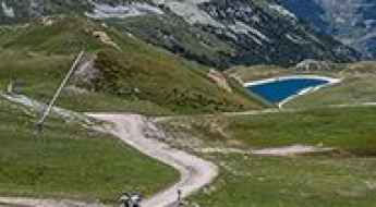
A gravel road to Lac de Plan d'Amont
Lac de Plan d'Amont is a high mountain reservoir at an elevation of 2.078m (6,817ft) above the sea level, located in the Savoie department in the Rhône-Alpes region in south-eastern France.