What are the most spectacular roads in France?
France is a true paradise for those wishing to experience the most spectacular roads, and it provides endless experiences for each driver. From stunning balcony roads, mountain passes, and coastal drives, to roads disappearing with the tides, it hosts more than 750 roads listed as the most spectacular in the world.
Located in the western part of Europe, France covers an area of 551,695 square kilometers and shares borders with 7 countries: Belgium, Luxembourg, Germany, Switzerland, Italy, Spain, and Andorra. With high mountains in the Alps and the Pyrenees, the roads of the country are famous worldwide because of the Tour de France, the most important cycling race. When traveling to the country, be sure to experience a drive through the best balcony roads. Dramatically carved out of rock on the side of mountains, the balcony roads are a unique experience for any rider.
The country also hosts iconic roads, known worldwide, including Col du Chaussy, a mountain pass at 1,533m (5,029ft) above sea level, famous for the “Lacets de Montvernier,” a special 3 km stretch with 17 hairpins as the road virtually climbs a cliff, or Col de Turini, a treacherous Alpine road with a legendary driving history, as one of the most dangerous and challenging stages of the Monte Carlo Rally and one of the most scenic drives in the world. For those preferring another kind of experience, don’t forget to drive Passage du Gois, the tide-covered road. It’s a natural passage flooded twice a day by the high tide leading to the island of Noirmoutier.
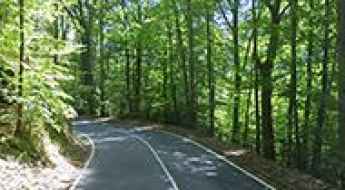
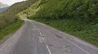
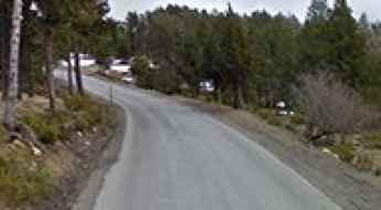
17 Tournants de Chevreuse, an iconic drive south of Paris
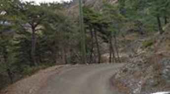
17 Turns of Chevreuse is a legendary motorcycle ride located in the Yvelines department in the Île-de-France, in the south suburb of Paris, in north-central France.
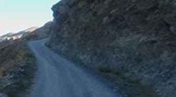
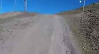
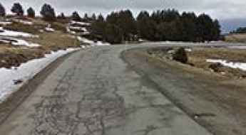
Driving the paved road to Puerto de Larrau
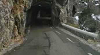
Port de Larrau is an international high mountain pass at an elevation of 1.615m (5,298ft) above the sea level, on the French-Spanish border in the western Pyrenees.
Col du Piéfroid
Col du Piéfroid is a high mountain pass at an elevation of 2.937m (9,635ft) above the sea level, located in the Isère department in the Rhône-Alpes region of south-eastern France. It’s one of the highest roads of Europe.
Col de Pernante
Col de Pernante is an international high mountain pass at an elevation of 1.898m (6,227ft) above the sea level, located in the Alps, on the border between France and Italy.
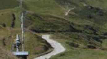
Les Arcs 2000
Les Arcs 2000 is a ski station at an elevation of 2.120m (6,955ft) above the sea level, located in the Savoie department in the Rhône-Alpes region in south-eastern France.
Col de Marocaz
Col de Marocaz is a mountain pass at an elevation of 958m (3,143ft) above the sea level, located in the Savoie department in the Rhône-Alpes region in south-eastern France.
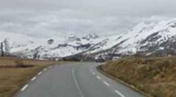
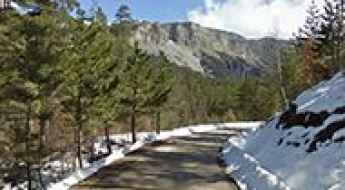
Road trip guide: Conquering Col du Vallon
Col du Vallon is a high mountain pass at an elevation of 2.456m (8,057ft) above sea level, located in the Hautes-Alpes department in southeastern France.
Col du Merdassier
Col du Merdassier is a high mountain pass at an elevation of 1.500m (4,921ft) above the sea level, located in the Haute-Savoie department of the Rhône-Alpes region in south-eastern France.
Aiguille Croche
Aiguille Croche is a high mountain peak at an elevation of 2.398m (7,867ft) above the sea level, located on the Savoie and Haute-Savoie border, in the Auvergne-Rhône-Alpes region of the French Alps. The climb will test your fear of heights.
Col de Pierre Vesce
Col de Pierre Vesce is a mountain pass at an elevation of 1.042m (3,418ft) above the sea level, located in the Drôme department in southeastern France.
Taking on the Twists and Turns of Gorges Du Val de Fier
Gorges Du Val de Fier is a very scenic canyon located on the boundary of the Haute-Savoie and the Savoie departments in the Auvergne-Rhône-Alpes region in France. It’s one of the scenic French balcony roads.
Col de Rioupes
Col de Rioupes is a mountain pass at an elevation of 1.430m (4,691ft) above the sea level, located in the Hautes-Alpes department in Provence-Alpes-Côte d'Azur region in southeastern France.
Col del Pam
Col del Pam is a high mountain pass at an elevation of 1.998m (6,555ft) above the sea level, located in the Pyrénées-Orientales and Cerdagne near the Spanish border in the south of France.
Sommet de l'Eychauda
Sommet de l'Eychauda is a high mountain peak at an elevation of 2.639m (8,658ft) above the sea level, located in the Hautes-Alpes department in southeastern France.
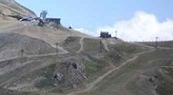
Avoriaz
Avoriaz is a ski station at an elevation of 1.814m (5,951ft) above the sea level, located in the territory of the commune of Morzine, in France.
Basèra Pass
Pas de Basèra is an international high mountain pass at an elevation of 2.040m (6,692ft) above the sea level, located on the French-Italian border between Liguria, Piemonte and Provence-Alpes-Côte d'Azur.
Col de Porte
Col de Porte is a mountain pass at an elevation of 1.060m (3,477ft) above the sea level, located in the Alpes-Maritimes department in southeastern France.
Rocher du Charvet
Rocher du Charvet is a high mountain peak at an elevation of 2.712m (8,897ft) above the sea level, located in the Savoie department in the Auvergne-Rhône-Alpes region in south-eastern France. It’s one of the highest roads of Europe.
Col de Font Belle
Col de Font Belle is a mountain pass at an elevation of 1.304m (4,278ft) above the sea level, located in the Alpes-de-Haute-Provence in the south of France.
Gorges de la Ruda: The Ultimate Road Trip Guide
Gorges de la Ruda is a very scenic canyon located in the Haute-Corse department of France on the island of Corsica. It’s one of the French balcony roads.
Col Gaudissart
Col Gaudissart is a mountain pass at an elevation of 896m (2,939ft) above the sea level, located in the Drôme department in southeastern France.
Col d'Albanne
Col d'Albanne is a high mountain pass at an elevation of 1.652m (5,419ft) above the sea level, located in the Maurienne Valley, in the Savoie department in the Rhône-Alpes region in south-eastern France.
Col de la Grande Forcle
Col de la Grande Forcle is a high mountain pass at an elevation of 2.270m (7,447ft) above the sea level, located in the Graian Alps, in the Savoie department in the Auvergne-Rhône-Alpes region in south-eastern France.
Auron
Auron is a ski resort at an elevation of 1.652m (5,419ft) above the sea level, located in the French alps in the Alpes-Maritimes department.
Lac de Pramol
Lac de Pramol is a high mountain lake at an elevation of 1.728m (5,969ft) above the sea level, located in the Maurienne Valley, in the Savoie department in the Rhône-Alpes region in south-eastern France. The lake lies two kilometres beyond les Karellis ski resort.
Col Nord des Lacs
Col Nord des Lacs is a high mountain pass at an elevation of 2.533m (8,310ft) above the sea level, located in the Savoie department in the Rhône-Alpes region in south-eastern France.
Col de la Loge
Col de la Loge is a mountain pass at an elevation of 1.002m (3,287ft) above the sea level, located in the Drôme department in southeastern France.
Fort Tabourde
Fort Tabourde (Forte Taburda) is a military fortress at an elevation of 1.987m (6,519ft) above the sea level, located in the Alpes-Maritimes department in southeastern France, near the Italian border.
Pla de la Calma-Mollera dels Clots
Pla de la Calma-Mollera dels Clots is a high mountain pass at an elevation of 2.040m (6,692ft) above the sea level, located in the Pyrénées-Orientales and Cerdagne near the Spanish border in the south of France.
A memorable road trip to Le Brévent
Le Brévent is a high mountain peak at an elevation of 2.484m (8,149ft) above the sea level, located in the Haute-Savoie department in the Auvergne-Rhône-Alpes region in south-eastern France.
Col de la Biche
Col de la Biche, also known as Golet de la Biche, is a mountain pass at an elevation of 1.310m (4,297ft) above the sea level, located in the Ain department in eastern France. The climbs is exceedingly steep with some sections up to 13.6%.
Road trip guide: Conquering the Pas de Bellecombe
Pas de Bellecombe is a high mountain pass at an elevation of 2.361m (7,746ft) above the sea level located on the eastern side of Réunion island in the Indian Ocean.
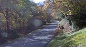
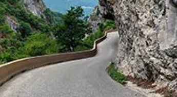
Driving the challenging Défilé de Ruoms, a French balcony road
Défilé de Ruoms is the name of a very scenic defile located in the Ardèche department in the Auvergne-Rhône-Alpes region of France. It’s one of the most scenic balcony roads of the country.

Les Fonds
Les Fonds is a high mountain town at an elevation of 2.040m (6,692ft) above the sea level, located in the Hautes-Alpes department in southeastern France.
Col de Plantara
Col de Plantara is a mountain pass at an elevation of 1.002m (3,287ft) above the sea level, located in the Drôme department in the Rhône-Alpes region in southeastern France.
How To Have The Ultimate Road Trip To Bocca à Canaghia
Bocca à Canaghia is a high mountain peak at an elevation of 1.848m (6,062ft) above the sea level, located in the Haute-Corse department of France on the island of Corsica. It’s one of the highest roads of Corsica.
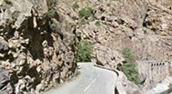
Route de Pierrefitte
Route de Pierrefitte (D920) is a mountain road located in the Hautes-Pyrénées department and the region of Midi-Pyrénées in south-western France.
Col de Fours
Col de Fours is a high mountain peak at an elevation of 2.318m (7,604ft) above the sea level, located in the extreme north of the Alpes-de-Haute-Provence, in southeastern France, near the Italian border.
Pas de Cherferie
Pas de Cherferie is a high mountain pass at an elevation of 2.142m (7,027ft) above the sea level located in the Savoie department in the Auvergne-Rhône-Alpes region in south-eastern France.

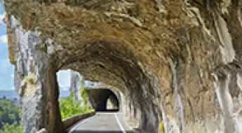
Driving the M59, a French balcony road
M59 is the name of a very scenic yet challenging road located in the Alpes-Maritimes department, in the Provence-Alpes-Côte d'Azur region of southeastern France. It's one of the famous French balcony roads.
Pas des Escaliers
Pas des Escaliers is a high mountain pass at an elevation of 1.700m (5,577ft) above the sea level, located in the Isère department in southeastern France.
Travel guide to the top of Col de la Ricelle
Col de la Ricelle is a high mountain pass at an elevation of 2.366m (7,762ft) above the sea level, located in the Hautes-Alpes department in southeastern France.

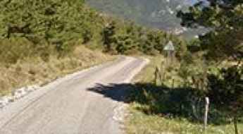
Route de Thiéry is a balcony road to Col de la Madone
Col de la Madone is a mountain pass at an elevation of 1.165m (3,822ft) above the sea level, located in the Alpes-Maritimes department, in the Provence-Alpes-Côte d'Azur region of southeastern France. It’s one of the French balcony roads.
The road to Col de Saluces is not for the faint of heart
Col de Saluces is a high mountain pass at an elevation of 2.445m (8,021ft) above the sea level, located in the Hautes-Alpes department in southeastern France.
Mont Janus
Mont Janus is a high mountain peak at an elevation of 2.529m (8,297ft) above the sea level, located in the Hautes-Alpes department in southeastern France.