What are the most spectacular roads in France?
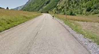
France is a true paradise for those wishing to experience the most spectacular roads, and it provides endless experiences for each driver. From stunning balcony roads, mountain passes, and coastal drives, to roads disappearing with the tides, it hosts more than 750 roads listed as the most spectacular in the world.
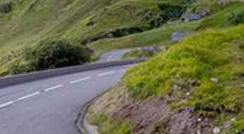
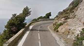
Located in the western part of Europe, France covers an area of 551,695 square kilometers and shares borders with 7 countries: Belgium, Luxembourg, Germany, Switzerland, Italy, Spain, and Andorra. With high mountains in the Alps and the Pyrenees, the roads of the country are famous worldwide because of the Tour de France, the most important cycling race. When traveling to the country, be sure to experience a drive through the best balcony roads. Dramatically carved out of rock on the side of mountains, the balcony roads are a unique experience for any rider.
The country also hosts iconic roads, known worldwide, including Col du Chaussy, a mountain pass at 1,533m (5,029ft) above sea level, famous for the “Lacets de Montvernier,” a special 3 km stretch with 17 hairpins as the road virtually climbs a cliff, or Col de Turini, a treacherous Alpine road with a legendary driving history, as one of the most dangerous and challenging stages of the Monte Carlo Rally and one of the most scenic drives in the world. For those preferring another kind of experience, don’t forget to drive Passage du Gois, the tide-covered road. It’s a natural passage flooded twice a day by the high tide leading to the island of Noirmoutier.
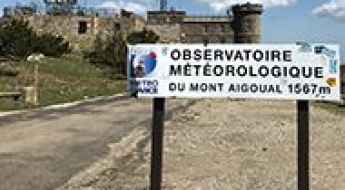
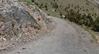
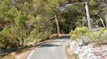
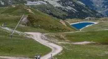
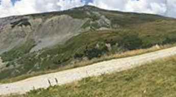
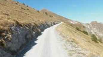
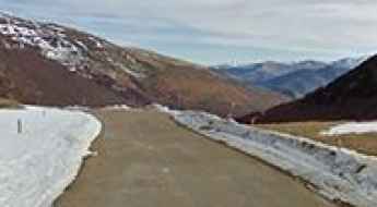
Water, snow and fog at the top of Mont-Aigoual
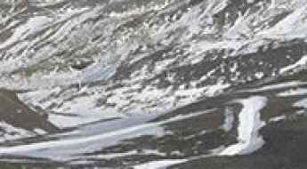
Mont-Aigoual is a high mountain pass at an elevation of 1.567m (5,141ft) above the sea level, located on the border of the Lozère and Gard departments in southern France. At the peak you have unlimited views and the highest manned weather station in France.
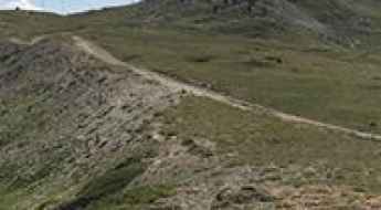
Col d’Eylac
Col d’Eylac is a high mountain pass at an elevation of 1.442m (4,730ft) above the sea level, located in Auvergne, in south-central France.
The military road to Fort de la Redoute
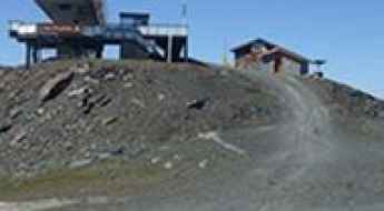
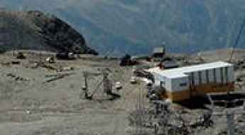
Fort de la Redoute is a high mountain fort at an elevation of 2.346m (7,696ft) above the sea level, located in the Savoie department in the Auvergne-Rhône-Alpes region in south-eastern France, near the Italian border.
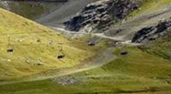
The road to Cim de Coma Morera: be ready to make room for oncoming vehicles
Cim de Coma Morera is an international high mountain pass at an elevation of 2,205m (7,234ft) above sea level, located on the Spanish-French border.
A curvy paved road to Col de Perty
Col de Perty is a mountain pass at an elevation of 1.302m (4,271ft) above the sea level, located in the Drôme department in the Auvergne-Rhône-Alpes region in southeastern France.
Adventure along Pas de Colle Ardente
Passo di Collardente-Pas de Colle Ardente, is a high mountain pass at an elevation of 1.617m (5,305 ft) above the sea level, located in the Maritime Alps on the border between Italy and France. The pass is traversed by the spectacular Via del Sale.
Travel guide to the top of Col des Annes
Col des Annes is a high mountain pass at an elevation of 1.721m (5,646ft) above the sea level, located in the Haute-Savoie department in the Rhône-Alpes region in south-eastern France.
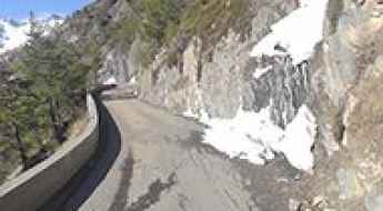
The narrow paved road to the international Col des Veaux
Col des Veaux is an international mountain pass at an elevation of 540m (1,771ft) above the sea level, located on the French-Spanish border.
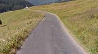
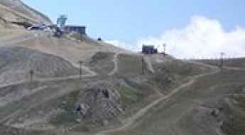
The iconic climb to Luz Ardiden
Luz Ardiden is a ski resort at an elevation of 1.720m (5,643ft) located in the Hautes-Pyrénées department in the Occitan region of south-western France. It has featured several times as a summit finish in the Tour de France and Vuelta a España races.
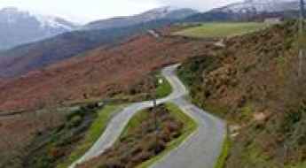
An awe-inspiring drive to Col d'Ornon
Col d'Ornon is a mountain pass at an elevation of 1.360m (4,462ft) above the sea level, located in the Dauphiné Alps, in the department of Isère in France.
A memorable road trip to Col de Riou in the Pyrenees
Col de Riou is a high mountain peak at an elevation of 1.949m (6,394ft) above the sea level, located in the Hautes-Pyrénées department in the Occitan region of south-western France.
The military road to Colle delle Chaberton
Colle delle Chaberton is a high mountain pass at an elevation of 2.674m (8,772ft) above the sea level, located in the French Alps, in the département of Hautes-Alpes.
Mont de la Chambre
Mont de la Chambre is a high mountain pass at an elevation of 2.844m (9,330ft) above the sea level located in the Savoie department in the Auvergne-Rhône-Alpes region in south-eastern France. It's one of the highest roads of Europe.
Col de Thorens
Col de Thorens is a high mountain peak at an elevation of 3.118m (10,229ft) above the sea level, located in the Savoie department in the Auvergne-Rhône-Alpes region in southeastern France. It’s one of the highest roads of Europe.
Tour de Madeloc
The Tour de Madeloc or Route Madeloc is a very small road located near the Spanish border and Cap Cerbere, in southern France. The drive starts in Banyuls-Sur-Mer and ends in Colliure. The road is called D86 and is part of the Route des Cols. There are labels to lead you to the street in both villages.
The wild road to Col de la Fréte o de la Chiaupe
Col de la Fréte o de la Chiaupe is a high mountain pass at an elevation of 2.494m (8,182ft) above the sea level, located in the Graian Alps, in the Savoie department in the Auvergne-Rhône-Alpes region in south-eastern France.
A hairpinned steep road to Parking des Millefonts
Parking des Millefonts is a high mountain parking at an elevation of 2.040m (6,692ft) above the sea level, located in the Alpes-Maritimes department in the Provence-Alpes-Côte d'Azur region in southeastern France.
Col de Fresse
Col de Fresse is a high mountain pass at an elevation of 2.777m (9,110ft) above the sea level, located in the Savoie department, in the Auvergne-Rhône-Alpes region of the French Alps. It'sone of the highest roads of Europe.
A brutally steep classic climb to Planche des Belles Filles
Planche des Belles Filles is a ski resort at an elevation of 1.148m (3,766ft) above the sea level, located in the Haute-Saône department of the Bourgogne-Franche-Comté region, in France.
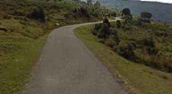
Prat d'Albis is a drive worth taking
Prat d'Albis is a mountain pass at an elevation of 1.201m (3,940ft) above the sea level, located in the Ariège department in southwestern France in the Occitanie region.
Mont Faron
Mont Faron is a mountain pass at an elevation of 584m (1,916ft) above the sea level, located on southern France’s Mediterranean coast, overlooking the city and roadstead of Toulon.
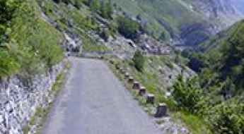
Crossing the 108m high Pont Du Châtelet
Pont Du Châtelet is the name of a narrow stone bridge located in the Alpes-de-Haute-Provence department in Provence-Alpes-Côte d'Azur region of France. It’s one of the most spectacular bridges in the world.

Fort de la Platte
Fort de la Platte is a military fortress at an elevation of 2.009m (6,591ft) above the sea level, located in the Savoie department in the Rhône-Alpes region in south-eastern France.
A memorable road trip to Collet du Plan Nicolas
Collet du Plan Nicolas is a high mountain pass at an elevation of 2.406m (7,893ft) above the sea level, located in the Savoie department in the Rhône-Alpes region in south-eastern France.
The road to Mont Vial is said to be the scary of scaries
Mont Vial is a high mountain peak at an elevation of 1.527m (5,009ft) above the sea level, located in the Alpes-Maritimes department in southeastern France. It’s one of the few peaks of the backcountry behind Nice that is recognisable from the sea.
Col de la Chal
Col de la Chal is a high mountain pass at an elevation of 2.460m (8,070ft) above the sea level, located in the Savoie department in the Rhône-Alpes region in south-eastern France.
A very bumpy, grueling road to Grand Col
Grand Col is a high mountain peak at an elevation of 2.939m (9,642ft) above the sea level, located in the Savoie department in the Auvergne-Rhône-Alpes region in south-eastern France. It’s one of the highest roads of Europe.
The road to Lac du Barrage d'Ossoue isn't an easy one
Lac du Barrage d'Ossoue is a high mountain lake at an elevation of 1.842m (6,043ft) above the sea level, located in the Hautes-Pyrénées, a department in southwestern France.
A curvy scenic road to Col de la Vaccia
Col de la Vaccia is a mountain pass at an elevation of 1.193m (3,914ft) above the sea level, located in the Corse-du-Sud department of France on the island of Corsica.
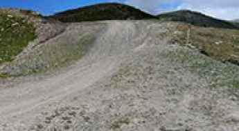
Col des Posettes: a wild unpaved road to the summit
Col des Posettes is a high mountain pass at an elevation of 1.997m (6,551ft) above the sea level, located in the Haute-Savoie département in the Rhône-Alpes region in south-eastern France.

Roche de Mio
Roche de Mio is a high mountain peak at an elevation of 2.716m (8,910ft) above the sea level, located in the Graian Alps, in the Savoie department in the Auvergne-Rhône-Alpes region in south-eastern France. It’s one of the highest roads of Europe.
A historic road to Col des Gondrans
Col des Gondrans is a high mountain pass at an elevation of 2.347m (7,700ft) above the sea level, located in the Hautes-Alpes department in southeastern France.
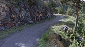
Route Du Pas de la Confession, a balcony road in the French Alps
Located in the Isère department, in the Auvergne-Rhône-Alpes region, in southeastern France, Route Du Pas de la Confession is a very challenging drive. The road is so defiant that travelers were encouraged to make confession before using it. It’s one of the French balcony roads.
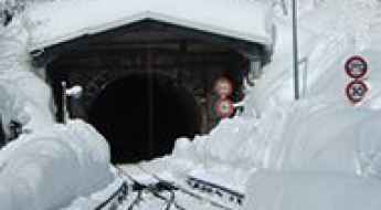
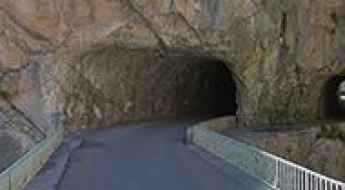
Tunnel des Montets
Located in the Haute-Savoie department of France, Tunnel des Montets is a mountain tunnel used by trains which also allows road traffic to avoid theCol des Montets mountain pass when there is heavy snowfall or avalanche danger.
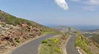
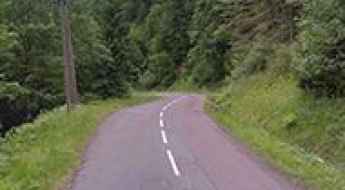
D33 is a winding paved road in Corsica
Located in the Haute-Corse department of France, on the north-east of the island of Corsica, D33 is a very scenic coastal road. Drive slowly because there is no room for mistakes.
Col de la Core, an absolute must for road lovers
Col de la Core is a high mountain pass at an elevation of 1.395m (4,577ft) above the sea level, located in the Ariège department of France in the Pyrenees.
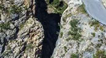
Clue du Peroure is a French balcony road
Clue du Pérouré is a canyon with dramatic views located in the Alpes-de-Haute-Provence department in the Provence-Alpes-Côte d'Azur region of France. It’s one of the most scenic French balcony roads.
Pointe de la Masse
Pointe de la Masse is a high mountain peak at an elevation of 2.790m (9,153ft) above the sea level, located in the Savoie department in the Auvergne-Rhône-Alpes region of the French Alps. It's one of the highest roads of Europe.
An epic road to Selle Vecchie Pass in the Alps
Col de la Celle Vieille is a high mountain pass at an elevation of 2.099m (6,886ft) above the sea level, located in the Mercantour National Park, on the French-Italian border.
The breathtaking road to Col de la Sinne
Col de la Sinne is a mountain pass at an elevation of 1.438m (4,717ft) above the sea level, located in the Alpes-Maritimes department in the Provence-Alpes-Côte d'Azur region in southeastern France. Expect sections up to 15% near the summit.
Travel guide to the top of Col du Festre
Col du Festre is a mountain pass at an elevation of 1.441m (4,727ft) above the sea level, located in the Hautes-Alpes department in Provence-Alpes-Côte d'Azur region in southeastern France.
A nice drive to Pas de Morgins
Pas de Morgins is an international high mountain pass at an elevation of 1.378m (4,520ft) above the sea level, located on the border of France and Switzerland.
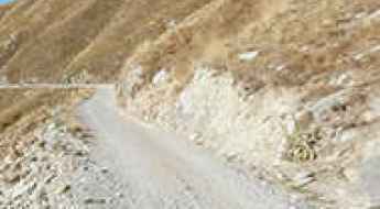
Port de Lers
The Port de Lers is a high mountain pass at an elevation of 1.517m (4,977ft) above the sea level, located in the French Pyrenees in the department of Ariège. There are numerous ramps above 10%.
Road trip guide: Conquering Col de la Ramaz
Col de la Ramaz is a high mountain pass at an elevation of 1.549m (5,082ft) above the sea level, located in the Haute-Savoie department in the Auvergne-Rhône-Alpes region of France.
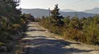
Mont Bouquet
Mont Bouquet is a mountain pass at an elevation of 628m (2,060ft) above the sea level, located in the Gard department in southern France.