What are the most spectacular roads in France?
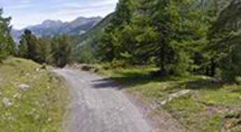
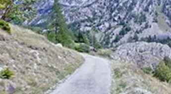
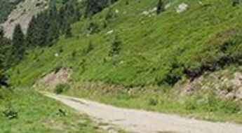
Set against the backdrop of Western Europe, France boasts an intricate tapestry of roads that offer some of the most breathtaking drives globally.
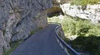
Enthusiasts can traverse the famed balcony roads, which cling perilously to cliff faces, ascend the serpentine bends of Col du Chaussy, navigate through the historical Tunnel de Parpaillon, or challenge themselves on the towering peaks of Col de l'Iseran, Col du Jandri, and Col du Télégraphe. From the undulating vineyards and sunlit fields to majestic mountains and turquoise coastlines, France's diverse topography is a treasure trove for those keen on picturesque journeys. The iconic Route Napoleon meanders through the heart of the country, while the shimmering Corniche d'Or offers unparalleled views of the Mediterranean's azure embrace.
But France's roads are more than just pathways carved into its stunning landscapes. They are gateways to its rich tapestry of history, culture, and traditions, from medieval towns and alpine villages to sun-soaked Mediterranean beaches. So, the next time wanderlust calls you to the charm of France, rev up your engine and set forth on an adventure across its most captivating routes.
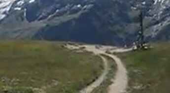
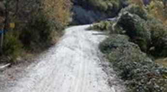
Piste de Clausis, pure adventure
Piste de Clausis is a high mountain gravel road located in the Hautes-Alpes department in southeastern France in the Queyras Regional Natural Park. The road is 6.2km long.
Col de Pierre Grosse
Col de Pierre Grosse is a mountain pass at an elevation of 1.322m (4,337ft) above the sea level, located in the Isère department in southeastern France.
Col de Saint Georges-Chalet Josserand
Col de Saint Georges-Chalet Josserand is a high mountain pass at an elevation of 2.245m (7,477ft) above the sea level, located in the Alps in the department of Hautes-Alpes in France.
Bocca de Sevi
Bocca de Sevi, also known as Col de Sevi, is a mountain pass at an elevation of 1.101m (3,612ft) above the sea level, located in the Corse-du-Sud department of France on the island of Corsica.
Sommet de la Saulire, one of the highest roads of France
Sommet de la Saulire is a high mountain pass at an elevation of 2.697m (8,848ft) above the sea level, located in the Massif de la Vanoise range, in Savoie department, in the Auvergne-Rhône-Alpes region of the French Alps.
A narrow road to the top of Col de Carabes
Col de Carabes is a mountain pass at an elevation of 1.261m (4,137ft) above the sea level, located in southeastern France.
Col des Fourches
Col des Fourches is a high mountain pass at an elevation of 2.258m (7,408ft) above the sea level located in the Maritime Alps, in the French region of Provence-Alpes-Côte-d'Azur
Refugi de Marialles
Refugi de Marialles is a high mountain refuge at an elevation of 1.718m (5,636ft) above the sea level, located in the Pyrénées-Orientales department in southern France.
Col du Souchet
Col du Souchet is a high mountain pass at an elevation of 2.365m (7,759ft) above the sea level, located in the Hautes-Alpes department in southeastern France.
Col du Val d'Ese
Col du Val d'Ese is a mountain pass at an elevation of 1.615m (5,298ft) above the sea level, located between the valleys of Prunelli and Taravo, in the Corse-du-Sud department of France on the island of Corsica.
Route Du Pas de la Confession, a balcony road in the French Alps
Located in the Isère department, in the Auvergne-Rhône-Alpes region, in southeastern France, Route Du Pas de la Confession is a very challenging drive. The road is so defiant that travelers were encouraged to make confession before using it. It’s one of the French balcony roads.
Fort de Lenlon
Fort de Lenlon is a military fortress at an elevation of 2.508m (8,228ft) above the sea level, located in the Dauphiné region of southeastern France.
Col du Ranfolly
Col du Ranfolly is a high mountain pass at an elevation of 1.650m (5,413ft)above the sea level, located in the Haute-Savoie department in the Rhône-Alpes region in south-eastern France.
Road trip guide: Conquering Col de l’Eychauda
Col de l’Eychauda is a high mountain pass at an elevation of 2.433m (7,982ft) above the sea level, located in the Hautes-Alpes department in southeastern France.
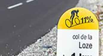
A new paved road to Col de la Loze
Col de la Loze is a high mountain pass at an elevation of 2.308m (7,572ft) above the sea level, located in the Savoie department in the Auvergne-Rhône-Alpes region in south-eastern France.
Les Grandes Platières
Les Grandes Platières is a high mountain pass at an elevation of 2.473m (8,113ft) above the sea level, located in the Haute-Savoie department in the Auvergne-Rhône-Alpes region in southeastern France.
Pic de Chabrières is a Most Tricky Scenic Drive
Pic de Chabrières is a high mountain pass at an elevation of 2.701m (8,861ft) above the sea level, located in the Hautes-Alpes department in southeastern France. It’s one of the highest roads of the country.
Grande Motte
Grande Motte is a high mountain peak at an elevation of 3.030m (9,940ft) above the sea level, located in Savoie department in the Auvergne-Rhône-Alpes region, France. It’s one of the highest roads of Europe.
Roche Madeleine
Roche Madeleine is a high mountain pass at an elevation of 2.370m (7,775ft) above the sea level located in the French Alps, near the border with Italy, within the Mercantour National Park on the department of Alpes-de-Haute-Provence.
Col du Jovet
Col du Jovet is a high mountain pass at an elevation of 2.404m (7,887ft) above the sea level, located in the Savoie department in the Rhône-Alpes region in south-eastern France.
Col du Mont Noir
Col du Mont Noir is a mountain pass at an elevation of 1.421m above the sea level, located in the Isère department in southeastern France.
Les 12 lacets de Ceillac: a breathtaking road with 12 challenging hairpins
Located in the Hautes-Alpes department in southeastern France, Les 12 lacets de Ceillac is a collection of 12 hairpin turns on the road to the small town of Ceillac.
A Most Tricky Scenic Drive to Lac de la Glère
Lac de la Glère is a high mountain lake at an elevation of 2.152m (7,060ft) above the sea level, located in the Hautes-Pyrénées department in the Occitanie region of south-western France.
Sanctuaire de Notre Dame de la Salette
Sanctuaire de Notre Dame de la Salette is a high mountain sanctuary at an elevation of 1.787m (5,862ft) above the sea level, located in the Isère department in southeastern France.
The narrow D102 is a dangerous balcony road
D102 is a short mountain road located in the Alpes-de-Haute-Provence department, in the region of Provence-Alpes-Côte d'Azur in southeastern France. It’s one of the most scenic French balcony roads.
Mont Caume, a narrow and winding mountain road
Mont Caume is a mountain pass at an elevation of 801m (2,627ft) above the sea level, located in the Var department in the Provence-Alpes-Côte d'Azur region in southeastern France.
Col de Furfande
Col de Furfande is a high mountain pass at an elevation of 2.500m (8,202ft) above the sea level, located in the Hautes-Alpes department in the Provence-Alpes-Côte d'Azur region of south-eastern France.
Col de Savel
Col de Savel is a mountain pass at an elevation of 972m (3,188ft) above the sea level, located in the Alpes-Maritimes department in southeastern France.
Col de Bousson
Col de Bousson is an international high mountain pass at an elevation of 2.154m (7,066ft) above the sea level, located in the Cottian Alps, between France and Italy.
Vallon de la Gordolasque
Vallon de la Gordolasque is a high mountain pass at an elevation of 1.689m (5,541ft) above the sea level, located in the Alpes-Maritimes department in southeastern France.
Hourquette d'Ancizan
Hourquette d'Ancizan is a high mountain pass at an elevation of 1.564m (5,131ft) above the sea level, located in the French Pyrenees in the department of Hautes-Pyrénées.
Pas de l'Âne
Pas de l'Âne is a high mountain pass at an elevation of 2.091m (6,860ft) above the sea level, located in the Savoie department in the Auvergne-Rhône-Alpes region in south-eastern France.
Col de la Pertie
Col de la Pertie is a mountain pass at an elevation of 972m (3,188ft) above the sea level, located in the Drôme department in southeastern France.
Mont Tauch
The Mont Tauch is a mountain pass at an elevation of 871m (2,857ft) above the sea level, located in the Aude department in southern France.
Col de la Pousterle
Col de la Pousterle is a high mountain pass at an elevation of 1.763m (5,784ft) above the sea level, located in the Hautes-Alpes department in southeastern France.
Cugnai Lift
Cugnai Lift is a chair lift for skiers at an elevation of 2.884m (9,471ft) above the sea level, located in the Savoie department of southeastern France. It's one of the highest roads of Europe.
Fort de Ronce
Fort de Ronce is a high mountain fortress at an elevation of 2.294m (7,526ft) above the sea level, located in the Savoie department in the Rhône-Alpes region in south-eastern France.
Coll de Creu
Coll de Creu is a high mountain pass at an elevation of 1.708m (5,603ft) above the sea level, located in the Pyrenees, a range of mountains in southwest Europe that forms a natural border between France and Spain.
Col de la Baume
Col de la Baume is a mountain pass at an elevation of 1.068m (3,503ft) above the sea level, located in the Alpes-de-Haute-Provence department in southeastern France.
Col de Casardo
Col de Casardo is a mountain pass at an elevation of 1.093m (3,585ft) above the sea level, located in the Haute-Corse department of France on the island of Corsica.
Lac de Bious-Artigues
Lac de Bious-Artigues is a high mountain lake at an elevation of 1.416m (4,646ft) above the sea level, located in Pyrénées-Atlantiques, Pyrénées, southwestern France.
Col de Saint-Alexis
Col de Saint-Alexis is a mountain pass at an elevation of 1.222m (4,009ft) above the sea level, located in the department of Drôme in southeastern France.
Col de Castellaras
Col de Castellaras is a mountain pass at an elevation of 1.248m (4,094ft) above the sea level, located in the Alpes-Maritimes department in southeastern France.
Col de Muse
Col de Muse is a mountain pass at an elevation of 932m (3,057ft) above the sea level, located in the Drôme department in the Rhône-Alpes region in southeastern France.
Col du Palet
Col du Palet is a high mountain pass at an elevation of 2.658m (8,720ft) above the sea level, located in the Savoie department in the Auvergne-Rhône-Alpes region in southeastern France. It’s one of the highest mountain roads of the country.
