What are the most spectacular roads in France?
Set against the backdrop of Western Europe, France boasts an intricate tapestry of roads that offer some of the most breathtaking drives globally.
Enthusiasts can traverse the famed balcony roads, which cling perilously to cliff faces, ascend the serpentine bends of Col du Chaussy, navigate through the historical Tunnel de Parpaillon, or challenge themselves on the towering peaks of Col de l'Iseran, Col du Jandri, and Col du Télégraphe. From the undulating vineyards and sunlit fields to majestic mountains and turquoise coastlines, France's diverse topography is a treasure trove for those keen on picturesque journeys. The iconic Route Napoleon meanders through the heart of the country, while the shimmering Corniche d'Or offers unparalleled views of the Mediterranean's azure embrace.
But France's roads are more than just pathways carved into its stunning landscapes. They are gateways to its rich tapestry of history, culture, and traditions, from medieval towns and alpine villages to sun-soaked Mediterranean beaches. So, the next time wanderlust calls you to the charm of France, rev up your engine and set forth on an adventure across its most captivating routes.
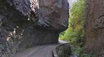
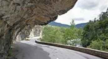
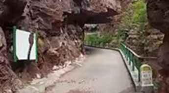
Gorges de Rebenty, a balcony road in France
Gorges de Rebenty is a very scenic canyon located in the department of Aude, region Languedoc-Roussillon, in southern France. The drive is very lovely but can also be very challenging if you are driving. It’s one of the famous French balcony roads.
Adventure Along the Wild Road to Col de Cluy
Col de Cluy is a high mountain pass at an elevation of 1.813m (5,948ft) above the sea level, located in the Isère department in southeastern France.
A thrilling (scary) off road experience to Clot de l’Alpe
Clot de l’Alpe is a high mountain pass at an elevation of 2.361m (7,746ft) above the sea level, located in the Hautes-Alpes department in southeastern France.
A brutal unpaved road to Col dés Pres
Col dés Pres is a high mountain pass at an elevation of 2.652m (8,700ft) above the sea level, located in the Savoie department, in the Auvergne-Rhône-Alpes region of the French Alps.
Col de La Madeleine in Savoie, pure adventure
Col de La Madeleine is a high mountain pass at an elevation of 2.716m (8,910ft) above the sea level located in the Tarentaise Valley, in the Savoie department of southeastern France. It's one of the highest roads of Europe.
The wild road to Collade des Roques Blanches
Collade des Roques Blanches is a high mountain pass at an elevation of 2.260m (7,414ft) above the sea level, located in the Pyrénées-Orientales department in southern France, near the border with Spain and the Autonomous Community of Catalonia.
Chris Froome has become the first man to cycle non-stop the Eurotunnel
Completed in 1993, the Channel Tunnel is the longest undersea tunnel in the world and connects the southern part of England with northern France.
A memorable road trip to Mont Colombis
Mont Colombis is a high mountain pass at an elevation of 1.734m (5,686ft) above the sea level, located in the Hautes-Alpes department in southeastern France.
Guide to the top of Col de Finiels
Col de Finiels is a high mountain pass at an elevation of 1.541m (5,055ft) above the sea level, located in the Lozère département in southern France.
The road to Mount Saleve, the "Balcony of Geneva"
Mount Saleve is a mountain peak at an elevation of 1.379m (4,524ft) above the sea level, located in the Haute-Savoie department in the Auvergne-Rhône-Alpes region in south-eastern France.
The road to Col de Chavière is not for the faint of heart
Col de Chavière is a high mountain peak at an elevation of 2.477m (8,126ft) above the sea level, located in the Savoie department in the Auvergne-Rhône-Alpes region in south-eastern France.
A memorable road trip to Col du Poutran
Col du Poutran is a high mountain pass at an elevation of 1.996m (6,548ft) above the sea level, located in the Central French Alps, in the commune of Huez, in the Isère département in the Rhône-Alpes region.
A beautiful road through a scenic valley to Col de Peyresourde
Col de Peyresourde is a high mountain pass at an elevation of 1.569m (5,148ft) above the sea level, located in the central Pyrenees, in France.
The Wild Road to Col de Jou
Col de Jou is a mountain pass at an elevation of 1.125m (3,690ft) above the sea level located in the Pyrénées-Orientales department in southern France.
An epic road to Col d'Azet in the Pyrenees
Col d'Azet is a high mountain pass at an elevation of 1.580m (5,183ft) above the sea level, located in the Hautes-Pyrénées department in south-western France.
Driving the scenic Gorges de la Vésubie
Gorges de la Vésubie is the name of a canyon located in the Alpes-Maritimes department in the region of Provence-Cote d'Azur of France. It’s one of the scenic French balcony roads.
The road to Col du Lachens isn’t an easy one
Col du Lachens, also known as Mont du Lachens, is a high mountain pass at an elevation of 1.714m (5,623ft) above the sea level, located in the Alpes-Maritimes in the Provence-Alpes-Côte d'Azur region in the extreme southeast corner of France.
An iconic Tour de France road to Col de Jau
Col de Jau is a high mountain pass at an elevation of 1.509m (4,950ft) above the sea level, located on the boundary between the Aude and the Pyrénées-Orientales department in southern France.
Travel guide to the top of Col de la Colle-Saint-Michel
Col de la Colle-Saint-Michel is a high mountain pass at an elevation of 1.431m (4,694ft) above the sea level, located in the Alpes-de-Haute-Provence, in France.
A paved road to Refuge du Plan du Lac in the Alps
Refuge du Plan du Lac is a high mountain refuge in the Alps at an elevation of 2.370m (7,775ft) above the sea level, located in the Savoie department in the Rhône-Alpes region in south-eastern France.
Col de Sanson, an old military unpaved road in the Ligurian Alps
Sanson Pass (also known as Colla di Sanson, Bassa di Sanson o Baisse de Sanson) is an international high mountain pass at an elevation of 1.694m (5,557ft) above the sea level, located in the Ligurian Alps, a mountain range on the border between France and Italy.
A paved road to Col de Port in the French Pyrenees
Col de Port is a mountain pass at an elevation of 1.249m (4,098ft) above the sea level, located in the French Pyrenees between Massat and Tarascon-sur-Ariège in the "massif de l'Arize".
A demanding narrow road to Col de Portel in the French Pyrenees
Col de Portel is a mountain pass at an elevation of 1.432m (4,698ft) above the sea level, located in the Ariège department in southwestern France.
A mediocre quality but deserted road to Val Pelouse
Val Pelouse is an abandoned ski station at an elevation of 1.728m (5,669ft) above the sea level, located in the Savoie department in the Rhône-Alpes region in south-eastern France.
Mont Chauve: this road is not for timid drivers
Mont Chauve d'Aspremont is a mountain peak at an elevation of 835m (2,739ft) above the sea level, located in the Alpes-Maritimes department in the Provence-Alpes-Côte d'Azur region of France.
Plus hautes routes de montagne de France
Située en Europe occidentale, la France est le plus grand pays de l’Union Européenne. C’est un pays très montagneux. Les deux chaînes de montagnes les plus importantes du pays sont les Alpes et les Pyrénées.
Passage de la Grande Clue, a balcony road in France
Passage de la Grande Clue is a short balcony road located in the Alpes-Maritimes department, in the Provence-Alpes-Côte d'Azur region of southeastern France. It was bypassed by a tunnel and totally closed to motor vehicles.
A gravel road to the top of Pas du Tanarel
Tanarello Pass is a high mountain pass at an elevation of 2.042m (6,699ft) above the sea level, located on the French-Italian border between Liguria, Piemonte and Provence-Alpes-Côte d'Azur. It belongs to the Ligurian Alps. The road to reach the pass is a gravel dirt track.
An epic climb to Col de Tramassel in the Pyrenees
Col de Tramassel is a high mountain pass at an elevation of 1.620m (5,314ft) above the sea level, located in the Hautes-Pyrénées department in the Occitanie region of France.
The road to Col d'Orgambide is not for the faint of heart
Col d'Orgambide-Collado de Orgambide is an international high mountain pass at an elevation of 992m (3,254ft) above the sea level, located on the Spanish-French border.
A lonely paved road to Refuge de Laval
Refuge de Laval is a high mountain refuge at an elevation of 2.008m (6,587ft) above the sea level, located in the Hautes-Alpes department in southeastern France.
Col de Rousset is an epic road in the Vercors massif
Col de Rousset is a high mountain pass at an elevation of 1.254m (4,114ft) above the sea level, located in the Drôme department in southeastern France. The road winds its way between Die and the village of Chamaloc in a setting that still feels like Provence, with its lavender fragrance.
An awe-inspiring road to Mont Revard
Mont Revard is a mountain pass at an elevation of 1.562m (5,125ft) above the sea level, located in the Bauges Massif near Aix-les-Bains in Savoie, France. The pass is traversed by the D913 road.
A pretty bumpy narrow road to Col de Bleine
Col de Bleine is a high mountain pass at an elevation of 1.439m (4,721ft) above the sea level, located in Provence-Alpes-Cote d'Azur, in France.
A steep paved road to Madone de Fenestre
Madone de Fenestre is a high mountain sanctuary at an elevation of 1.904m (6,246ft) above the sea level, located in the Mercantour National Park, in the Alpes-Maritimes, a department of the Provence-Alpes-Côte d'Azur region in the extreme southeast corner of France.
Travel guide to the top of Coll de Sansa
Coll de Sansa is a high mountain pass at an elevation of 1.770m (5,807ft) above the sea level, located in the Pyrénées-Orientales department in southern France.
A lonely paved road to Col de Bostmendieta
Col de Bostmendieta is a mountain pass at an elevation of 1.054m (3,458ft) above the sea level, located in the Pyrénées-Atlantiques département, in France.
Clue de Carajuan, a balcony road in France
Clue de Carajuan is a very scenic drive located in the Alpes-de-Haute-Provence department in southeastern France. It’s one of the famous French balcony roads. Driving on this narrow road between walls of cliffs and gorges is a delight.
Road trip guide: Conquering Punta Bagna
Punta Bagna is a high mountain peak at an elevation of 2.730m (8,956ft) above the sea level, located in the Savoie department in the Auvergne-Rhône-Alpes region in southeastern France. It's one of the highest roads of Europe.
A brutal road to Col de Lauzun in the French Alps
Col de Lauzun is a high mountain pass at an elevation of 2.809m (9,215ft) above the sea level, located in the Savoie department of the Auvergne-Rhône-Alpes region in France. It's one of the highest roads of Europe.
A memorable road trip to Col des Voltes
Col des Voltes is a high mountain pass at an elevation of 1.823m (5,980ft) above the sea level, located in the Pyrénées-Orientales department in southern France.
The old military road to Col de l’Infernet
Col de l’Infernet is a high mountain peak at an elevation of 2.355m (7,726ft) above the sea level, located in the Hautes-Alpes department in southeastern France.
Passage de la Petite Clue, a balcony road in France
Passage de la Petite Clue is a short balcony road located in the Alpes-Maritimes department, in the Provence-Alpes-Côte d'Azur region of southeastern France. It was bypassed by a tunnel and totally closed to motor vehicles.
The paved D89, a road to Puigmal
D89 is a very scenic paved mountain road located in the Pyrénées-Orientales department in southern France, near the Spanish border, on the way to Puigmal (also called Puigmal d'Err).
Col de la Llose, a sensational drive in the French Pyrenees
Col de la Llose is a high mountain pass at an elevation of 1.866m (6,122ft) above the sea level, located in the Pyrénées-Orientales department in the Occitanie region of Southern France.
