What are the most spectacular roads in France?
France is a true paradise for those wishing to experience the most spectacular roads, and it provides endless experiences for each driver. From stunning balcony roads, mountain passes, and coastal drives, to roads disappearing with the tides, it hosts more than 750 roads listed as the most spectacular in the world.
Located in the western part of Europe, France covers an area of 551,695 square kilometers and shares borders with 7 countries: Belgium, Luxembourg, Germany, Switzerland, Italy, Spain, and Andorra. With high mountains in the Alps and the Pyrenees, the roads of the country are famous worldwide because of the Tour de France, the most important cycling race. When traveling to the country, be sure to experience a drive through the best balcony roads. Dramatically carved out of rock on the side of mountains, the balcony roads are a unique experience for any rider.
The country also hosts iconic roads, known worldwide, including Col du Chaussy, a mountain pass at 1,533m (5,029ft) above sea level, famous for the “Lacets de Montvernier,” a special 3 km stretch with 17 hairpins as the road virtually climbs a cliff, or Col de Turini, a treacherous Alpine road with a legendary driving history, as one of the most dangerous and challenging stages of the Monte Carlo Rally and one of the most scenic drives in the world. For those preferring another kind of experience, don’t forget to drive Passage du Gois, the tide-covered road. It’s a natural passage flooded twice a day by the high tide leading to the island of Noirmoutier.
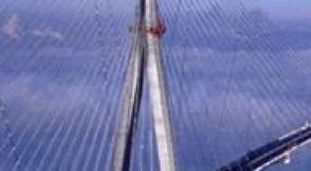
Crossing the beautiful Pont de Normandie
Pont de Normandie is a very beautiful and modern cable-stayed road bridge located in northern France. It’s one of the most spectacular bridges in the world.
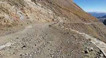
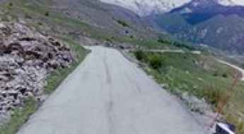
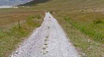
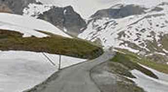
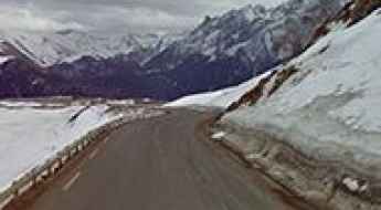
Discovering the unpaved road up to Col de Sencours in the Pyrenees
Col de Sencours is a high mountain pass at an elevation of 2.378m (7,801ft) above sea level, located in the Hautes-Pyrénées department in the Occitan region of France.
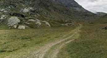
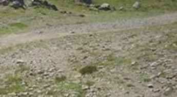
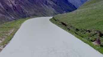
A gravel road to Col des Laquets in the French Pyrenees
Col des Laquets is a high mountain pass situated at an elevation of 2,637m (8,651ft) above sea level. Located in the Hautes-Pyrénées department of France, it’s one of the highest roads in the country.
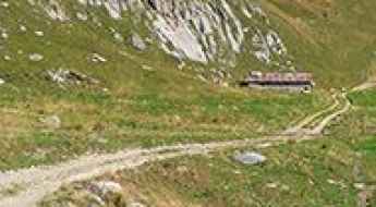
Col du Clapier is where Hannibal crossed the Alps
Col du Clapier-Colle Clapier is an international high mountain pass at an elevation of 2.480m (8,170ft) above sea level, straddling the Italian-French border.
Driving the unpaved road to Col de la Legette in the French Alps
Col de la Légette is a high mountain pass at an elevation of 1.776m (5,826ft) above sea level, located in the Savoie department of France.
A steep paved road to Col de Mehatche in the Pyrenees
Col de Méhatché is an international mountain pass at an elevation of 716m (2,349ft) above sea level, located on the Spanish-French border.
The road to Col d'Errozate is not recommended to newbies
Collado de Errozate-Col d'Errozate is an international mountain pass at an elevation of 1.076m (3,530ft) above sea level, located on the Spanish-French border.
Ultimate 4WD Destination: Col des Lessieres in the Alps
Col des Lessières is a high mountain peak at an elevation of 2,936m (9,632ft) above sea level, located in the Savoie department of the Auvergne-Rhône-Alpes region of France. It's one of the highest roads in Europe.
Discovering the narrow steep road to Col du Sabot in France
Col du Sabot is a high mountain pass at an elevation of 2.100m (6,889ft) above sea level, located in the Isère département in the Rhône-Alpes region of France.
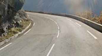
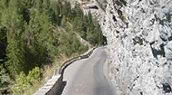
A steep paved road to Col de Vars in the Alps
Col de Vars is a high mountain pass at an elevation of 2.108m (6,916ft) above sea level, located in the Provence-Alpes-Côte d'Azur region of France. The pass is traversed by the scenic Route des Grandes Alpes.
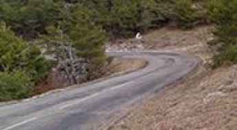
A curvy scenic road to Col de la Couillole
Col de la Couillole is a high mountain pass at an elevation of 1.678m (5,495ft) above sea level, located in the Alpes-Maritimes department of France. The road through the summit is part of the scenic Route des Grandes Alpes.
Alpe d'Huez is a mythical climb with 21 hairpin turns
Alpe d’Huez is a cycling legend. It’s the most famous mountain climb in the Tour de France. Located in the Isère département of the Rhône-Alpes region in France, the ski resort is at an elevation of 1.860m (6,100ft) above sea level.
Driving the D22, a balcony road in France
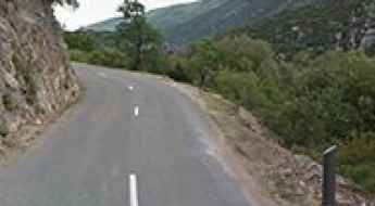
Perched high above the coastline of the Côte d'Azur in France, the D22 road is the name of a sharply winding and precipitous ascent in a steep and narrow zig-zag road, on the French Riviera. It is one of the most famous balcony roads in the country.
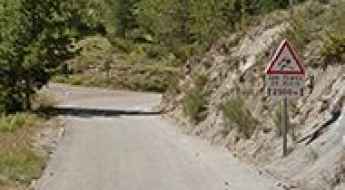
Col du Pourtalet: A Scenic Mountain Pass at the France-Spain Border
Col du Pourtalet is an international high mountain pass at an elevation of 1.798m (5,898ft) above sea level, located on the border of Spain and France. The pass offers the most beautiful views of Ossau Valley.
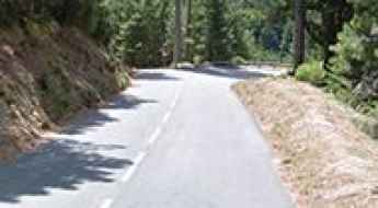
D43 is a scenic balcony road in France
Located in the Lot department of France, driving on the D43 road is a thrilling experience. It's one of the famous balcony roads of France.
How to get by car to Lac de la Sassiere in the Tarentaise Valley?
Lac de la Sassière is a high mountain lake at an elevation of 2.462m (8,077ft) above sea level, located in the Savoie department of the Auvergne-Rhône-Alpes region, in France.
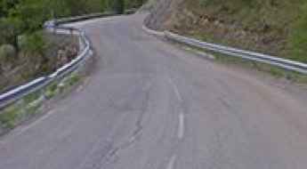
D918 is a challenging balcony road in France
D918 is an extreme high mountain road located in the Pyrenees, a range of mountains in southwest Europe that forms a natural border between France and Spain. It’s one of the French balcony roads.
Travel guide to the top of Col des Glieres
Col des Glières is a mountain pass at an elevation of 1,440m (4,724ft) above sea level, located in the Haute-Savoie department of France. There is a 2 km gravel stretch.
How to get by car to Pre de Madame Carle?
Pré de Madame Carle is a natural site at an elevation of 1,879m (6,164ft) above sea level, located in the Hautes-Alpes department in the Provence-Alpes-Côte d'Azur region of France.
The breathtaking road to Col de Salese in the Maritime Alps
Col de Salèse is a high mountain pass at an elevation of 2,036m (6,679ft) above sea level, located in the Alpes-Maritimes department in the Provence-Alpes-Côte d'Azur region of France.
The breathtaking road to Col de Caron in the Massif de la Vanoise
Col de Caron is a high mountain pass at an elevation of 2.996m (9,829ft) above sea level, located in Orelle, a commune in the Savoie department of France. It's one of the highest roads of Europe.
The legendary Col de la Madeleine is one of the greatest cycling climbs
Col de la Madeleine is a high mountain pass at an elevation of 1,998m (6,555ft) above sea level, located in the Savoie department of France. It’s one of the most emblematic French Alps mountain passes.
Pas de Peyrol is the highest road pass in the Massif Central
Pas de Peyrol is a high mountain pass at an elevation of 1,589m (5,213ft) above sea level, located in the Cantal department of France.
A great road to Cormet de Roselend in the Alps
Cormet de Roselend is a high mountain pass at an elevation of 1,991m (6,532ft) above sea level, located in the Savoie department of France. The pass is traversed by the scenic Route des Grandes Alpes.
Driving the scenic balcony road through the Gorges de la Meouge
Gorges de la Méouge is an incredible canyon located in the Hautes-Alpes department of France. The gorge is 7-kilometre (4.3 mi) long, carved by the Méouge which has its source in the Drôme. It’s one of the famous French balcony roads.
A gravel road to Col de Cibieres in the Alps
Col de Cibières is a high mountain pass at an elevation of 2,525m (8,284ft) above sea level, located in the Hautes-Alpes department of France.
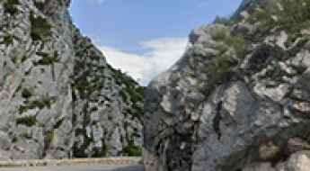
Gorges du Guiers Vif is a balcony road in France
Gorges du Guiers Vif is a very picturesque canyon located on the boundary between the Isère and Savoie departments of France. It is one of the famous French balcony roads.
A fabulous narrow road to the top to Col de l’Hysope
Col de l’Hysope is a mountain pass at an elevation of 1,236m (4,055ft) above sea level, located in the Alpes-de-Haute-Provence department of France.
Driving one of the highest roads of Europe to Sommet de Bellecote in the Graian Alp
Sommet de Bellecote is a high mountain peak at an elevation of 3.071m (10,075ft) above sea level, located in the Savoie department of France. It's one of the highest roads in Europe.
Gorges de la Blanche is a balcony road in France
Gorges de la Blanche is an amazing canyon carved by the La Blanche river, located in the Alpes-de-Haute-Provence department of France. It’s one of the scenic French balcony roads.
You'll never forget the road to Lac de Cema
Lac de Céma is a high mountain lake at an elevation of 2.745m (9,005ft) above sea level, located in the department of Savoie of France. It’s one of the highest roads in Europe.
Col du Glandon is one of the toughest climbs in the French Alps
Col du Glandon is a high mountain pass at an elevation of 1.930m (6,332ft) above sea level, located in the Savoie department of France. It’s one of the toughest climbs in the French Alps.
A road with very nice scenery to Col des Aravis
Col des Aravis is a mountain pass at an elevation of 1,487m (4,879ft) above sea level, located on the boundary between the Haute-Savoie and the Savoie departments of France. The pass is traversed by the scenic Route des Grandes Alpes.
Col de Bavella is one of the most scenic roads of Corsica
Col de Bavella is a mountain pass at an elevation of 1.226m (4,022ft) above sea level, located in the Corse-du-Sud department of France on the island of Corsica. It’s one of the highest roads of Corsica.
Clue de la Roche Percee is a French balcony road
Clue de la Roche Percée is a narrow canyon located in Southeastern France. It’s one of the famous French balcony roads. Driving on this narrow road through the canyon, between walls of cliffs and gorges, is a delight.
Driving the Scenic Balcony Road through Gorges de Chouvigny
Gorges de Chouvigny is a very scenic canyon straddling the Allier and Puy-de-Dôme departments of France. It’s one of the famous French balcony roads.
A bumpy scenic road to Lac de Roterel in the Alps
Lac de Roterel is a high mountain lake at an elevation of 1,941m (6,368ft) above sea level located in the Savoie department in the Auvergne-Rhône-Alpes region of France.
Driving the scenic road to Col d’Olivier
Col d’Olivier is a mountain pass at an elevation of 711m (2,332ft) above sea level, located in the Alpes-de-Haute-Provence department of France.
A sensational paved road to Col de l’Holme
Col de l’Holme is a mountain pass at an elevation of 1.207m (3,959ft) above sea level, located in the Isère department of France.
An iconic road to Col du Grand Colombier in the western Alps
Col du Grand Colombier is a high mountain pass at an elevation of 1.501m (4,925ft) above sea level, located in the department of Ain in France.
A wild paved road to the top of Col du Negron
Col du Négron is a mountain pass at an elevation of 1,242m (4,074ft) above sea level, located in the Drôme department of France.
Superbagneres: the road continually snakes its way up ahead
Superbagnères is a ski station at an elevation of 1.804m (5,918ft) above sea level, located in the department of Haute-Garonne, in France.
Col de Ve Gautier: good road quality and pleasant grading
Col de Vé Gautier is a mountain pass at an elevation of 1.099m (3,605ft) above sea level, located in the Alpes-Maritimes department of France.
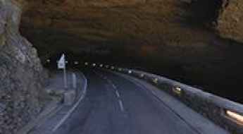
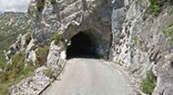
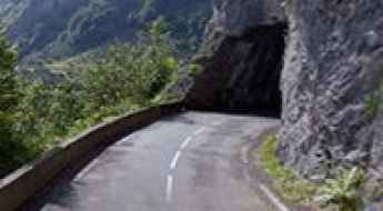
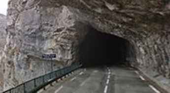
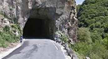
Driving Inside the Earth: Grotte du Mas d'Azil Is the Only Road Through a Cave in France
Located in the Ariège department in southwestern France, the Grotte du Mas d'Azil is a 500-meter long tunnel dug by the Arize River in the Ariège Pyrenees. It’s one of the few roads in the world that runs through a cave.
A French balcony road through Gorges du Bachelard
Gorges du Bachelard is a narrow, rocky canyon crammed with waterfalls, stone bridges, and soaring cliffs carved by the Bachelard River, located in the department of Alpes-de-Haute-Provence, in France. It's one of the French balcony roads.