What are the most spectacular roads in Italy?
Located in the southern part of Europe, Italy is a dream for drivers as it hosts the mountain passes (the Alps), coastal drives (Adriatic, Ionian, Tyrrhenian, and Ligurian), and some of the most famous scenic routes in the world.
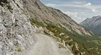
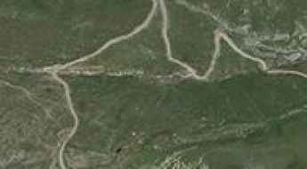
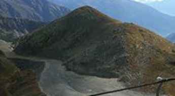
Choosing only a few roads to drive in the country is nearly impossible, as there are about 600 spectacular routes. Stelvio Pass is Europe's most famous road. At an elevation of 2,757m (9,045ft) above sea level, the pass is located in the northern part of the country. It's one of the highest roads in Europe. Featuring 48 hairpin turns, the road through the summit is a marvel of engineering.
If you prefer coastal drives, you must experience the breathtaking Amalfi Coast Road. The road follows the shoreline from Sorrento south to Salerno. The road has been featured in films since cameras started rolling at 24 frames per second. If you want to feel like James Bond, don’t skip Strada della Forra. A small car with a functioning horn is recommended. For skilled drivers only. The drive is known by motorcyclists from all over Europe, as it is impressive and not without danger in a few narrow and steep spots. If you prefer roads with a story, don’t miss the Strada delle 52 Gallerie, a WWI military mule road. Built on the massif of Pasubio, it was constructed in this position to stay away from Austro-Hungarian artillery fire.

Lazaunhutte Refuge
Rifugio Lazaunhutte is a high mountain refuge at an elevation of 2.425m (7,956ft) above the sea level, located in the Ortler Range, in South Tyrol, in northern Italy.
Forte del Monte Scale
Forte del Monte Scale is a high mountain military fortress at an elevation of 2.213m (7,260ft) above the sea level, located in the municipality of Valdidentro Sondrio, in Lombardy (Italy) and belongs to the Alps.

Lago Dietro la Torre
Lago Dietro la Torre is a high mountain artificial lake at an elevation of 2.372m (7,782ft) above the sea level, located in the Italian region Piedmont.
Selle Pass
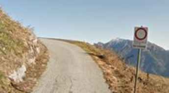
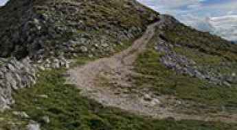
Passo le Selle is a high mountain peak at an elevation of 2.536m (8,320ft) above the sea level, located in Trentino in the northern Italian region Trentino-Alto Adige/Südtirol. High winds blow here all year long. It’s one of the highest roads of the country.
Lago Volaia
The Lago Volaia (Wolayersee) is a high mountain lake at an elevation of 1.963m (6,440ft) above the sea level, located in the Carnic Alps, on the Swiss-Italian border.
Malga Trela
Malga Trela is a high mountain pass at an elevation of 2.181m (7,155ft) above the sea level, located in the Province of Sondrio, Lombardy region of the Alps in northern Italy.
Malga Table
Malga Table is a high mountain pass at an elevation of 1.616m (5,298ft) above the sea level, located in Trentino-Alto Adige/Südtirol in Italy.
Alpe Vieille
Alpe Vieille is a high mountain pass at an elevation of 2.240m (7,349ft) above the sea level, located in the Valle d’Aosta region, in northwestern Italy.
Alpe Buri
Alpe Buri is a high mountain pass at an elevation of 1.525m (5,000ft) above the sea level, located in the Piedmont region of northwestern Italy.
Punta Chaligne
Punta Chaligne is a high mountain peak at an elevation of 2.311m (7,582ft) above the sea level, located in the Valle d’Aosta region, in northwestern Italy.
Col Sud de Menouve
Col Sud de Menouve is a high mountain peak at an elevation of 2.429m (7,969ft) above the sea level, located in the Valle d’Aosta region, in northwestern Italy.
Punta del Cavallo Pass
Punta del Cavallo is a high mountain pass at an elevation of 2.290m (7,513ft) above the sea level, located in the Province of Cuneo in the Italian region Piedmont.
Coletto di Laus
Coletto di Laus is a high mountain pass at an elevation of 1.948m (6,391ft) above the sea level, located in the Province of Cuneo in the Italian region Piedmont.
Sella della Valletta
Sella della Valletta is a high mountain pass at an elevation of 2.054m (6,738ft) above the sea level, located in the province of Imperia in the Italian region Liguria.
Monte Cuccio
Monte Cuccio is a mountain peak at an elevation of 1.041m (3,415ft) above the sea level, located in the Italian island of Sicily. The climb is brutal: narrow and steep.
Grosté Pass
Passo Grosté is a high mountain peak at an elevation of 2.446m (8,024ft) above the sea level, located in Trentino in the northern Italian Alps.
Colle di Sant'Anna di Vinadio
Colle di Sant'Anna di Vinadio is a high mountain pass at an elevation of 2.301m (7,549ft) above the sea level, located in the Maritime Alps, on the French-Italian border.
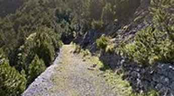
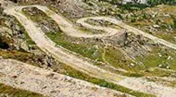
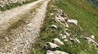
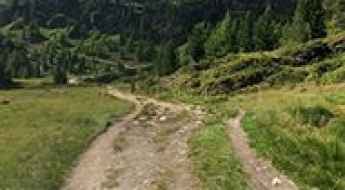
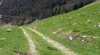
Translessinia
Translessinia (Strada Provinciale 14) is a very funny dirt-road experience in the Province of Verona in the Italian region Veneto, running entirely over 1.500m above the sea level.
Vallone di Chavannes
Vallone di Chavannes is a high mountain peak at an elevation of 2.184m (7,165ft) above the sea level, located in the Valle d’Aosta region, in northwestern Italy.

Colle Ciarbonet
Colle Ciarbonet is a high mountain pass at an elevation of 2.290m (7,513ft) above the sea level, located in the Province of Cuneo in the Italian region Piedmont.
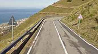
Road SP35
Strada Provinciale 35 is a very challenging road in the Calabria region of southern Italy. The road is very steep with several hairpin turns, offering stunning views of the Tyrrhenian Sea.
Malga Coltrondo
Malga Coltrondo is a high mountain pass at an elevation of 1.892m (6,207ft) above the sea level, located in the heart of the southern Alps in the Veneto region of Northern Italy.
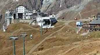
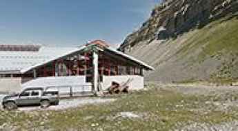
Plan Maison
Plan Maison is a ski resort at an elevation of 2.552m (8,372ft) above the sea level, located in the Aosta Valley region of north-western Italy.
Lavaredo Refuge
Rifugio Lavaredo is a high mountain hut at an elevation of 2.353m (7,719ft) above the sea level, located in the Sexten Dolomites of northeastern Italy, rising on the border between the northernmost section of the province of Belluno and Alta Pustera, in South Tyrol.
Monte Zoufplan
Monte Zoufplan da Cercivento is a high mountain peak at an elevation of 1.968m (6,456ft) above the sea level, located in the Province of Udine in the Italian region Friuli-Venezia Giulia.
Champillon
Champillon is a high mountain plateau at an elevation of 2.092m (6,863ft) above the sea level, located in the Aosta Valley region of north-western Italy.
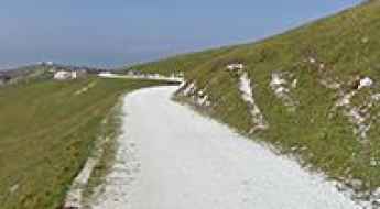
Padon Pass
Passo Padon is a high mountain peak at an elevation of 2.427m (7,962ft) above the sea level, located in Veneto region, in Northern Italy. The average gradient is 17.05%, with some sections up to 25%.
Punta di Santa Maria
Punta di Santa Maria is a high mountain pass at an elevation of 2.138m (7,014ft) above the sea level, located in the province of Imperia in the Italian region Liguria.
Nino Corsi Refuge
Rifugio Nino Corsi, also known as Zufallhütte, is a high mountain refuge at an elevation of 2.245m (7,365ft) above the sea level, located of the Ortler Alps on the border between South Tyrol and the Province of Sondrio, Italy.
Croce di Poverzone
Croce di Poverzone is a high mountain pass at an elevation of 1.908m (6,256ft) above the sea level, located in the heart of the Valtellina, in Italy.
Monte Lagazuoi
Monte Lagazuoi is a high mountain peak at an elevation of 2.572m (8,438ft) above the sea level, located in the Veneto region of northern Italy. It’sone of the highest roads of the country.
Testa Bassa
Testa Bassa is a high mountain peak at an elevation of 2.454m (8,051ft) above the sea level, located in the Aosta Valley, in the Italian Alps.
Contrabbandieri Pass
Passo dei Contrabbandieri (Smugglers pass) is a high mountain peak at an elevation of 2.581m (8,467ft) above the sea level, located in Trentino-South Tyrol in northern Italy. The road goes through the ruins of several WWI fortifications. It's one of the highest roads of the country.
Strada delle Farfalle, a wild road in Sardinia
Strada delle Farfalle is a mountain road located in the Province of Sassari in the Italian region Sardinia. Located in the Limbara mountain range, the road is pretty rough in parts.
How to get by car to Gobba di Rollin?
Gobba di Rollin is a high mountain peak at an elevation of 3.911m (12,831ft) above the sea level, located on the border of Switzerland and Italy. It’s one of the highest roads of Europe.
Feistritzer Alm
Feistritzer Alm is a high mountain pass at an elevation of 1.718m (5,633ft) above the sea level, located in the Carnic Alps, on the border of Austria and Italy.