What are the most spectacular roads in France?
France is a true paradise for those wishing to experience the most spectacular roads, and it provides endless experiences for each driver. From stunning balcony roads, mountain passes, and coastal drives, to roads disappearing with the tides, it hosts more than 750 roads listed as the most spectacular in the world.
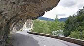
Located in the western part of Europe, France covers an area of 551,695 square kilometers and shares borders with 7 countries: Belgium, Luxembourg, Germany, Switzerland, Italy, Spain, and Andorra. With high mountains in the Alps and the Pyrenees, the roads of the country are famous worldwide because of the Tour de France, the most important cycling race. When traveling to the country, be sure to experience a drive through the best balcony roads. Dramatically carved out of rock on the side of mountains, the balcony roads are a unique experience for any rider.
The country also hosts iconic roads, known worldwide, including Col du Chaussy, a mountain pass at 1,533m (5,029ft) above sea level, famous for the “Lacets de Montvernier,” a special 3 km stretch with 17 hairpins as the road virtually climbs a cliff, or Col de Turini, a treacherous Alpine road with a legendary driving history, as one of the most dangerous and challenging stages of the Monte Carlo Rally and one of the most scenic drives in the world. For those preferring another kind of experience, don’t forget to drive Passage du Gois, the tide-covered road. It’s a natural passage flooded twice a day by the high tide leading to the island of Noirmoutier.
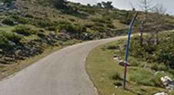
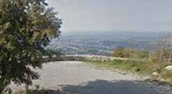
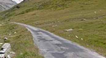
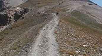
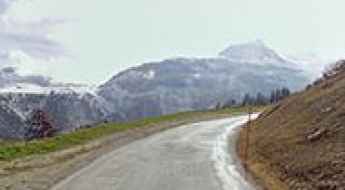
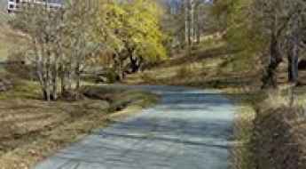
The road to Col du Lachens isn’t an easy one
Col du Lachens, also known as Mont du Lachens, is a high mountain pass at an elevation of 1.714m (5,623ft) above the sea level, located in the Alpes-Maritimes in the Provence-Alpes-Côte d'Azur region in the extreme southeast corner of France.
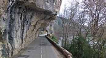
Clue de Carajuan, a balcony road in France
Clue de Carajuan is a very scenic drive located in the Alpes-de-Haute-Provence department in southeastern France. It’s one of the famous French balcony roads. Driving on this narrow road between walls of cliffs and gorges is a delight.
How to Drive The Balcony Road Through Gorges de l’Asco in Corsica
Gorges de l’Asco is an incredible canyon located in Corsica, a French island in the Mediterranean Sea. It’s one of the famous French balcony roads. Tucked away in the Haute-Corse department, the gorge is carved by the Asco River. This hidden gem is traversed by the D147, a narrow-paved road following the winding course of the river.
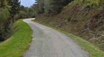
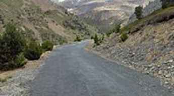
The Wild Road to Col de Jou
Col de Jou is a mountain pass at an elevation of 1.125m (3,690ft) above the sea level located in the Pyrénées-Orientales department in southern France.
Quelles sont les routes les plus hautes de France?
Située en Europe occidentale, la France est le plus grand pays de l’Union Européenne. C’est un pays très montagneux. Les deux chaînes de montagnes les plus importantes du pays sont les Alpes et les Pyrénées.
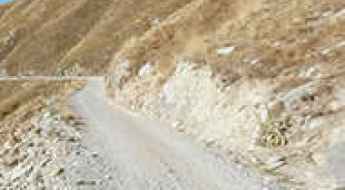
A pretty bumpy narrow road to Col de Bleine
Col de Bleine is a high mountain pass at an elevation of 1.439m (4,721ft) above the sea level, located in Provence-Alpes-Cote d'Azur, in France.
An old military unpaved road to Sanson Pass in the Ligurian Alps
Sanson Pass is an international high mountain pass at an elevation of 1.694m (5,557ft) above sea level, located on the border between France and Italy.
Clue de la Maglia, a balcony road in France
Clue de la Maglia is a very scenic drive located on the isolated valley of Maglia River near the village of Breil-sur-Roya in Alpes-Maritimes department of southeastern France. It’s one of the famous French balcony roads. Driving on this narrow road between walls of cliffs and gorges is a delight.
Mont Chauve: this road is not for timid drivers
Mont Chauve d'Aspremont is a mountain peak at an elevation of 835m (2,739ft) above the sea level, located in the Alpes-Maritimes department in the Provence-Alpes-Côte d'Azur region of France.
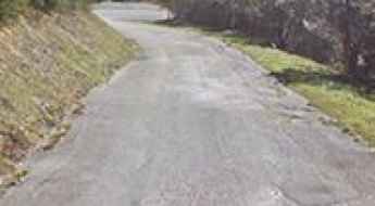
A demanding narrow road to Col de Portel in the French Pyrenees
Col de Portel is a mountain pass at an elevation of 1.432m (4,698ft) above the sea level, located in the Ariège department in southwestern France.
A gravel road to the top of Pas du Tanarel in the Ligurian Alps
Tanarello Pass is a high mountain pass at an elevation of 2,042m (6,699ft) above sea level, located on the French-Italian border.
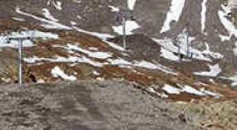
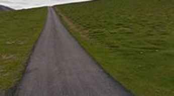
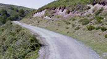
A mediocre quality but deserted road to Val Pelouse
Val Pelouse is an abandoned ski station at an elevation of 1.728m (5,669ft) above the sea level, located in the Savoie department in the Rhône-Alpes region in south-eastern France.
A paved road to Refuge du Plan du Lac in the Alps
Refuge du Plan du Lac is a high mountain refuge in the Alps at an elevation of 2.370m (7,775ft) above the sea level, located in the Savoie department in the Rhône-Alpes region in south-eastern France.

The road to La Tovière isn't for the sissies
La Tovière is a high mountain peak at an elevation of 2.682m (8,799ft) above the sea level, located in the Savoie department, in the Auvergne-Rhône-Alpes region of France. It’sone of the highest roads of the country.

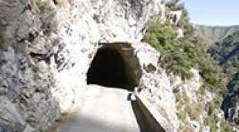
Passage de la Petite Clue, a balcony road in France
Passage de la Petite Clue is a short balcony road located in the Alpes-Maritimes department, in the Provence-Alpes-Côte d'Azur region of southeastern France. It was bypassed by a tunnel and totally closed to motor vehicles.

A paved road to Col de Port in the French Pyrenees
Col de Port is a mountain pass at an elevation of 1.249m (4,098ft) above the sea level, located in the French Pyrenees between Massat and Tarascon-sur-Ariège in the "massif de l'Arize".
Col de Rousset is an epic road in the Vercors massif
Col de Rousset is a high mountain pass at an elevation of 1.254m (4,114ft) above the sea level, located in the Drôme department in southeastern France. The road winds its way between Die and the village of Chamaloc in a setting that still feels like Provence, with its lavender fragrance.
The road to Col d'Orgambide is not for the faint of heart
Col d'Orgambide-Collado de Orgambide is an international high mountain pass at an elevation of 992m (3,254ft) above the sea level, located on the Spanish-French border.
An epic climb to Col de Tramassel in the Pyrenees
Col de Tramassel is a high mountain pass at an elevation of 1.620m (5,314ft) above the sea level, located in the Hautes-Pyrénées department in the Occitanie region of France.
The old military road to Col de l’Infernet
Col de l’Infernet is a high mountain peak at an elevation of 2.355m (7,726ft) above the sea level, located in the Hautes-Alpes department in southeastern France.
The unpaved road to Col de la Bâthie
Col de la Bâthie is a high mountain pass at an elevation of 1.884m (6,181ft) above the sea level, located in the Savoie department in the Auvergne-Rhône-Alpes region in south-eastern France.
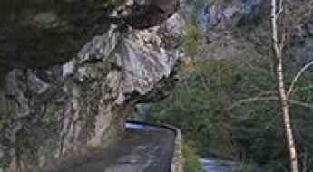
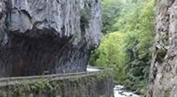
Défilé de Joucou, a treacherous balcony road in France
Défilé de Joucou is a very narrow canyon located in the department of Aude, region Languedoc-Roussillon, in southern France where even the road barely fits. Pictures don’t do it justice.
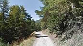
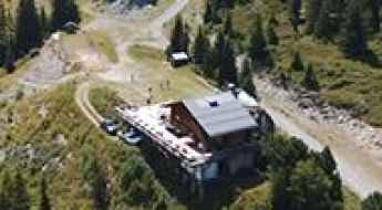
A lonely paved road to Refuge de Laval
Refuge de Laval is a high mountain refuge at an elevation of 2.008m (6,587ft) above the sea level, located in the Hautes-Alpes department in southeastern France.
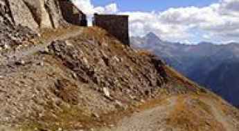
Dare to drive the dangerous road to Monte Chaberton
Monte Chaberton is a high mountain peak at an elevation of 3.131m (10,272ft) above sea level, located in the department of Hautes-Alpes, in France. The summit features a fortress with remnants of a WWI & WWII artillery battery. It's one of the highest roads in Europe.
An awe-inspiring road to Mont Revard
Mont Revard is a mountain pass at an elevation of 1.562m (5,125ft) above the sea level, located in the Bauges Massif near Aix-les-Bains in Savoie, France. The pass is traversed by the D913 road.
Road trip guide: Conquering Punta Bagna
Punta Bagna is a high mountain peak at an elevation of 2.730m (8,956ft) above the sea level, located in the Savoie department in the Auvergne-Rhône-Alpes region in southeastern France. It's one of the highest roads of Europe.

A brutal road to Col de Lauzun in the French Alps
Col de Lauzun is a high mountain pass at an elevation of 2.809m (9,215ft) above the sea level, located in the Savoie department of the Auvergne-Rhône-Alpes region in France. It's one of the highest roads of Europe.
A steep paved road to Madone de Fenestre
Madone de Fenestre is a high mountain sanctuary at an elevation of 1.904m (6,246ft) above the sea level, located in the Mercantour National Park, in the Alpes-Maritimes, a department of the Provence-Alpes-Côte d'Azur region in the extreme southeast corner of France.
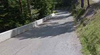
Altiport de Courchevel
Located in the heart of the French Alps, Courchevel Airport is an altiport at an elevation of 2.014m (6,607ft) above the sea level. It’s ranked as the seventh most dangerous airport in the world.
The road to Lac de la Girotte is not for the sissies
Barrage de la Girotte is a high mountain reservoir at an elevation of 1.753m (5,751ft) above the sea level, located in the Savoie department in the Auvergne-Rhône-Alpes region in south-eastern France.

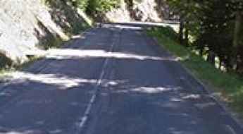
Road trip guide: Conquering Mur de Péguère
Mur de Péguère, also known as Col de Péguère, is a mountain pass at an elevation of 1.375m (4,511ft) above the sea level, located in the department of Ariège, in the Occitanie region of southwestern France. It’s a killer climb: on paper it only averages 7.9 per cent, but that’s thanks to some relatively gently lower slopes.
Col de Pierre Plate: The Road That Has it All!
Col de Pierre Plate is a mountain pass at an elevation of 1.027m (3,369ft) above the sea level, located in the Lozère department in southern France.
Travel guide to the top of Coll de Sansa
Coll de Sansa is a high mountain pass at an elevation of 1.770m (5,807ft) above the sea level, located in the Pyrénées-Orientales department in southern France.
The paved D89, a road to Puigmal
D89 is a very scenic paved mountain road located in the Pyrénées-Orientales department in southern France, near the Spanish border, on the way to Puigmal (also called Puigmal d'Err).
A lonely paved road to Col de Bostmendieta
Col de Bostmendieta is a mountain pass at an elevation of 1.054m (3,458ft) above the sea level, located in the Pyrénées-Atlantiques département, in France.
A memorable road trip to Col des Voltes
Col des Voltes is a high mountain pass at an elevation of 1.823m (5,980ft) above the sea level, located in the Pyrénées-Orientales department in southern France.
Col de la Llose, a sensational drive in the French Pyrenees
Col de la Llose is a high mountain pass at an elevation of 1.866m (6,122ft) above the sea level, located in the Pyrénées-Orientales department in the Occitanie region of Southern France.
D662, a balcony road in France
Route Départementale D662 is a very scenic drive located in the Lot department in south-western France. It’s one of the French balcony roads.
Road D914
The D914 road, also known as Route d’Espagne, is a very scenic drive through the Côte Vermeille, in south west France.
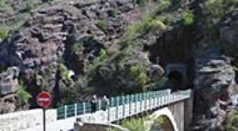
Crossing the scenic Pont de la Mariée
Located in the Alpes-Maritimes, in Provence-Alpes-Côte d'Azur, in southeastern France, Pont de la Mariée (Bride's Bridge) is one of the most spectacular bridges in the world.
Glacier du Varet
Glacier du Varet is a high mountain glacier at an elevation of 2.883m (9,458ft) above the sea level, located in the Savoie department in the Auvergne-Rhône-Alpes region in south-eastern France. It’s one of the highest roads of Europe.

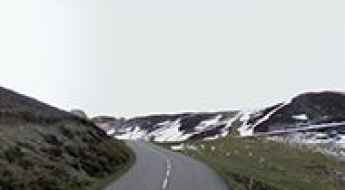
A classic road trip to Col de Soudet
Col de Soudet is a high mountain pass at an elevation of 1.540m (5,052ft) located in the Pyrénées-Atlantiques department in south-western France.
Col du Mollard: an iconic road in the French Alps
Col du Mollard is a high mountain pass at an elevation of 1.638m (5,374ft) above the sea level, located in the Savoie department in the Rhône-Alpes region in south-eastern France.
Gorges de l'Aude, a French balcony road
Located in the Aude department in southern France, Gorges de l'Aude is a narrow canyon to the south of Quillan, itself south of Carcassonne. It’sone of the famous French balcony roads.
Le Mauvais Pass, a narrow road to the summit
Le Mauvais Pass is a high mountain pass at an elevation of 1.779m (5,836ft) above the sea level located in the department of Hautes-Alpes in France, close to the Italian border.