What are the most spectacular roads in France?
France is a true paradise for those wishing to experience the most spectacular roads, and it provides endless experiences for each driver. From stunning balcony roads, mountain passes, and coastal drives, to roads disappearing with the tides, it hosts more than 750 roads listed as the most spectacular in the world.
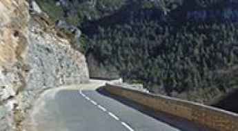
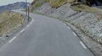
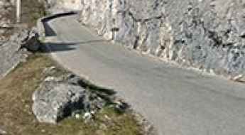
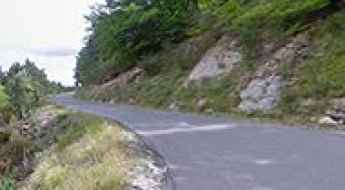
Located in the western part of Europe, France covers an area of 551,695 square kilometers and shares borders with 7 countries: Belgium, Luxembourg, Germany, Switzerland, Italy, Spain, and Andorra. With high mountains in the Alps and the Pyrenees, the roads of the country are famous worldwide because of the Tour de France, the most important cycling race. When traveling to the country, be sure to experience a drive through the best balcony roads. Dramatically carved out of rock on the side of mountains, the balcony roads are a unique experience for any rider.
The country also hosts iconic roads, known worldwide, including Col du Chaussy, a mountain pass at 1,533m (5,029ft) above sea level, famous for the “Lacets de Montvernier,” a special 3 km stretch with 17 hairpins as the road virtually climbs a cliff, or Col de Turini, a treacherous Alpine road with a legendary driving history, as one of the most dangerous and challenging stages of the Monte Carlo Rally and one of the most scenic drives in the world. For those preferring another kind of experience, don’t forget to drive Passage du Gois, the tide-covered road. It’s a natural passage flooded twice a day by the high tide leading to the island of Noirmoutier.
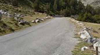
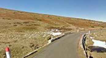
Col de la Met is one of the highest mountain roads in Europe
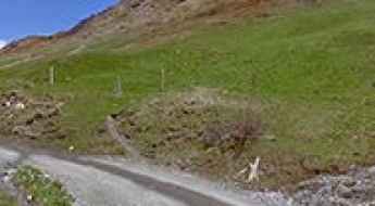
Col de la Met is a high mountain peak at an elevation of 2.750m (9,022ft) above sea level located in the Savoie department of France. It's one of the highest roads in Europe.
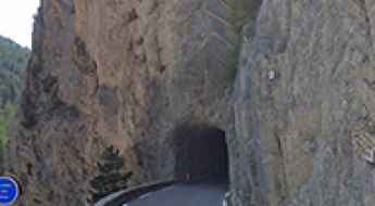
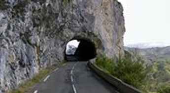
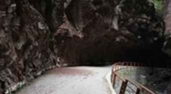
Driving Through the Iconic Tunnel du Galibier
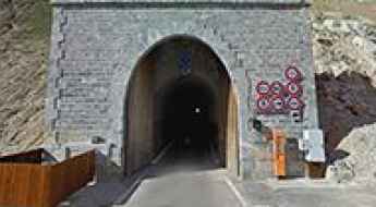
Tunnel du Galibier is a high mountain tunnel at an elevation of 2,576m (8,451ft) above sea level, located in France. Before 1976, the tunnel was the only passage point at the summit. It was closed for restoration until 2002, after which a new road was constructed over the summit.
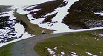
Travel Guide to the Top of Col de Pause in the Pyrenees
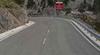
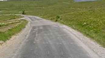
Col de Pause is a high mountain pass at an elevation of 1,542m (5,059ft) above sea level, located in the Ariège department of France.
A curvy road to Col de Scalella, in Corsica
Col de Scalella is a mountain pass at an elevation of 1,193m (3,914ft) above sea level, located on the island of Corsica, in France.
Travel Guide to the Cirque de Gavarnie
Cirque de Gavarnie is a large rock amphitheater at an elevation of 1,690m (5,544ft) above sea level, located in the Hautes-Pyrénées department of France.
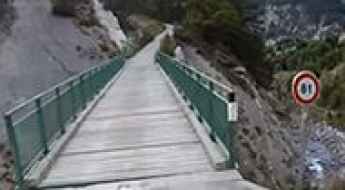
Travelling through the spectacular L’Ubayette Bridge
Located within the Mercantour National Park, in the Alpes-de-Haute-Provence department in southeastern France, L’Ubayette Bridge is a short wooden bridge. It’s one of the most spectacular bridges in the world.

How to Get to the Abandoned Fort de la Turra by Car?
The ancien Fort de La Turra is an abandoned high-mountain fort at an elevation of 2,493m (8,179ft) above sea level, located in the Savoie department of France.
A thrilling (scary) off-road experience to Col de Chérine
Col de Chérine is a high mountain pass at an elevation of 2,295m (7,529ft) above sea level, located in the Hautes-Alpes department of France.
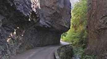
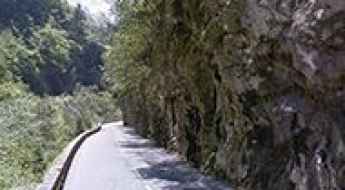
A narrow balcony road through Gorges de Rebenty
Gorges de Rebenty is a very scenic canyon located in the department of Aude, France. The drive is breathtaking but can also be challenging, especially if you are the one behind the wheel. It’s one of the famous French balcony roads.
Travel Guide to Pas de la Graille
Pas de la Graille is a high mountain pass at an elevation of 1,597m (5,239ft) above sea level, located in the Alpes-de-Haute-Provence department in France.
A paved road to the summit of Col de la Luzette in the Massif Central
Col de la Luzette is a mountain pass at an elevation of 1,350m (4,429ft) above sea level, located in the Gard department of France.
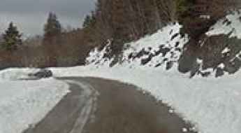
Faux Col de Restefond is one of the highest paved roads in France
Faux Col de Restefond is a high mountain pass at an elevation of 2,656m (8,713ft) above sea level, located in the Alpes-de-Haute-Provence department in France. It's one of the highest roads in the country.
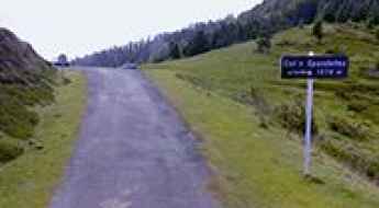
Dare to Drive the Challenging Col de Spandelles
Col de Spandelles is a mountain pass at an elevation of 1,378m (4,520ft) above sea level, located in the Hautes-Pyrénées department in France.
A scenic paved road to Col de la Pierre Saint-Martin
Col de la Pierre Saint-Martin (Piedra de San Martín) is a high mountain pass at an elevation of 1,760 m (5,774 ft) above sea level, located on the French-Spanish border.
Driving the Scenic Road Through the Gorges de la Vesubie in Alpes-Maritimes
Gorges de la Vésubie is a breathtaking canyon located in the Alpes-Maritimes department of France. It’s one of the most scenic French balcony roads.
D29 is a scenic balcony road in the Alpes-Maritimes
D29 is a short mountain road linking the villages of Guillaumes and Valberg, in the Alpes-Maritimes department of France. It’s one of the most scenic French balcony roads.
Travel Guide to L'Aiguille Percee
L'Aiguille Percée is a rock formation at an elevation of 2,732m (8,963ft) above sea level, located in the Savoie department of France. It’s one of the highest roads in Europe.
A Hairpinned Paved Road to Col du Coq
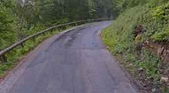
Col du Coq is a mountain pass at an elevation of 1,434m (4,704ft) above sea level, located in the Isère department of France. This climb is definitely harsh and grueling.
An epic mountain road to Signal de Bisanne
Signal de Bisanne is a high mountain peak at an elevation of 1,930m (6,332ft) above sea level, located in the Savoie department of France. This pass is one of only two climbs in France classified by the ASO as "Epic", which is similar to an Hors Catégorie (HC) climb.
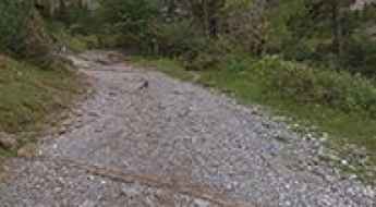
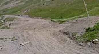
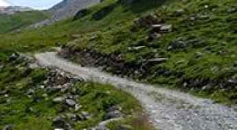
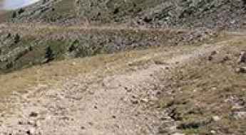
The unpaved road to Col de Moulata in the Pyrenees
Col de Moulata is a high mountain pass at an elevation of 1,685m (5,528ft) above sea level, located in the Hautes-Pyrénées department of France.
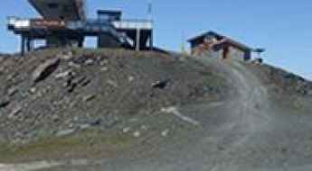
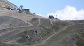
A wild high-mountain road to Pic Blanc in the Alps
Pic Blanc is a high mountain peak at an elevation of 3.305m (10,843ft) above sea level, located in the Isère department of France. It’s one of the highest roads in Europe.
Col de la Chambre: this drive is not for timid drivers
Col de la Chambre is a high mountain pass at an elevation of 2.879m (9,445ft) above the sea level located in the Savoie department in the Auvergne-Rhône-Alpes region in south-eastern France. It's one of the highest roads of Europe.
A brutal unpaved road to Col dés Pres
Col dés Pres is a high mountain pass at an elevation of 2.652m (8,700ft) above the sea level, located in the Savoie department, in the Auvergne-Rhône-Alpes region of the French Alps.
A thrilling (scary) off road experience to Clot de l’Alpe
Clot de l’Alpe is a high mountain pass at an elevation of 2.361m (7,746ft) above the sea level, located in the Hautes-Alpes department in southeastern France.
A wild road along the Gorges de la Jonte
Gorges de la Jonte is a canyon formed by the Jonte River, located in the border between the Lozère and the Aveyron counties, in southern France. The road through the gorges is the challenging D996 road.
An awe-inspiring road to Col du Raspaillon
Col du Raspaillon is a high mountain pass at an elevation of 2.525m (8,284ft) above the sea level, located on the boundary of the Alpes-Maritimes and the Alpes-de-Haute-Provence departments in southeastern France.
A delightful yet challenging road to Col du Soulor
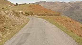
Col du Soulor is a high mountain pass at an elevation of 1.474m (4,835ft) above the sea level, located in the Hautes-Pyrénées department in southwestern France.
A curvy paved road to Col de la Chambotte
Col de la Chambotte is a mountain pass at an elevation of 650m (2,132ft) above the sea level, located in the Savoie department in the Rhône-Alpes region in south-eastern France.
The road to Col de Chavière is not for the faint of heart
Col de Chavière is a high mountain peak at an elevation of 2.477m (8,126ft) above the sea level, located in the Savoie department in the Auvergne-Rhône-Alpes region in south-eastern France.
Col de La Madeleine in Savoie, pure adventure
Col de La Madeleine is a high mountain pass at an elevation of 2.716m (8,910ft) above the sea level located in the Tarentaise Valley, in the Savoie department of southeastern France. It's one of the highest roads of Europe.
Passage de la Grande Clue, a balcony road in France
Passage de la Grande Clue is a short balcony road located in the Alpes-Maritimes department, in the Provence-Alpes-Côte d'Azur region of southeastern France. It was bypassed by a tunnel and totally closed to motor vehicles.
Lac d'Aumar, one of the highest paved roads in the Pyrenees
Lac d'Aumar (also known as Lac d'Aumer) is a high mountain lake at an elevation of 2.192m (7,191ft) above the sea level, located in Hautes-Pyrénées, a department in southwestern France. It is part of the Midi-Pyrénées region.
Adventure Along the Wild Road to Col de Cluy
Col de Cluy is a high mountain pass at an elevation of 1.813m (5,948ft) above the sea level, located in the Isère department in southeastern France.
Travel guide to the top of Col de Bassachaux
Col de Bassachaux is a high mountain pass at an elevation of 1.778m (5,833ft) above the sea level, located in the region of Porteis du Soleil, in Haute-Savoie, a department in the Rhône-Alpes region of eastern France.
Travel guide to the top of Col de la Colle-Saint-Michel
Col de la Colle-Saint-Michel is a high mountain pass at an elevation of 1.431m (4,694ft) above the sea level, located in the Alpes-de-Haute-Provence, in France.
Col des Montets
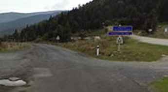
Col des Montets is a mountain pass at an elevation of 1.461m (4,793ft) above the sea level, located in the Haute-Savoie department of France.
The wild road to Collade des Roques Blanches
Collade des Roques Blanches is a high mountain pass at an elevation of 2.260m (7,414ft) above the sea level, located in the Pyrénées-Orientales department in southern France, near the border with Spain and the Autonomous Community of Catalonia.
A beautiful road through a scenic valley to Col de Peyresourde
Col de Peyresourde is a high mountain pass at an elevation of 1.569m (5,148ft) above the sea level, located in the central Pyrenees, in France.
A memorable road trip to Col du Poutran
Col du Poutran is a high mountain pass at an elevation of 1.996m (6,548ft) above the sea level, located in the Central French Alps, in the commune of Huez, in the Isère département in the Rhône-Alpes region.
An iconic Tour de France road to Col de Jau
Col de Jau is a high mountain pass at an elevation of 1.509m (4,950ft) above the sea level, located on the boundary between the Aude and the Pyrénées-Orientales department in southern France.
The road to Mount Saleve, the "Balcony of Geneva"
Mount Saleve is a mountain peak at an elevation of 1.379m (4,524ft) above the sea level, located in the Haute-Savoie department in the Auvergne-Rhône-Alpes region in south-eastern France.
An epic road to Col d'Azet in the Pyrenees
Col d'Azet is a high mountain pass at an elevation of 1.580m (5,183ft) above the sea level, located in the Hautes-Pyrénées department in south-western France.
Guide to the top of Col de Finiels
Col de Finiels is a high mountain pass at an elevation of 1.541m (5,055ft) above the sea level, located in the Lozère département in southern France.
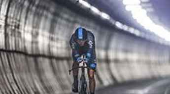
Chris Froome has become the first man to cycle non-stop the Eurotunnel
Completed in 1993, the Channel Tunnel is the longest undersea tunnel in the world and connects the southern part of England with northern France.

A memorable road trip to Mont Colombis
Mont Colombis is a high mountain pass at an elevation of 1.734m (5,686ft) above the sea level, located in the Hautes-Alpes department in southeastern France.