Driving a road to the brutally high Abra Huayta in Arequipa
Abra Huayta is a high mountain pass at an elevation of 5,323m (17,463ft) above sea level, located in the province of Castilla in Peru. It’s one of the highest roads in the country.
Where is Abra Huayta?
The pass is located south of Cusco, in the Chachas District, in the Arequipa Region, in the southern part of the country.
Why is it called Abra Huayta?
Set high in the Chila mountain range, the pass is named after the mountain Huayta.
Is the road through Abra Huayta unpaved?
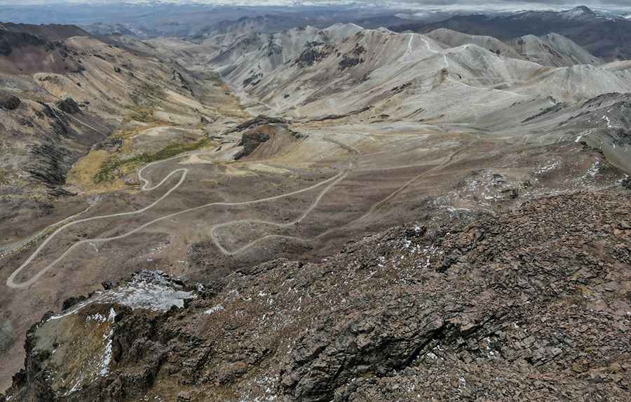
The road through the summit is totally unpaved, with many turns and countless hairpin bends. At this elevation, with steep parts, a 4x4 vehicle is recommended. At this elevation, oxygen levels drop and visitors need to take adequate precautions against AMS (Acute Mountain Sickness).
How long is the road through Abra Huayta?
The road through the pass is 98.7 km (61.32 miles) long, running west–east from Orcopampa to Caylloma. The road is never heavily used and it's better not to travel alone. If your ideal road trip involves getting way off the beaten track, then this is the drive for you.
Road suggested by: Hugh Wilson
Pic: Rolando Huamani