Driving a Wild Curvy Road to Abra Ucchuchacua in the Andes
Abra Ucchuchacua is a high mountain pass at an elevation of 4,740 m (15,551 ft) above sea level, located on the boundary between the Yanahuanca and Oyón districts of Peru.
Where is Abra Ucchuchacua?
The pass, also known as Abra Uchucchacua and Abra Uchuc Chacua, links the provinces of Oyón and Daniel Alcides Carrión, in the central part of the country, high in the Andes mountain range.
Why is Abra Ucchuchacua Famous?
The mountain gave its name to a mineral known as Uchucchacuaite. It was first discovered in the Uchucchacua Mine in Peru, which is where it gets its name. The mine is known for producing silver, lead, manganese, and zinc ores. Uchucchacuaite is relatively rare and mainly found in hydrothermal vein deposits, typically associated with other silver-bearing minerals.
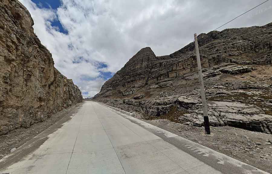
Is Abra Ucchuchacua Paved?
The road through the summit is mostly unpaved. However, it comprises a few paved sections with concrete near the summit. It’s called Ruta 18 (Carretera 18).
How Long is Abra Ucchuchacua?
The pass is 82.8 km (51 miles) long, running west–east from Oyón (the capital of the province Oyón in the Department of Lima) to Yanahuanca (the capital of the province Daniel Alcídes Carrión in the region Pasco). The road is heavily used by trucks due to the presence of mines in the area.
Road suggested by: Hugh Wilson