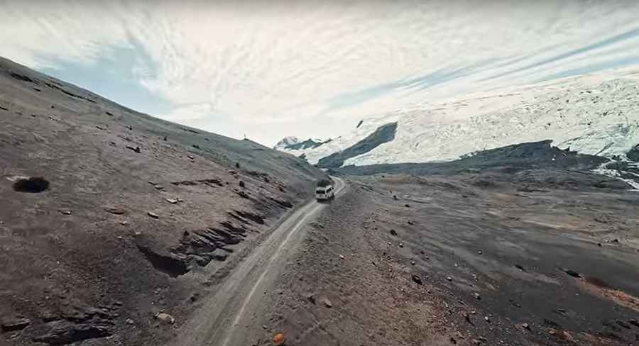
The Road to Caliz Pass in the Andes: Be Ready to Make Room for Oncoming Vehicles
Paso Caliz is a high mountain pass at an elevation of 5,206 meters (17,080 feet) above sea level, located on the boundary between the Canchis and Quispicanchi provinces of Peru. It is one of the highest roads in the country.

Where is Caliz Pass?
The pass, also known as Abra de Caliz and Abra Laccopata, is located in the Cusco Region in the southern highlands of the country, within the snow-capped Quesso Queperina, near the Quelccaya Glacier.
Is Caliz Pass open in winter?
Set high in the Cordillera Vilcanota range of the Andes, the road through the summit is totally impassable in winter due to snow. Always check the weather forecast before you start your journey, as adverse conditions are common.
Is Caliz Pass unpaved?
The road to the summit is entirely unpaved. It is called Road 1406. It is not an easy drive, as the road features dangerous drop-offs, narrow parts, steep sections, and countless curves, many of them hairpin turns. At this elevation, oxygen levels drop, and visitors need to take adequate precautions against AMS (Acute Mountain Sickness).
How long is Caliz Pass?
The road through the summit is about 50 kilometers (31 miles) long, running north-south from Marcapata, a town on Carretera 30C (Interoceánica Sur), to CU-125 Road. It is an unforgettable journey through one of the most awe-inspiring regions on the planet.
Road suggested by: Hugh Wilson
Pic & video: Deivis Choque