Road Trip Guide: Conquering Milagrosa Waterfall
Cascada Milagrosa is a high mountain waterfall at an elevation of 3,806m (12,486ft) above sea level, located in the Napo Province of Ecuador.
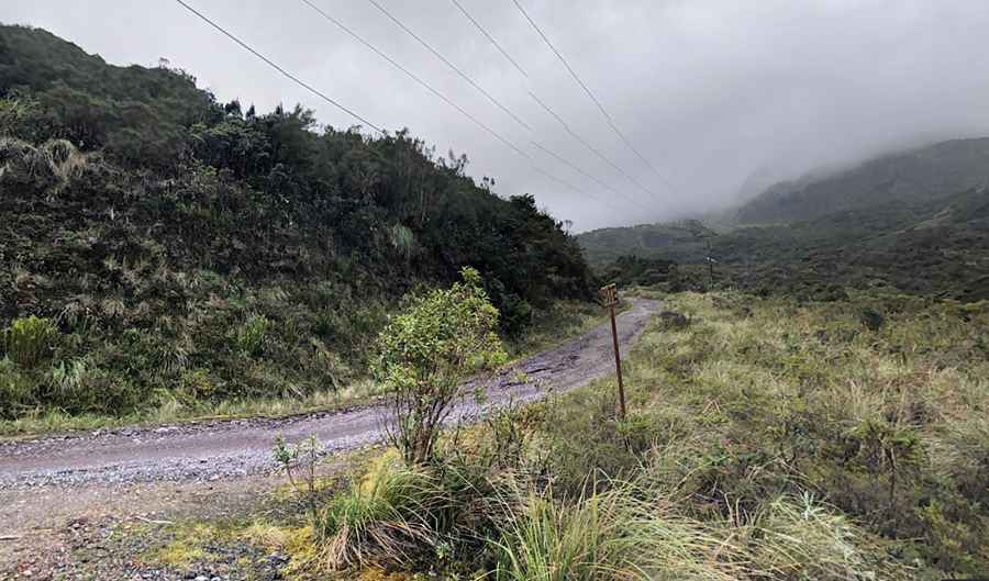
Is the road to Milagrosa Waterfall unpaved?
Nestled in the Andes Mountains of Ecuador, just an hour from Quito, within the Cayambe Coca National Park, the road to the waterfall is fully paved and challenging. It’s called Carretera Papallacta - Laguna Baños. A 4x4 vehicle is recommended. It is called "milagrosa" = miraculous because it is in the middle of a Polylepis forest and was part of the ceremonies or rituals of the Shaman.
How long is the road to Milagrosa Waterfall?
Starting from Papallacta, one of the highest towns accessible by car on Earth, the road to the waterfall is 7.6 km (4.72 miles) long. Over this distance, the elevation gain is 569m, and the average gradient is 7.48%. The road ends at a checkpoint just below the waterfall. From the checkpoint, you must walk about 900 meters along a marked, gravel, and wide path.
Pic: B Auer