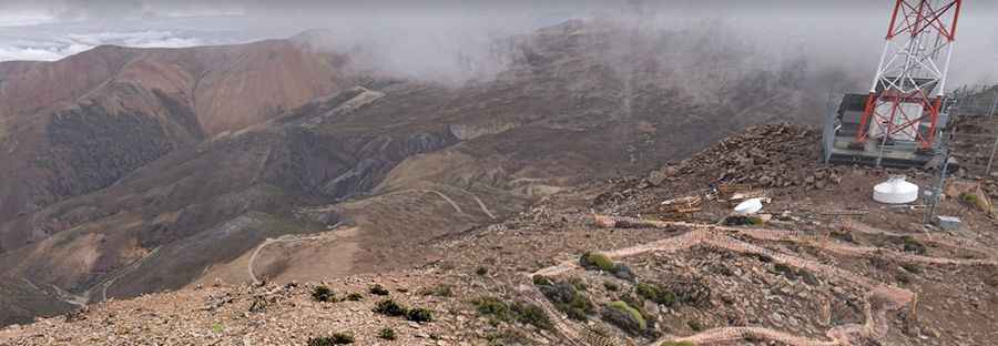
The Road to Portezuelo de Chapiquina in the Andes is Not for Timid Drivers
Portezuelo de Chapiquiña is a high mountain pass at an elevation of 4,453m (14,609ft) above sea level, located in the Arica and Parinacota Region of Chile.

Where is Portezuelo de Chapiquiña?
The pass is situated in the Arica-Parinacota Region, in the northern part of Chile, within the Parque Nacional Lauca.
How Long is Portezuelo de Chapiquiña?
Set high in the Andes, the road to the summit is called A-201. It’s entirely unpaved and very steep. The pass is 47.1 km (29.26 miles) long, running from Murmuntani to Las Cuevas.
To the west of the pass, a minor gravel road climbs up to 4,760m (15,616ft) above sea level, featuring 16 hairpin turns and an average gradient of 15%. At the summit, you’ll find many communication towers. At this elevation it’s one of the highest roads in the country.
Pic: Jose Luis Urrutia Oliva