Agua Negra Pass is the highest road between Argentina and Chile
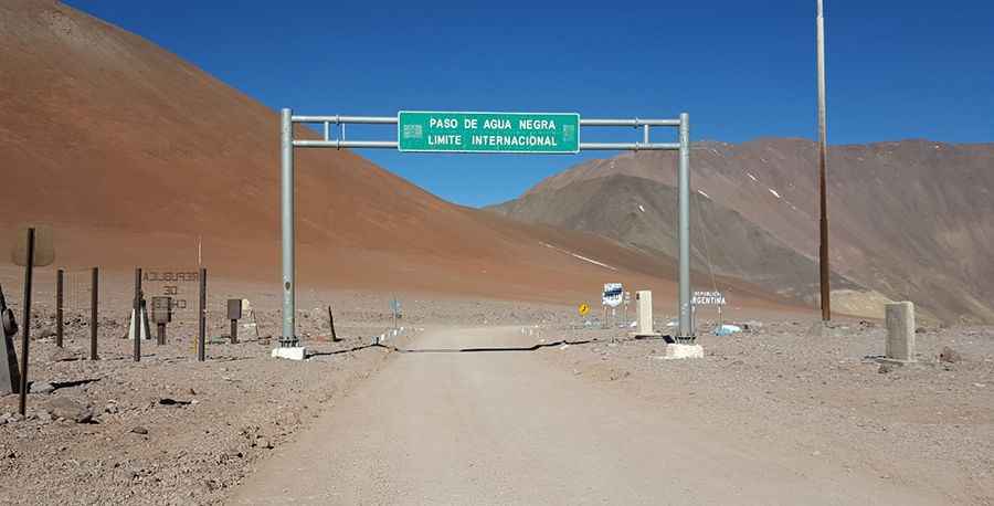
Paso de Agua Negra (Black Water Pass) is an international high mountain pass at an elevation of 4.774m (15,662ft) above sea level, located on the border of Argentina and Chile. It's one of the highest roads in the country.
Where is Agua Negra Pass?
Set high in the Andes mountain range, the pass links the IV Region of Coquimbo (Chile) with the Province of San Juan (Argentina). It is the highest border crossing between Argentina and Chile, and the traffic is very low, with around 200 vehicles using it every year.
Can you drive to Agua Negra Pass?
Located in the central region of both countries, the road to the summit is mostly unpaved. It’s called Ruta 41 (in Chile) and Ruta Nacional 150 (in Argentina). The pass is 318km (198 miles) long, running east-west from Las Flores (in San Juan Province of Argentina) to La Serena (the capital of the Coquimbo region on Chile’s coast). The pass is driveable with any kind of vehicle. Opened in 1965, the pass was closed in 1977 due to political problems between the two countries and reopened to the public in 1994.
Is the Agua Negra pass open?
Because of its altitude, this pass is open only in summers (from December through April). The rest of the year is blocked by snow. Remember to check before you drive, as the dates are dependent on snow conditions each year.
What’s Agua Negra tunnel?
A new tunnel (Agua Negra tunnel) is planned to bypass the mountain pass, allowing year-round traffic. The project consists of two parallel 13.9km (8.63 miles) tunnels, each comprised of two traffic lanes. The tunnels will have a maximum width of 11m, but because they run through high mountains, the maximum incline has been limited to 4%. The tunnel is expected to greatly improve economic connections between Chile, Argentina, Brazil, and Paraguay.
Pic: Marisa Matesevach