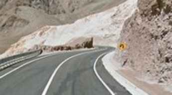
What are the most spectacular roads in Chile?
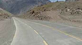
From the dunes of the Atacama to the ice of Patagonian glaciers, Chile is a dream for road trip enthusiasts. Located in South America, the narrow and long country hosts a never-ending list of mountain passes acting as a border with other countries. It’s worth remembering the country shares borders with Argentina, Bolivia and Peru. So, prepare to conquer Agua Negra Pass, the highest road between Argentina and Chile. At an elevation of 4.774m (15,662ft) above sea level and located on the border of Argentina and Chile, it's one of the highest roads in Chile. And, don’t miss Planchon Pass in the Andes, at 2.515m (8,251ft) above sea level, on the border with Argentina.
When you travel to Chile, there are hundreds of roads that must be in your list as it hosts more than 150 roads listed on the most spectacular drives in the world. Starting on Ruta 5, part of the Panamerican Highway, that offers a glimpse of Chile's dramatic geography; Paso Internacional Los Libertadores, a series of hairpin turns on the border with Argentina, and ending at Ojos del Salado stratovolcano, the world’s highest active volcano. At 6,891m (22,608ft) above sea level, this mountain has been the scene of several records for attaining the highest altitude aboard a land vehicle. It’s one of the highest accessible points by car on Earth.
Carreteras más altas de Chile
Ubicado en el continente sudamericano, Chile es una larga y estrecha área de tierra entre los Andes y el Océano Pacífico. El país más largo del mundo se caracteriza por una estrecha depresión entre las montañas y el mar.
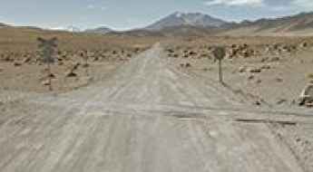
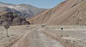
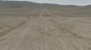
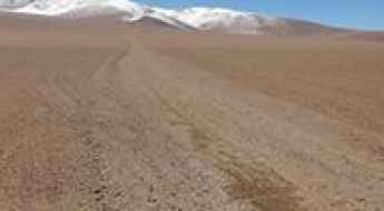
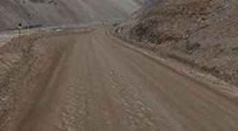
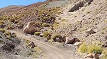
Ruta 24
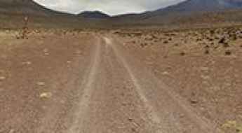
Ruta 24 is a stunning drive in the Atacama Desert, one of the driest areas in the world. The road is 156km long and links Calama and Tocopilla.
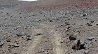
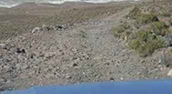
The breathtaking road to Portezuelo Sairécabur
Portezuelo Sairécabur is a high mountain peak at an elevation of 5.541m (18,179ft) above the sea level, located northeast of San Pedro de Atacama, on the border of Bolivia and Chile. It's one of the highest roads of the country.
A memorable road trip to Curiquinca Volcano
Curiquinca is a stratovolcano at an elevation of 5.625m (18,454ft) above the sea level, located on the border between Bolivia and Chile. It’s one of the highest roads of the country.
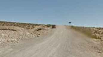
Road CH-21
CH-21 is a high mountain road located in northern Chile, in Antofagasta Region. The road is mostly unpaved and runs entirely over the 2.300m above the sea level.
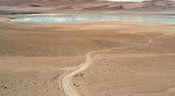
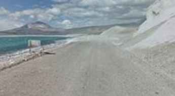
Laguna de Lejia
Laguna de Legia is a high mountain lake at an elevation of 4.350m (14,271ft) above the sea level located in the Antofagasta Region of northern Chile. This is a maintained road where a high clearance 2WD vehicle is able to travel safely at low speeds on long dry straight-of-ways, without losing control due to wash boarding, ruts, or dips.
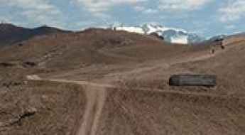
Driving a 4x4 mine road to Acotango Volcano in the Andes
Volcán Acotango is a volcano located on the border of Bolivia and Chile. A 4x4 mining trail climbs up to 5,509m (18,074ft) above sea level near the summit. The track beyond this point continues further, but it is impassable. It is one of the highest roads in the country.
Laguna Salar de Pajonales
Laguna Salar de Pajonales is a high mountain lake at an elevation of 3.541m (11,617ft) above the sea level, located in the Región de Antofagasta, in Chile.
Laguna del Inca o del Portillo
Laguna del Inca o del Portillo is a high mountain lake at an elevation of 2.853m (9,360ft) above the sea level, located in the high mountains of the Andes, in Valparaíso Region of Chile, close to the border with Argentina.
Picavilque Pass, pure adventure
Abra Picavilque is a high mountain pass at an elevation of 5.085m (16,683ft) above the sea level, located near the Bolivian border, in Chile’s Region I (Tarapacá). It’s one of the highest mountain roads of the country.
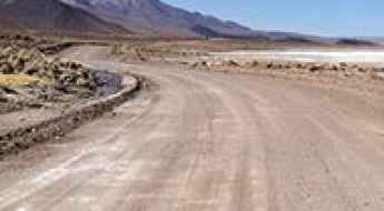
Laguna Santa Rosa
Laguna Santa Rosa is a high mountain salt lake at an elevation of 3.810m (12,500ft) above the sea level, located in northern Chile’s Atacama Desert. Daytime temperatures will reach up to 30 °C, while at night temperatures will tend to drop very low, even below freezing point in winter. There are often also b winds in the area.
Laguna Verde
Located in the Andes Mountains of Chile, Laguna Verde is a high mountain lake at an elevation of 4.328m (14,200ft).
Geisers del Tatio
Located within the Andes Mountains of northern Chile, El Tatio is the highest geyser field of the world, at an elevation of 4.320m (14,173ft) above the sea level.
Embalse La Laguna
Embalse la Laguna is a high mountain reservoir at an elevation of 3.180m (10,433ft) above the sea level located in the Coquimbo Region of Chile.
Cordón de Inacaliri
Cordón de Inacaliri is a volcano at an elevation of 5.395m (17,700ft) above the sea level, located on the Chilean-Bolivian border. It’s one of the highest mountain roads of the country.
Cerro Blanco
Cerro Blanco is a high mountain peak at an elevation of 5.161m (16,932ft) above the sea level, located in the Andes, in the Tarapacá Region of Chile. It’s one of the highest mountain roads of the country.
Cerro Llullaillaco
Cerro Llullaillaco is a dormant volcano located on the border of Argentina (Salta Province) and Chile (Antofagasta Region). A gravel rough 4x4 road southwest of the volcano climbs up to 5.049m (16,564ft) above the sea level.
Quebrada de Camarones
Quebrada de Camarones is a mountain pass at an elevation of 1.391m (4,563ft) above the sea level located in the Arica y Parinacota Region in Chile.
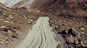
Road C-173
C-173 is a high mountain track located in the Atacama region of Chile, running entirely over the 3.000m above the sea level.
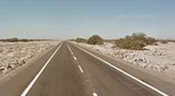
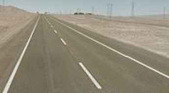
Pan-American Highway, the longest road in the world
The challenging Pan-American Highway is one of the biggest adventures in the world. It’s a network of roads covering almost 30,000 kilometres (19,000 mi) from North America to South America. It’s said to be the longest road on Earth.

The road to Paso Barros Arana in the Andes
Paso Barros Arana is a high mountain pass at an elevation of 3.431m (11,256ft) above the sea level, located on an arid high plateau in the Andes mountains of northeastern Chile.
Pascua Lama
Pascua Lama is an international high mountain peak at an elevation of 5.256m (17,244ft) above the sea level, located in the Andes mountains, in the southern reaches of Atacama Desert, on the border of Argentina and Chile. It’s one of the highest roads of the country.
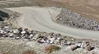
Chollay-Punta Colorada Road
Chollay-Punta Colorada road is one of the most scenic drives in Chile. The road climbs several mountain passes through more than 30 hairpin turns.
Cerro Tololo
Cerro Tololo is a high mountain pass at an elevation of 2.207m (7,241ft) above the sea level, located in the foothills of the Andes, in the Coquimbo Region of northern Chile.
Cerro Las Campanas
Cerro Las Campanas is a high mountain peka at an elevation of 2.380m (7,810ft) above the sea level, located in the Atacama Desert of northern Chile, the driest and remotest desert on Earth.
Road R-925-S
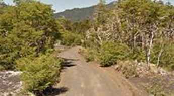
R-925-S is a very scenic drive located at the foot of the Andes, in the Province of Cautín, Araucanía Region, in Chile.
Cuesta Chita
Cuesta Chita is a high mountain pass at an elevation of 4.512m (14,803ft) above the sea level, located in the Andes mountains of northeastern Chile. It’s one of the highest roads of the country, running entirely over 3.000m above the sea level.
Cerro Canasa
Cerro Canasa is a high mountain pass at an elevation of 4.304m (14,119ft) above the sea level, located in the Chilean Tarapacá Region, near the Bolivian border.
Mirador de Toconce
Mirador de Toconce is a high mountain observation deck at an elevation of 3.339m (19,954ft) above the sea level located in the Antofagasta region of Chile.
Apacheta de Irpa o Cancosa Pass
Paso Apacheta de Irpa o Cancosa is an international high mountain pass at an elevation of 4.010m (13,156ft) above the sea level, located on the border of Chile and Bolivia.
Valle Nevado chairlift
Valle Nevado chairlift lies in the Andes Mountains of Chile, at an elevation of 3.306m (10,846ft) above the sea level.
A wild road to Portezuelo Maricunga
Portezuelo Maricunga is a high mountain pass at an elevation of 4.133m (13,559ft) above the sea level, located in northern Chile’s Atacama Desert. Daytime temperatures will reach up to 30 °C, while at night temperatures will tend to drop very low, even below freezing point in winter. There are often also b winds in the area.
La Silla
La Silla is a high mountain pass at an elevation of 2.400m (7,900ft) above the sea level, located in the southern part of the Atacama desert of northern Chile, the driest and remotest desert on Earth.
Ruta A-235
A-235 is a very exciting journey in the heart of the Las Vicuñas National Reserve, in the Arica and Parinacota Region of Chile. It runs entirely over 4.100m above the sea level.
San Juan Pass
Paso de San Juan is a high mountain pass at an elevation of 3.607m (11,833ft) above the sea level, located in the Andes mountains of northeastern Chile.
Visviri Pass
Paso Visviri is an international high mountain pass at an elevation of 4.095m (13,435ft) above the sea level, located on the border of Chile and Bolivia.