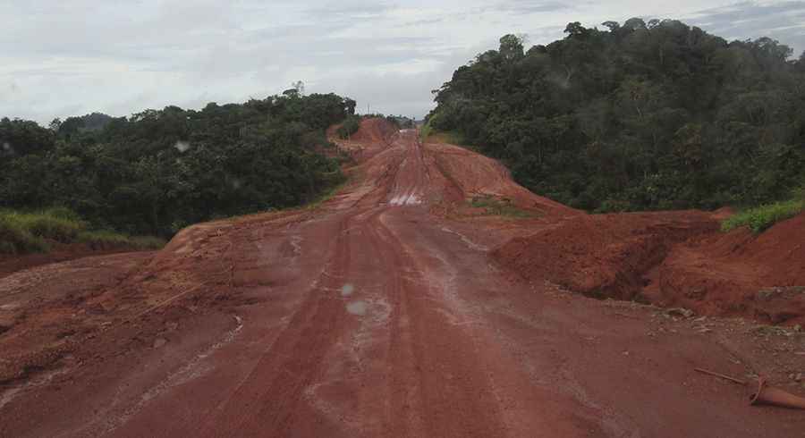
Trans-Amazonian Highway runs through the Amazon forest in Brazil
Rodovia Transamazônica (BR-230) is the name of a road in the depths of the huge state of Amazonas in Brazil, running through mud and jungles.

How long is the Trans-Amazonian Highway?
The road is 4,260 km (2,647 miles) long, spanning Brazil from the coastal city of João Pessoa in the northeast to the border with Peru. Running through the depths of the huge Amazon forest, the road includes paved and unpaved sections.
When was the Trans-Amazonian Highway built?
The road was inaugurated on September 27, 1972, and it’s the third-longest highway in Brazil. It runs across the states of Paraíba, Ceará, Piaui, Maranhão, Tocantins, Pará, and Amazonas. Some of the states that it runs through (Amazonas, Pará, Tocantins) are among the least densely populated in Brazil, so strips of road are hundreds of miles with little villages and infrastructure, just jungle. The highway was intended to integrate some regions of Brazil with the rest of the country, and with Colombia, Peru, and Ecuador. It was originally planned to be a fully paved highway 5200 kilometers long. However, these plans were modified following its inauguration.
Is the Trans-Amazonian Highway paved?
Designed in the seventies as a fully paved road, the huge construction costs and the remoteness of their path led to abandoning the original idea and building the BR-230 (its official name) as a dirt road in almost all its extension. Construction of the highway was very challenging because of the remoteness of the site. Workers building the road were frequently isolated and without communication. Access to the construction sites was mostly accomplished by small airplanes using temporary airstrips and boats. Today construction vehicles can be seen traversing the road east and west bringing dirt and gravel to prepare for paving operations. Subsequently, much of it has been paved, and there are stretches of hundreds of miles in the process of conversion on-road.
Is the Trans-Amazonian Highway challenging?
The final part of the track (almost 1,000 kilometers) remains completely unpaved, making it difficult or even impossible for the flow in the rainy season (October to March), and the road makes a circuit of resistance bumpy, pits, and holes capable of dismantling any vehicle dampers. The road will be completed with a final leg up to nearly a thousand kilometers to the town of Benjamin Constant, on the border with Peru. The project was plagued from the start. The sediments of the Amazon Basin rendered the highway unstable and subject to inundation during heavy rains, blocking traffic and leaving crops to rot.
Pic: By Keith Irwin - Own workTaken by Keith Irwin using a Canon PowerShot A2500, no flashPreviously published: on Keith Irwin's Blog, CC BY-SA 4.0, https://commons.wikimedia.org/w/index.php?curid=47922929