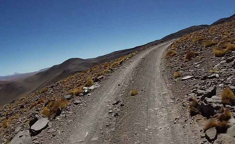
Travel guide to the top of Cerro Uturuncu
Cerro Uturuncu is a stratovolcano located in the Potosí Department of Bolivia. A minor gravel road climbs up to 6.008m (19,711ft) above sea level. It’s one of the highest roads in the world. The biggest problem is the extremely low oxygen for engine combustion.

Where is Uturuncu?
The volcano is located in San Pablo de Lípez Municipality, Sur Lípez Province, in the southwestern part of the country.
When was the road to Cerro Uturuncu built?
It's one of the highest roads in Bolivia. The mountain (also known as Uturunku or Uturunco) hosted a sulfur mine until the mid-1990s, which could be accessed via an unpaved road built between 1948-1950.
Is the road to Cerro Uturuncu maintained?
A 4x4 vehicle is required. The track is usually in acceptable condition, although depending on the season, it is possible to find some rock or snowfall on it. The runway is currently only maintained for touristic purposes by a few local guides. However, travelogues report very different information about the trafficability of that runway. As the old mine is no longer in operation, the road is now blocked by landslides.
Can you drive to the summit of Cerro Uturuncu?
Set high in the Bolivian Altiplano, all reports agree that the road is only rideable to a few hundred meters below the summit. Respective information varies from 5,200 meters to 5,900 meters. Satellite pictures clearly show the interrupted runway leading to an elevation of around 5,700 meters. At this elevation, motor vehicles are blocked by a landslide that occurred a few years ago, and although there is a 5,760m "pass" between Uturunco's two summits, it is a cul-de-sac that leads only to a mine. Still, a French team evidently managed to cycle and/or push their bicycles to Uturunco's summit.
How is the road to Cerro Uturuncu?
It’s one of the highest roads in South America. The roadway is very sandy in its lower part, and at an altitude of more than 5,000 meters, the lack of oxygen becomes a severe problem. While the road gets a little narrow in a couple of spots and there is a steep drop to your left, you should be able to drive up in a car as long as the engine doesn't give up due to a lack of oxygen. The average gradient on the first five kilometers is about 8%, increases to more than 10% between 5,100 and 5,600 meters, and finally lowers in the upper part of the road. The ride provides a gorgeous adventure in the gigantic scenery, with active volcanoes and colorful lagoons.