What are the most spectacular roads in Bolivia?
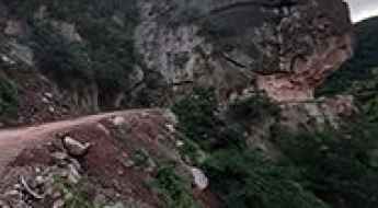
Located in South America, Bolivia is home to the most famous road in the world: the unpaved Death Road. Locally known as Carretera de los Yungas, this gravel dirt track covers a 36.4km (22.61 miles) stretch between La Paz and Coroico.
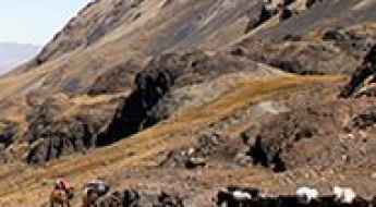
Part of the Andes Mountains (in the western part of the country), Bolivia is home to amazing mountain roads, including a few challenging mountain passes acting as a border. It’s worth driving the international Chungara-Tambo Quemado Pass, at 4.687m (15,377ft) above sea level on the border with Chile. For lovers of mountain roads, don’t miss Cerro Sairécabur, a volcano at 5.541m (18,179ft) above sea level, on the border with Chile. It’s one of the highest roads in Bolivia. Or Cerro Uturuncu, a stratovolcano in the Potosí Department, climbing up to 6.008m (19,711ft) above sea level. It’s one of the highest roads in the world. If you’re brave enough, you can tackle El Angosto, one of the deadliest roads in the world. Located in the Tarija Department, the Pilcomayo canyon ranks among the world's most treacherous roads.
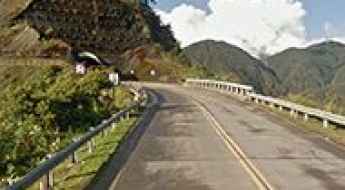
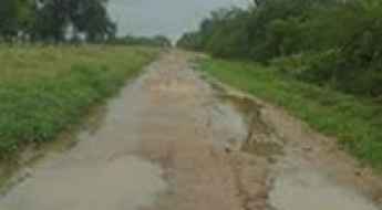
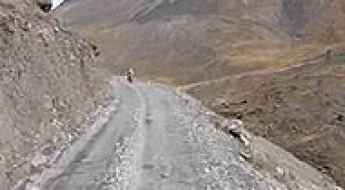
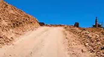
Tarija-Villamontes Road
The Tarija-Villamontes road is an amazing journey in the mountains of south-eastern Bolivia. Part of the Ruta Nacional 11, the road links Tarija (or San Bernardo de la Frontera de Tarixa) and Villamontes. It’s said to be the most dangerous road in the country.
Las carreteras más altas de Bolivia
Ubicado en la región oeste y centro de Sudámerica, Bolivia es un país del mismo tamaño que California y Texas juntos. La geografía del país es única entre los países del continente. Con sus altos picos, las montañas del país guardan cierto parecido con los picos del Himalaya.
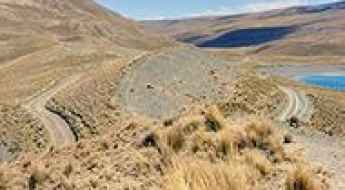
Laguna Salada
Laguna Salada is a high mountain salt lake at an elevation of 4.407m (14,458ft) above the sea level, located in the Sur Lípez Province of the Potosí Department, Bolivia.
Laguna Jankho Khota
Laguna Jankho Khota is a high mountain lake at an elevation of 4.701m (15,423ft) above the sea level, located in La Paz Department, in Bolivia.
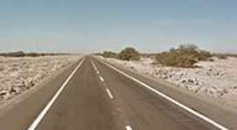
Pan-American Highway, the longest road in the world
The challenging Pan-American Highway is one of the biggest adventures in the world. It’s a network of roads covering almost 30,000 kilometres (19,000 mi) from North America to South America. It’s said to be the longest road on Earth.
Lago Zongo
Lago Zongo is a high mountain lake at an elevation of 4.776m (15,669ft) above the sea level, located in La Paz Department, in Bolivia.
Bolivar Mine
Mina Bolivar is a mine at an elevation of 5.161m (16,932ft) above the sea level, located in Sur Lípez (or Sud Lípez) province in the Potosí Department in southwestern Bolivia. It's one of the highest mountain roads of the country.
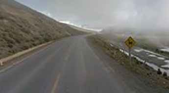
Visviri Pass
Paso Visviri is an international high mountain pass at an elevation of 4.095m (13,435ft) above the sea level, located on the border of Chile and Bolivia.
The road to Curiquinca Volcano isn’t an easy one
Curiquinca is a stratovolcano at an elevation of 5.625m (18,454ft) above the sea level, located on the border between Bolivia and Chile. It's one of the highest mountain roads of the country.
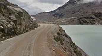
Lago Laramcota
Lago Laramcota is a high mountain lake at an elevation of 4.851m (15,915ft) above the sea level, located in the Kimsa Cruz mountain range in the Andes of Bolivia. The road to the lake, also known as Laram Quta, is gravel, rocky, tippy and bumpy at times. It's one of the highest mountain roads of the country.
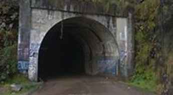
Tunel San Rafael
Located in the La Paz Department, in Bolivia, the San Rafael Tunnel is one of the highest tunnels in the world, at an elevation of 3.040m (9,973ft) above the sea level.

Cerro Santa Isabel
Cerro Santa Isabel is a high mountain peak at an elevation of 5.153m (16,906ft) above the sea level, in the Cordillera de Lípez in the Sud Lípez Province of the Potosí Department in southwestern Bolivia. It's one of the highest mountain roads of the country.
Rit'i Apachita
Rit'i Apachita (Riti Apacheta) is a high mountain peak at an elevation of 4.792m (15,721ft) above the sea level, located in the La Paz Department, in Bolivia. It's one of the highest mountain roads of the country.
Cordón de Inacaliri
Cordón de Inacaliri is a volcano at an elevation of 5.395m (17,700ft) above the sea level, located on the Chilean-Bolivian border. It’s one of the highest mountain roads of the country.
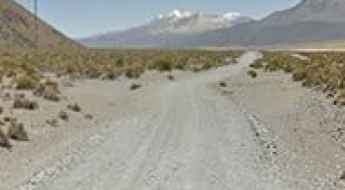
Cuesta de Sama
Cuesta de Sama is a high mountain pass at an elevation of 3.889m (12,759ft) above the sea level located in the Tarija Department in Bolivia.
Apacheta de Irpa o Cancosa Pass
Paso Apacheta de Irpa o Cancosa is an international high mountain pass at an elevation of 4.010m (13,156ft) above the sea level, located on the border of Chile and Bolivia.
Ch'iyar Qirini
Ch'iyar Qirini is a high mountain peak at an elevation of 5.194m (17,040ft) above the sea level, located in La Paz Department, in Bolivia. It's one of the highest mountain roads of the country.
A rough 4x4 road to Portezuelo Sairécabur
Portezuelo Sairécabur is a high mountain peak at an elevation of 5.541m (18,179ft) above the sea level, located northeast of San Pedro de Atacama, on the border of Bolivia and Chile. It's one of the highest roads of the country.
Antenas de Entel (Jamp'aturi)
Located in the La Paz Department, in Bolivia, las Antenas de Entel is a high mountain communication tower at an elevation of 4.937m (16,197ft) above the sea level. It's one of the highest mountain roads of the country.
Laguna Verde
Laguna Verde is a high mountain salt lake at an elevation of 4.300m (14,100ft) above the sea level, located in the Sur Lípez Province of the Potosí Department, Bolivia.
Laguna Milluni
Laguna Milluni is a high mountain lake at an elevation of 4,565m (14,977ft) above the sea level, located in the Cordillera Real of the Bolivian Andes.
Travel guide to the top of Mullu Apachita
Mullu Apachita is a high mountain pass at an elevation of 5.018m (16,463ft) above the sea level, located in La Paz Department, in Bolivia. It's one of the highest mountain roads of the country.
Unduavi Tunnel
Tunel de Unduavi is a high mountain tunnel at an elevation of 3.402m (11,161ft) above the sea level, located in La Paz Department, in Bolivia, within the Cordillera Real of the Bolivian Andes.
Mecoya-Mecoyita Pass
Paso de Mecoya-Mecoyita is an international high mountain pass at an elevation of 2.373m (7,785ft) above the sea level, located on the Bolivian-Argentinian border.
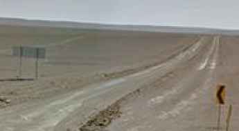
Road Picada 108
Carretera Picada 108 is a road linking the Ruta Ciudad Mariscal Estigarribia-Mayor Pablo Legerenza in the departments of Boquerón, Paraguay and the Bolivian border. This road, with a total length of 212km, crosses the infamous Ruta Transchaco and during the wet season, it’s totally impassable.
Laguna Estrellani
Laguna Estrellani is a high mountain lagoon at an elevation of 4.671m (15,324ft) above the sea level, located in the La Paz Department, in Bolivia.
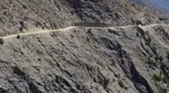
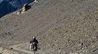
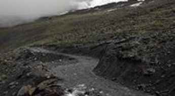
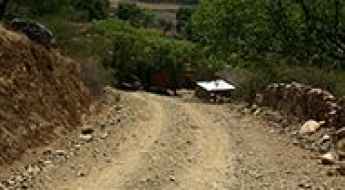
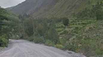
Huanacuno-Yunchara Road
The Carretera Huanacuno-Yunchara is a high mountain road located in southern Bolivia. This road tests the skill, and courage, of any driver. It’s definitely not for anyone suffering from vertigo or a fear of landslides.
Apagado Volcano
Volcán Apagado is a volcano at an elevation of 5.343m (17,529ft) above the sea level, located on the border of Chile (Región de Antofagasta) and Bolivia (Potosi Department).
Laguna Tuni
Laguna Tuni is a high mountain lake at an elevation of 4.494m (14,744ft) above the sea level, located in La Paz Department, in Bolivia. The road to the lake, located within the Cordillera Real of the Bolivian Andes, is gravel, rocky, tippy and bumpy at times with several hairpin turns.
Laguna Blanca
Laguna Blanca is a high mountain salt lake at an elevation of 4.350m (14,270ft) above the sea level, located in the Sur Lípez Province of the Potosí Department, Bolivia.
Milluni Chico
Milluni Chico is a high mountain lake at an elevation of 4.585m (15,042ft) above the sea level, located in the Cordillera Real of the Bolivian Andes.
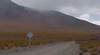
Wisalla
Wisalla is a high mountain pass at an elevation of 4.304m (14,120ft) above the sea level, located in the Andes of Bolivia. This is a maintained road where a high clearance 2WD vehicle is able to travel safely at low speeds on long dry straight-of-ways, without losing control due to wash boarding, ruts, or dips.
Pelechuco Pass: a winding road only for experienced drivers
Paso Pelechuco is a high mountain pass at an elevation of 4.863m (15,954ft) above the sea level, located in the La Paz Department in Bolivia, near the Peruvian border. It’s one of the highest roads of the country.
Abra Pucuani
Abra Pucuani is a high mountain pass at an elevation of 4.556m (14,947ft) above the sea level, located in the Cordillera Real in the Bolivian Andes.
A wild road to Cerro Rico, the silver mountain that eats men
Cerro Rico (Spanish for "Rich Mountain") is a cone-shaped peak famed for its historically large silver deposits at an elevation of 4.760m (15,616ft) above the sea level, located in the Tomás Frías Province in the Potosí Department in Bolivia.
Cerro Cachi Laguna
Cerro Cachi Laguna is a high mountain peak at an elevation of 5.491m (18,015ft) above the sea level, located in the department of Potosi of southwestern Bolivia, near the Chilean border. It’s one of the highest roads of the country.