The narrow unpaved road to Iruya in Salta Province
Iruya is a small town at an elevation of 2.790m (9,153ft) above sea level, located in the Iruya Department of Salta Province in Argentina.
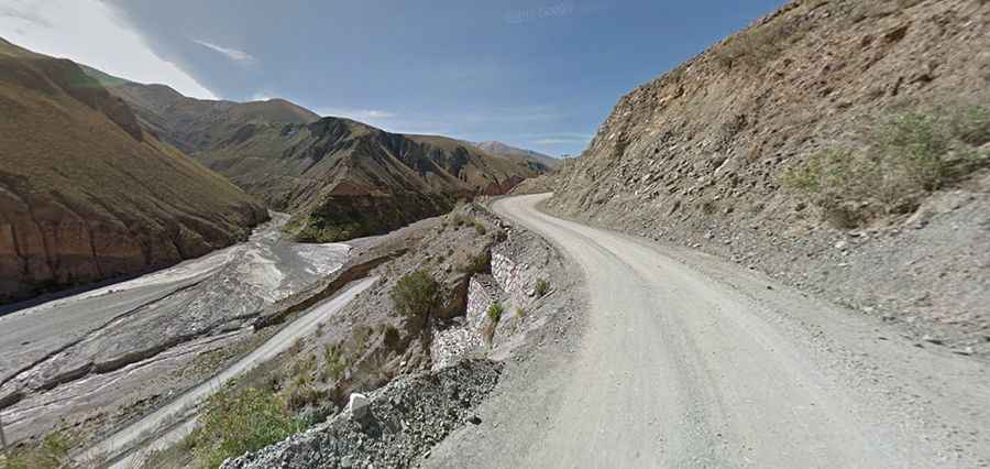
Is the road to Iruya in Argentina unpaved?
Set high on the northwestern part of the country, the road to the town is not for the sissies. It comprises the unpaved RP133 and RP13 roads, straddling Jujuy and Salta provinces. The area offers awesome mountain settings, isolated villages and spectacular off-road trails. The local people are more reminiscent of Bolivians than of Argentineans with their long, black braids tied together at the end, their short, layered skirts and sombreros, sometimes pimped with a fresh flower.
How long is the road to Iruya in Argentina?
Starting at the paved RN9, north of Humahuaca, the drive to the picturesque village is 47.4 km (29.45 miles) long. It’s a difficult drive, with countless curves and hairpin turns, dangerous drop offs with very narrow parts, fording many rivers and climbing up to Abra del Cóndor, a high mountain pass at an elevation of 3.942m (12,933ft) above sea level. Few people use it and the area is home to vicuñas. Just before reaching Iruya you will reach a beautiful gorge, rough and barren yet colorful in tinges of red and brown.
When is the best time to drive to Iruya in Argentina?
The road is very dry usually, but summer rainstorms can make it impassable. The best months to travel in this area are June, July, August, September and October.
Warnings:
A sign at the entrance to town warns visitors against:
- taking photographs of the residents without permission
- giving out charitable donations to the residents
- inappropriate dress. No bikinis.