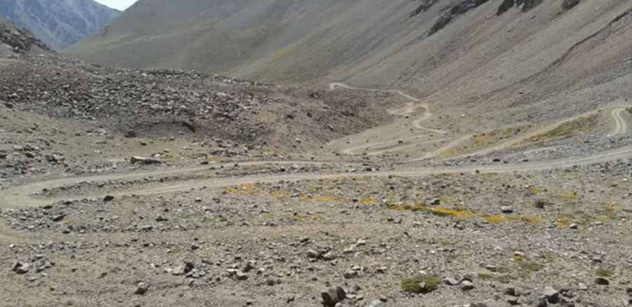
Cruce de los Andes-Paso de los Piuquenes
Cruce de los Andes Paso de los Piuquenes is a high mountain pass at an elevation of 4.350m (14,271ft) above the sea level, located in the province of Mendoza, Argentina.

The road to the summit, located within the Andes mountain range, is gravel, rocky, tippy and bumpy at times. The road is usually impassable from October to June (weather permitting). Great trail for experienced wheelers. Avoid driving in this area if unpaved mountain roads aren't your strong point. 4x4 vehicle required. Stay away if you're scared of heights. Expect a trail pretty steep. The last meters of the climb are just a walking path. Thunderstorm activity can quickly change unpaved roads to four-wheel-drive condition or make them impassable. Do not travel this road in severe weather conditions. It can often be treacherous, with ice and snow accumulating even in the summer, so exercise caution as you make your way. It is subject to winter snowfalls with such a high summit altitude, and the road can be closed anytime when the access is not cleared of snow. The pass was used in 1835 by Charles Darwin to pass from Chile to Argentina.
The pass, also known as Portillo Argentino, links the towns of Tunuyán (Argentina) and San Gabriel (Chile). Do not take this drive if you have respiratory problems or any type of heart condition. Notorius lack of oxygen that tests the organisms and a high degree of steepness. Most people feel altitude sickness at around 2,500-2,800 meters. Extremely low oxygen for engine combustion. A major hazard of altitude is the sickness that can indiscriminately affect anyone regardless of age or fitness. The summit has about 40% less oxygen than at sea level, thus breathing is more difficult. Your pulse rate will increase and movement will be more laborious at the summit. The high elevation with its risk of altitude sickness, weather concerns, steep road grade, and overall inaccessibility make the pass dangerous and summit trips difficult.
Pic: by Lima Indumentaria