How to drive La Sal Loop Road in Utah?
La Sal Mountain Loop Road is a scenic mountain drive in Moab, located in San Juan County, in the U.S. state of Utah. Though paved, it’s narrow and lacks guardrails.
Where is La Sal Loop Road?
The road is in the southeastern part of Utah, near the Colorado border, within the Manti-La Sal National Forest.
How long is La Sal Loop Road?
This popular two-lane loop road stretches 90.44 km (56.2 miles), beginning and ending in Moab. Due to its scenic views and frequent stops, the drive typically takes 2-3 hours.
Is La Sal Loop Road paved?
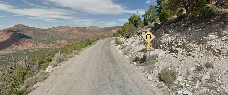
Yes, the road is fully paved, but it’s narrow, steep, and winding in some sections, with sharp turns and hairpin bends. The pavement is poorly maintained, with potholes and many 15-20 mph turns along a 20-mile stretch on the mountainside. Drive with caution as the road has dangerous drop-offs and no guardrails.
How remote is La Sal Loop Road?
The route is quite remote, with no services available. Ensure you have enough fuel, food, water, and supplies before starting the drive.
Can I drive my vehicle on La Sal Loop Road?
The highest elevation on the road reaches 2,543m (8,343ft) above sea level. While passenger cars can navigate the route, large RVs and trailers are not recommended due to tight switchbacks. The road is not for the faint of heart, as some sections have sheer drop-offs with no guardrails.
Is La Sal Loop Road worth the drive?
Absolutely! The road winds through stunning landscapes, transitioning from scorching desert to cool, green woodlands. Expect unforgettable views over Moab Valley and Canyonlands National Park, along with mesas and buttes featured in movies.