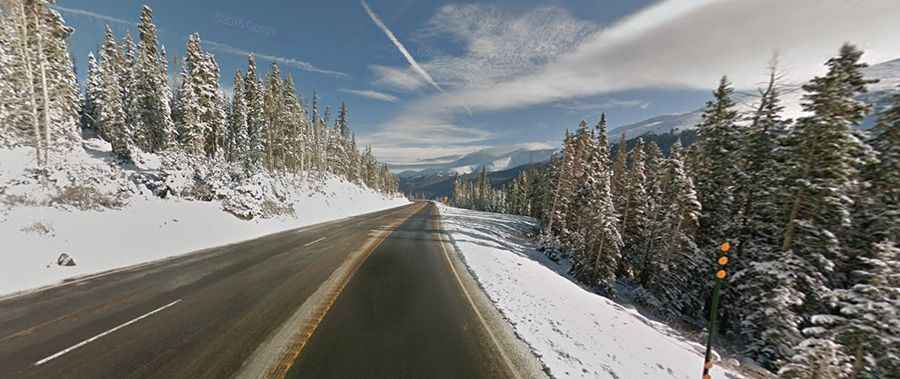
A white-knuckle drive to Berthoud Pass in Colorado
Berthoud Pass is a high mountain pass at an elevation of 3,446m (11,307ft) above sea level, located on the boundary between Clear Creek and Grand counties, in the U.S. state of Colorado.

How long is Berthoud Pass?
The road to the summit is totally paved. It’s called U.S. Highway 40. The pass is 75.15km (46.7 miles) long, running from the historic town of Empire (in Clear Creek County) to Granby (the most populous municipality in Grand County).
Who is Berthoud Pass named after?
Tucked away in the central part of Colorado, the pass is located on the Continental Divide at the Front Range. It’s named after Edward Berthoud, the chief surveyor of the Colorado Central Railroad during the 1870s.
Is Berthoud Pass open?
Set high in the Rocky Mountains, the road is plowed during the winter and open year-round; however, winter weather may cause restrictions and closures due to dangerous weather conditions, with avalanches and heavy snowfalls.
Is Berthoud Pass dangerous?
Located west of Denver, the pass can be a bit difficult for some drivers. Parts of the pass are three lanes. It's curvy and steep, but the exposure is not that bad in comparison to other passes. The pass has steep grades on either side (6.3%), along with winding switchbacks and many tight spots but equipped with guardrails and other safety measures. A gravel steep road to the east of the pass climbs up to Colorado Mines Peak, a mountain peak at an elevation of 3,812m (12,506ft) above sea level.
How long does it take to drive Berthoud Pass in Colorado?
To drive the road without stopping will take most people between 50 and 70 minutes. The drive is truly breathtaking and provides unbelievable views around every curve. Along the drive, there are several stopping points and overlooks to take in a view.