How to get by car to Alpine Tunnel in Colorado?
Located in Gunnison County, in the US state of Colorado, the Alpine Tunnel was once the highest railroad tunnel in the world, at an elevation of 3,559 meters (11,676 feet) above sea level.
Where is the Alpine Tunnel?
Part of the Great Alpine Tunnel Historic District, the tunnel is located in the central part of Colorado, within Gunnison National Forest. Both the east and the west portals have been closed, as the tunnel is extremely dangerous with rotted timbers. This trail is for anyone interested in ghost towns, mining, and railroad history.
When was the Alpine Tunnel built?
Excavation of the tunnel began in January 1880 and was expected to be finished in only six months. However, due to unforeseen circumstances, the task required longer. Completed in 1887 after six years of challenging construction, it was part of a railroad route designed to cross the Continental Divide. The tunnel was about 1,700 feet long and faced numerous engineering difficulties, including harsh weather and the high-altitude environment. It served as a key route for about 17 years before being abandoned in November of 1910 due to the increasing size of trains and maintenance difficulties.
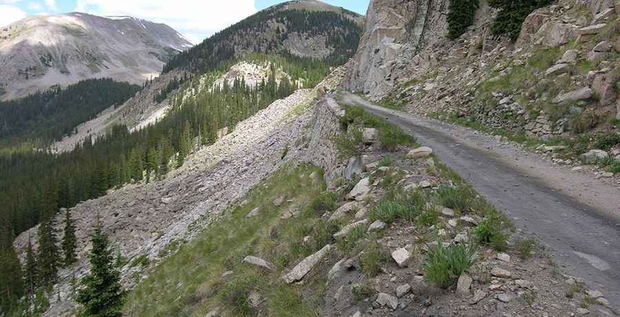
How long is the road to Alpine Tunnel?
The narrow dirt trail to the tunnel is called Alpine Tunnel Road (FDR 839). It runs along the old railroad grade that leads to the historic tunnel. The road is totally unpaved and not meant for average cars. A 4WD vehicle with high clearance is required. It’s about 10 miles long. The trail is no longer open to vehicle traffic (foot travel only) due to rock slides and a washout about one mile in. It is barricaded at the Hancock Pass merge.
Is the road to Alpine Tunnel open in winter?
Set high in the Rocky Mountains, the rough trail is high-altitude and subject to heavy snowfall. The trail is usually open from July 4 through Labor Day.
Pic: A.L. Szalanski (Wikimedia Commons).