How to get by car to the lookout at Bully Choop Mountain in California?
Bully Choop Mountain is a high mountain peak at an elevation of 2,126m (6,975ft) above sea level, located in the U.S. state of California.
Where is Bully Choop Mountain?
The peak is located west of Redding, on the boundary between Trinity and Shasta counties, in the northern part of California.
Why is it called Bully Choop Mountain?
Set high on the western edge of the Whiskeytown National Recreation Area, the peak is named after the Indian phrase “Bo-li Chu-ip,” which means “high sharp peak.”
What’s at the summit of Bully Choop Mountain?
At the summit, there’s a lookout tower built by the California Dept. of Forestry and Fire Control in 1978, still in active service, and a flat cement helipad at the base of the lookout.
How long is the road to Bully Choop Mountain?
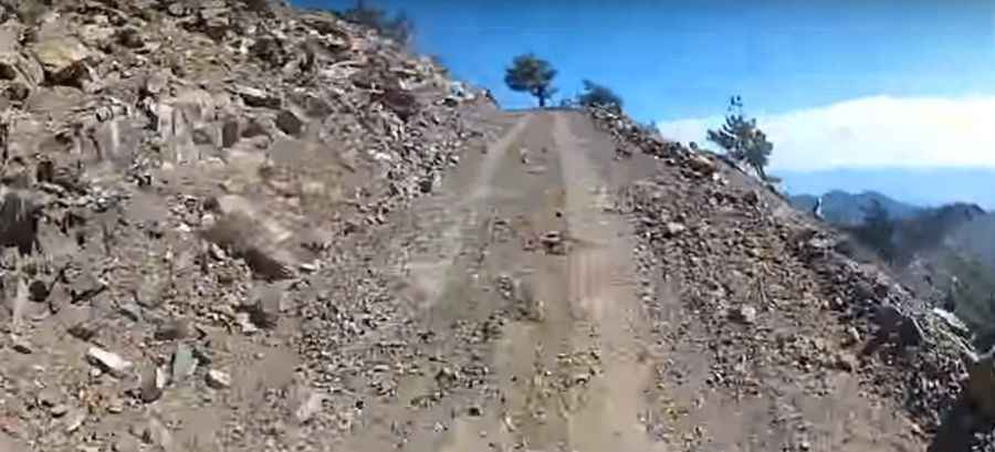
The rough road is totally unpaved and challenging. It’s called Bully Choop Mountain Road. A 4x4 vehicle is required. It is 1.93 km (1.2 miles) long, starting from E County Line Road.
Is the road to Bully Choop Mountain scary?
The road is not recommended, as it can be unnerving for most drivers. It’s narrow and has a dangerous drop. On narrow parts, if you encounter another vehicle, you’ll need to find a wide spot for one of you to pull over.
Pic&video: tiz20032