The Wild Road to Tesuque Peak in New Mexico
Tesuque Peak is a high mountain peak at an elevation of 3,678m (12,066ft) above sea level, located in Santa Fe County, in the U.S. state of New Mexico. It’s one of the highest roads in New Mexico. The road to the summit is currently closed to private vehicles, blocked with a barrier.
Where is Tesuque Peak?
The peak is located north of Santa Fe, in the northern part of New Mexico, within Santa Fe National Forest, to the east of Ski Santa Fe resort.
What’s at the summit of Tesuque Peak?
The summit is crowned with an array of communication towers. It offers great views well out to Mt. Taylor, the Sandia Mountains, and the Jemez.
Is the road to Tesuque Peak unpaved?
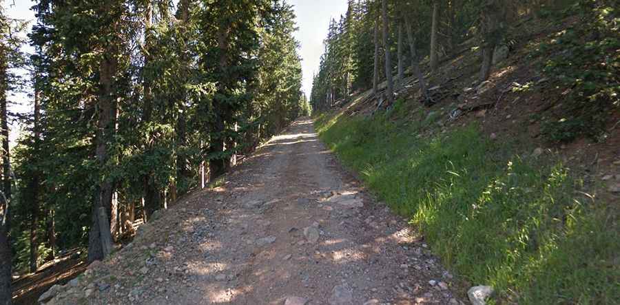
The forest service road to the summit is totally unpaved, with rocky parts. It’s called Tesuque Peak Road. It’s a steep, loose, and rowdy track, and a 4x4 vehicle is required. Stay alert for potential turnouts as you may meet traffic in inconvenient locations.
How long is the road to Tesuque Peak?
The road is very steep. Starting at the paved Hyde Park Road, the ascent is 5.6 miles (9km) long. Over this distance, the elevation gain is 631 meters. The average gradient is 7.01%, with some sections up to 10%.