A scenic and worthwhile drive to Antelope Pass in Idaho
Antelope Pass is a high mountain pass at an elevation of 2,726m (8,943ft) above sea level, located in Custer County, in the U.S. state of Idaho. It’s one of the highest roads in Idaho.
Where is Antelope Pass?
The pass is located west of Mackay, in the central part of Idaho, within the Sawtooth National Forest.
Is Antelope Pass unpaved?
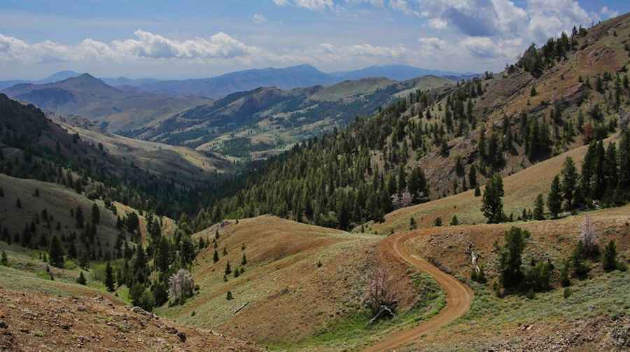
The road to the summit is totally unpaved. It’s called Cherry Creek Summit Road (Forest Road 135), also known as Challis National Forest Road 135. It’s a great road with no real challenges. However, a high-clearance 4WD vehicle is recommended as the road becomes somewhat rocky. The drive features steep sections, hitting a 13% maximum gradient through some of the ramps. Think twice about using this road after rainfall – four-wheel drive may be necessary.
How long is the road through Antelope Pass?
The pass road is 57.93km (36.0 miles) long, running from Forest Road 208 (Trail Creek Road) to Forest Road 137. Plan around 3 hours to complete the drive. You can make a day loop and wind up back in Sun Valley.
Is Antelope Pass open in winter?
Set high in the White Knob Mountains, the road to the summit is typically impassable in winter.
Road suggested by: John Emery
Pic: Greg Stringham