How to Get to Peak 8 in Colorado?
Peak 8 is a high mountain peak at an elevation of 3,712m (12,178ft) above sea level, located in Summit County, in the U.S. state of Colorado. It’s one of the highest roads in Colorado.
Where is Peak 8?
The peak is located south of Frisco, in the central part of Colorado.
Why is There a Trail to the Summit of Peak 8?
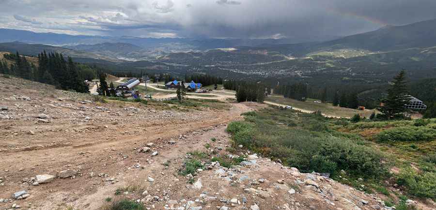
The trail to the summit is a chairlift access road for the Breckenridge Ski Area. It is primarily used to provide access for ski lift and lodge maintenance.
How Challenging is the Trail to Peak 8?
The road to the summit is entirely unpaved and extremely challenging, with brutally steep sections. Only 4x4 vehicles can handle the climb due to its intense gradient. The final stretch is especially intimidating, as it rises well above the timberline and remains very narrow. The trail is only open during the months when skiing is not available.
How Long is the Trail to Peak 8?
Set high in the Rocky Mountains’ Tenmile Range, the road to the summit is 4.66km (2.9 miles) long, starting from Breckenridge. Over this distance, the elevation gain is 786m, with an average gradient of 16.86%.
Pic: Jack Piephoff