The breathtaking road to Rocky Bottom Lake in California
Rocky Bottom Lake is a high mountain lake at an elevation of 3,280m (10,761ft) above sea level, located in Inyo County, in the U.S. state of California. It’s one of the highest roads in California.
Where is Rocky Bottom Lake?
The lake is situated southwest of Bishop, west of Funnel Lake, in the eastern central part of California, within the Inyo National Forest. It is well known for its abundance of fish.
Is the Road to Rocky Bottom Lake Unpaved?
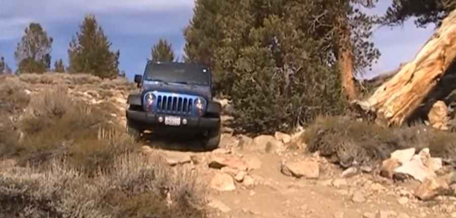
The road to the summit is completely unpaved and is known as the Coyote Flat 4×4 Trail. The trail is not suitable for larger vehicles. Only attempt the road with a high-clearance, four-wheel-drive vehicle, equipped with slightly deflated tires, a spare wheel, and a proper height to navigate the rough terrain.
How Long is the Road to Rocky Bottom Lake?
The road to the lake is very steep. Starting from Bishop, it stretches 25.42km (15.8 miles) with an elevation gain of 1,949 meters (6,394ft). The average gradient is 7.66%.
Is the Road to Rocky Bottom Lake Open in Winter?
Set high in the Eastern Sierras, the road is completely impassable during winter. The drive offers stunning views, frozen snow drifts, alpine vistas, and rolling meadows. Along the way, there are several abandoned mines.
How to Get to Brackett Prospect Mine?
A small, steep, unpaved mining road branches west, leading up to Brackett Prospect, at an elevation of 3,368m (11,049ft) above sea level.
Pic&video: mksracing