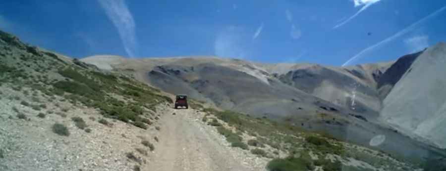
An old mining road to Mount Patterson in California
Mount Patterson is a high mountain peak at an elevation of 3,560m (11,679ft) above sea level, located in Mono County, in the U.S. state of California. It’s one of the highest roads in California.
Where is Mount Patterson?
The peak is located in the east-central portion of California, near the Nevada border, within the Toiyabe National Forest. The area is dotted with many mines that were active in the 1880s. The 360-degree views from the top are incredible.
Is the road to Mount Patterson unpaved?
Set high in the Sweetwater Mountains, the scenic road to the summit, with fantastic views, is totally unpaved. It’s pretty rough and requires using a 4WD vehicle. The road to the summit is an old mining road to Montague Mine Cabin.
Is Mount Patterson open?
The peak is accessible from July to October due to snow. The opening and closing dates all depend on snowmelt and snowfall each year. High winds blow here all year long. The higher you get, the more exposed you are to the wind.
How long is the road to Mount Patterson?
The road to the summit is very steep, hitting an 18% maximum gradient through some of the ramps. Starting at US395, the road is 25.7 km (15.96 miles) long. Over this distance, the elevation gain is 1,568 meters. The average gradient is 6.10%.
Pic: 4x4Husky