Driving through the lonely trail to Saint Sophia Ridge in Colorado
Saint Sophia Ridge is a high mountain ridge at an elevation of 3.829m (12,562ft) above sea level, located in Ouray County, in the U.S. state of Colorado. It’s one of the highest roads in Colorado.
Where is Saint Sophia Ridge?
The ridge is located at the head of Governor Basin, between Ouray and Telluride, in the southwestern part of Colorado.
What’s at the summit of Saint Sophia Ridge?
Near the summit are remnants of several abandoned old mining buildings. The views are spectacular. East of the summit, below Mendota Peak, a minor old mining road climbs up to 3.799m (12,463ft) above sea level (37.966950, -107.772151).
Is the road to Saint Sophia Ridge unpaved?
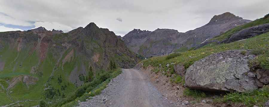
The road to the summit is totally unpaved. It is called Governor Basin Road. It’s an old mining road. The trail is narrow with few places for passing, so meeting someone can be a challenge. This trail is a treasure with no traffic and complete solitude. It is very steep, hitting a 17% maximum gradient through some of the ramps.
Can I drive my vehicle to Saint Sophia Ridge?
The road can be driven in many stock SUVs equipped with 4x4 and higher clearance. However, the road is continuously rocky and does present some degree of clearance challenges for stock SUVs.
Is the road to Saint Sophia Ridge open in winter?
Set high in the San Juan Mountains, the road is accessible from June to October. Keep an eye on the weather for thunderstorms and lightning.
How long is the road to Saint Sophia Ridge?
Starting from Yankee Boy Basin Road, the ascent is 5.6 km (3.47 miles) long. Over this distance, the elevation gain is 567 meters. The average gradient is 10.12%. It runs parallel to the iconic Million Dollar Highway.