Fish Lake Hightop: a truly outstanding 4x4 adventure in Utah
Fish Lake Hightop is a high mountain plateau at an elevation of 3,491m (11,453ft) above sea level, located in Sevier County, in the U.S. state of Utah. It’s one of the highest roads in Utah.
Where is Fish Lake Hightop?
The plateau is located north of Fish Lake, in central Utah, within the Fishlake National Forest. At this elevation, it’s said to be Sevier County’s highest point.
Is the road to Fish Lake Hightop unpaved?
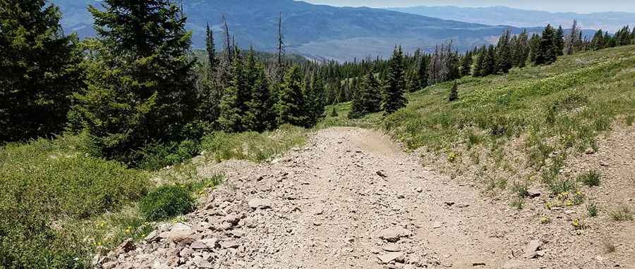
The road to the summit is completely unpaved, rough, rocky, and steep in places. It’s called Forest Road 325. A 4x4 vehicle with high clearance is required. You could easily get a flat tire on this track. The road is infrequently traveled.
How long is the road to Fish Lake Hightop?
Starting from Forest Road 352, the road to the summit is 5.79km (3.6 miles) long. Over this distance, the elevation gain is 299m, with an average gradient of 5.16%. You can park just below the summit rocks.
Is the road to Fish Lake Hightop open in winter?
At this elevation, the area experiences heavy snowfall in the winter, with snow occurring as late as June in any given year. It’s usually impassable from November through June.
Pic: Stephen Wasmund