Horseshoe Meadow is one of the highest roads of California
Horseshoe Meadow is a sub-alpine meadow at an elevation of 3,070m (10,072ft) above sea level, located in Inyo County, in the U.S. state of California. It’s one of the highest roads in California.
Where is Horseshoe Meadow?
The meadow is located in the central-eastern part of California, within the Inyo National Forest.
When was the road to Horseshoe Meadow built?
The road was planned in the 1920s and completed in 1967.
How long is Horseshoe Meadows Road in California?
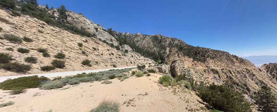
The road to the summit (former California State Route 190) has been fully paved since the 1980s. It’s called Horseshoe Meadows Road. Starting at Whitney Portal Road, it’s 35.40km (22 miles) long.
Is Horseshoe Meadows Road in California challenging?
This paved route climbs an extremely steep mountain face with a series of straights connected by sharp hairpin turns. It is a white-knuckle ride for sure. It’s rated as the second most difficult climb in California, with an average grade of 6.5%. This is a very rapid elevation change. Be advised. If you're not used to the change, it'll make you dizzy. The road constantly climbs with switchbacks, so be patient and keep your eyes on the road. Remember to use a low gear on the way down. Four-wheel drive will give you extra grip on the road. The area is prone to debris flows. Rocks are removed daily at 4:00 pm (that should give a hint to the nature of this road).
Is Horseshoe Meadows Road in California open?
Set high in the Eastern Sierra Nevada, southwest of Lone Pine, do not travel this road in severe weather conditions. The road is closed from approximately November to May due to snow.
How long does it take to drive Horseshoe Meadows Road in California?
Plan 45-60 minutes to complete the remarkable drive without stops, although you may want to block out extra time to stop, take photos, and explore the region it passes through. There are plenty of turnouts to get photos.
Pic: Gary Beckstrom