Thompson Peak
Thompson Peak is a high mountain peak at an elevation of 2.366m (7,762ft) above the sea level, located in Plumas County, in the Sierra Nevada of the U.S. state of California.
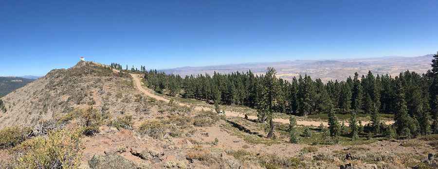
The road to the summit, located in the Diamond Mountains, a subrange of the great Sierra Nevada, is gravel, rocky, tippy and bumpy at times. It’s called National Forest System (NFS) Road 28N02A. The road is usually impassable from October to June (weather permitting). Great trail for experienced wheelers. Avoid driving in this area if unpaved mountain roads aren't your strong point. 4x4 vehicle required. Stay away if you're scared of heights. Expect a trail pretty steep. For your safety, be sure to check the weather forecast before you begin your trip. If there is a thunderstorm in the area, please do not visit a lookout. At the summit there’s a fire lookout built in 1931. It was built in 1931-32. The lookout was used during World War II for enemy plane spotting. Below the lookout is an abandoned building when the summit had a Gap-Filler Radar in the cold war era from 1960 to 1967.
Pic: Sierra Falkowski