The Ultimate Road Trip To Mestaa’Ėhehe Mountain
Mestaa’Ėhehe is a high mountain peak at an elevation of 3.493m (11,459ft) above the sea level, located in Clear Creek County, in the U.S. state of Colorado.
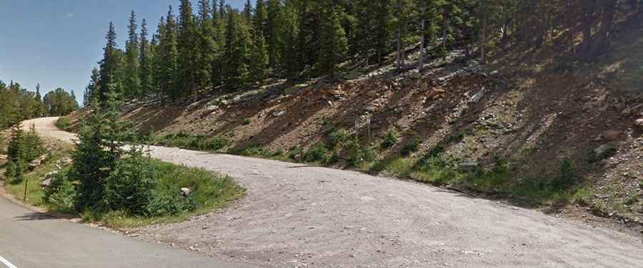
Located within the Arapaho National Forest, the summit, formerly known as Squaw Mountain, was renamed on 2021 as Mestaa’Ėhehe Mountain. The road to the summit is totally unpaved. It’s called Forest Service Road 192.1. A 4x4 vehicle is required.
The road to the summit is 2.89km (1.8 miles) long, starting at Mestaa’Ėhehe Road (formerly Squaw Pass Road), also known as Colorado State Highway 103. At the summit there is an array of communication towers, plus a two story stone lookout tower, built in 1925. The top provides 360 degree views of the Eastern Plains to the east, Pikes Peak to the south, Mt. Evans and the mountains of James Peak Wilderness to the west and the mountains of Indian Peaks Wilderness and Rocky Mountain National Park to the north. It’s among the highest lookout towers in the United States.
Located to the west of Mestaa’Ėhehe Pass (Squaw Pass), in the Front Range of the Rocky Mountains, the road is impassable in winters. Visitors should be prepared for high altitude conditions. Summertime temperatures average 70 degrees but can drop as low as 30 degrees at night or during the frequent summer afternoon thunderstorms. High winds frequently occur. For your safety, be sure to check the weather forecast before you begin your trip. If there is a thunderstorm in the area, please do not visit a lookout.