How to Get to Greens Peak in Arizona by Car?
Greens Peak is an extinct cinder-cone volcano at an elevation of 3,091m (10,141ft) above sea level, located in Apache County, in the U.S. state of Arizona. It's one of the highest roads in Arizona.

Where is Greens Peak?
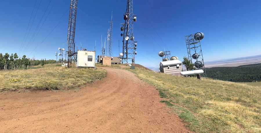
The peak is located in the northeast corner of Arizona, to the west of Springerville, within the Apache-Sitgreaves National Forests. The summit is crowned with radio towers and a lookout constructed in 1962, replacing an Aermotor MC24 lookout built in 1933. These towers are crucial for transmitting signals to mobile phones and other wireless devices. The fire lookout tower is also very active. The view from the summit is hard to beat.
Can I drive to Greens Peak?
The road to the summit is entirely unpaved. It’s called Forest Service Road 117 (Greens Peak Road). The drive requires a high-clearance, four-wheel-drive car.
How long is the road to Greens Peak?
The road to the summit is pretty steep. Starting at the paved Arizona State Route 260 (State Route 260), the ascent is 9.17km (5.7 miles) long. Over this distance, the elevation gain is 308 meters. The average gradient is 3.3%.
Is Greens Peak open in winters?
Set high in the White Mountains, in winters, access is severely restricted due to snow. Visitors should be prepared for high-altitude conditions. Summertime temperatures are very mild, averaging 70 degrees but can drop as low as 30 degrees at night or during the frequent summer afternoon thunderstorms. High winds frequently occur. In winter, this region gets considerable snow.
Pic: Joe Highley