Driving the road to Little Giant Peak in Colorado is not a piece of cake
Little Giant Peak is a high mountain peak at an elevation of 3,727 m (12,227 ft) above sea level, located in San Juan County, in the US state of Colorado. It’s one of the highest roads in Colorado.
Where is Little Giant Peak?
The peak is located to the east of Silverton, in the southwestern part of Colorado. Near the summit, there’s a very scenic alpine lake called Arrastra Gulch.
Is the road to Little Giant Peak unpaved?
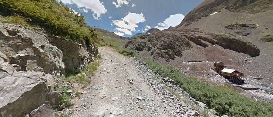
The road to the summit is totally unpaved: gravel and bumpy with embedded rocks. It’s an old mining road. There is evidence of mining all over Little Giant Peak. The road is precarious, offering the best in drop-offs and a boulder-lined roadbed. 4WD vehicles with high clearance only.
How long is the road to Little Giant Peak?
Starting from County Road 2 near Silverton, the road to the summit is 6.6 km (4.10 miles) long. Over this distance, the elevation gain is 812 m and the average gradient is 12.30%.
Is the road to Little Giant Peak open in winter?
Set high in the San Juan Mountains, the road is totally impassable in winter due to harsh conditions and snowfalls.