Discover the Beauty of Engineer Pass: Colorado's High Mountain Off-Road Adventure
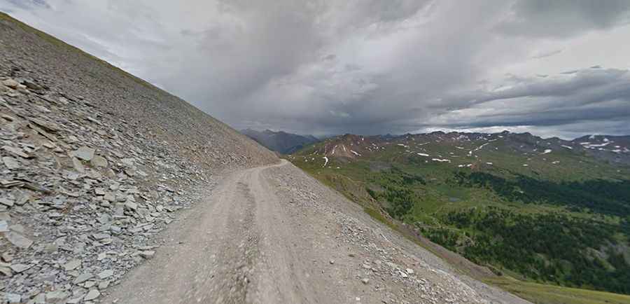
Engineer Pass is a high mountain pass at an elevation of 3,901m (12,800ft) above sea level, located in Ouray County, in the U.S. state of Colorado. It’s mostly a first-gear ride because the road is rough and rocky. It's one of the highest roads in Colorado.

Is the road to Engineer Pass paved?
The road to the summit is totally unpaved. It's called Engineer Pass Road or Ouray County Road 18. This trail, combined with Cinnamon Pass, constitutes the famous Alpine Loop. Engineer Pass begins four miles south of Ouray off U.S. 550 - Million Dollar Highway. The first two miles are the most rugged and difficult; portions of the road are extremely rocky. Novice four-wheelers should proceed cautiously.
Is the road to Engineer Pass dangerous?
The road to the top is recommended for high-clearance four-wheel-drive short-wheel-base vehicles and is really too narrow for a 4WD pickup truck. Most of the route is easy, but there are still a few narrow, steep places on the west side of the pass that will get your attention.
When was the road to Engineer Pass built?
Set high in the San Juan Mountains near Ouray, it’s said to be one of Colorado's most scenic off-road drives. The Russian-born engineer Otto Mears, famous for his construction of the Million Dollar Highway connecting Silverton to Ouray, is also credited for building the road known as Engineer Pass. Completed after 1877, this toll road was a major route connecting Silverton, Animas Forks, Ouray, and Lake City together.
Is the road to Engineer Pass open?
The road is usually open from late May to late October, but winter snows contribute to when you can access. This is a very high pass and should not be treated lightly. Don’t drive if snow-covered. Caution should be used at all times, especially in wet weather.
Is Engineer Pass worth it?
The drive is definitely worth it. There are many excellent photo opportunities here. At the summit, there are 360-degree panoramic views of 14,000 peaks. From this vantage point, the surrounding areas unfold, including Mt. Sneffels (14,150 ft.) to the west and Uncompahgre Peak (14,309 ft.) to the northeast. The extinct Lake City volcanic caldera, which the Alpine Loop encircles, lies to the east. It provides the adventurous off-roader an opportunity to see old mines, ghost towns, wildflowers, and scenic beauty that is truly epic. There is fishing, mountain climbing, hiking, camping, and much more. It is a trip into the past along a road used by miners and merchants over 100 years ago that you too can enjoy. Some of the highlights of this trail are the many mines, ghost towns, waterfalls, fishing, and incredible views. It is an exhilarating trip for drivers of all experience levels. There are many mines and points of historical interest along the route.