Road trip guide: Conquering the Harry Wade Road in Death Valley
Harry Wade Road is a very exciting desert drive located in Inyo County, in the U.S. state of California. The road leads visitors into the rugged and remote backcountry of Death Valley National Park. It’s one of the challenging backcountry roads in Death Valley National Park.
Where is the Harry Wade Road?
The road is located in the eastern central part of California, at the southern end of Death Valley National Park. This is a remote and seldom-traveled route — visitors must be well-prepared. It’s the possible route of the only Lost ‘49er pioneers to make it out of Death Valley with their wagons intact.
Is the Harry Wade Road Unpaved?
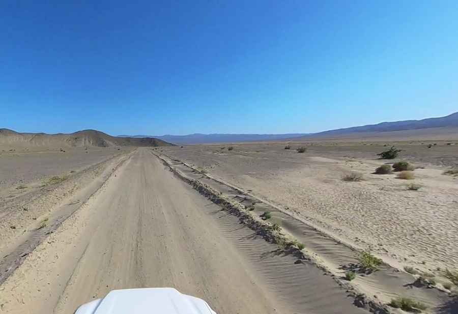
The rough road — following the Amargosa River — is totally unpaved. It switches between rocky terrain and soft sand. A high-clearance vehicle is needed most of the time, but 4WD is recommended when the Amargosa River is flowing. The drive offers some great scenery along the way. It is 50km (31 miles) long.
How to Cross the Amargosa River?
The road passes through the Amargosa River bed, which may present a 2-foot-deep water crossing when water is present. It can be impassable if there is deep water. Muddy areas develop quickly during times of heavy rainfall. There are some patches of sand, some mud at the river crossing, and lots of washboard throughout. Due to frequent flooding in the area, road conditions often vary throughout the park.
Pic: James Hatton