Pennock Pass is a great drive in Colorado
Pennock Pass is a high mountain pass at an elevation of 2,793m (9,163ft) above sea level, located in Larimer County, in the U.S. state of Colorado. The trail can often be very dusty.
How long is Pennock Pass?
The road to the summit is called Larimer County Road 44H, also known as Buckhorn Road. The pass is 46km (28.5 miles) long, running west-east from Pingree Park Road to Masonville.
Is the road to Pennock Pass in Colorado gravel?
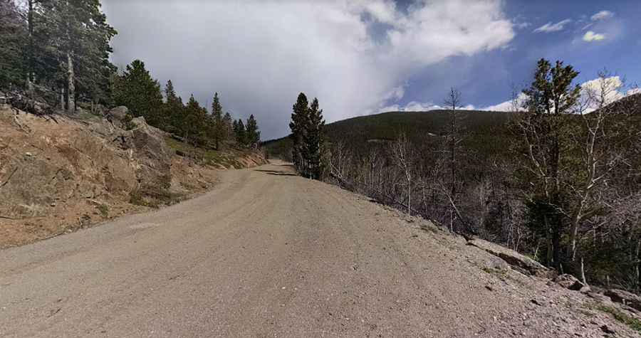
The road is maintained and generally passable by all vehicles. In inclement weather, 4WD or AWD vehicles are required. 32mm (or wider) tires are strongly recommended. The climb is gradual, the road is well-maintained, and punctuated by sweeping switchbacks to the summit. The bottom part has some tight curves and looks like it was paved ages ago. Now the road is covered with a layer of loose gravel, but in places, the old pavement can be seen. Further up the road, it’s mostly gravel, and even further up, it’s mostly dirt. The road is pretty steep, hitting a maximum gradient of 9% through some of the ramps.
Is the road to Pennock Pass in Colorado open?
Set high in the Roosevelt National Forest, the road is not plowed in the winter months. It’s closed from December to mid-June if conditions allow. You may encounter trees that have fallen across the road.
Is Pennock Pass in Colorado worth it?
Located to the west of Fort Collins, the drive offers magnificent views of the Mummy Range and the Stormy Peaks. This twisty and maintained dirt road offers access to many trails and is a beautiful drive through the trees.
Pic: Sara Kammlade