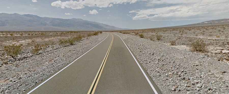
Driving the paved Scotty's Castle Road in Death Valley NP
Scotty's Castle Road is a scenic drive located in the desolate northern section of Death Valley National Park, in the US state of California, and it provides access to Scotty’s Castle historic house museum.

Where is Scotty's Castle Road?
The road, also known as Bonnie Claire Road, is hidden in the green oasis of Grapevine Canyon in the far northern part of Death Valley, in the eastern part of California, near the Nevada border.
What is Scotty's Castle?
Scotty's Castle (also known as Death Valley Ranch) is a two-story Spanish-colonial-revival-style villa.
How long is Scotty's Castle Road?
The road is fully paved. It’s 65.66km (40.8 miles) long, running north-south from CA-190 road to the Nevada border. The road leads to Ubehebe Crater Road. The drive out at sunrise is just as spectacular.
How remote is the drive on Scotty's Castle Road?
Death Valley is one of the hottest places in the world, with a record high temperature of 134°F (57°C). Visitors should drink plenty of water, avoid hiking in the heat, and stay on paved roads during summer. If your car breaks down, stay with it and carry extra water. No gasoline is available at Scotty's Castle. The nearest fuel is available at Stovepipe Wells (45 miles), Furnace Creek (53 miles), Beatty, Nevada (60 miles), and Tonopah, Nevada (88 miles). Symptoms such as dizziness, nausea, or headache require immediate shade and hydration. To avoid accidents, follow speed limits, use lower gears on steep grades, and wear seatbelts. Watch for rattlesnakes, scorpions, and spiders. Avoid canyons during rainstorms and be alert for water on roads. Hikers and backpackers must be self-reliant, carry detailed maps, and inform someone of their plans. Obtain a backcountry permit and dial 911 for emergencies, but don't rely on cell phones as coverage is limited.