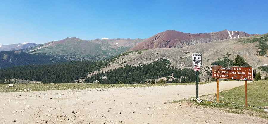
Georgia Pass is a long bumpy ride in the Rocky Mountains
Georgia Pass is a high mountain pass at an elevation of 3.535m (11,598ft) above sea level, located in the US state of Colorado. The entire route is very suitable for stock sport utility vehicles unless snow covered. It's one of the highest roads of Colorado.

Where is Georgia Pass?
The pass is located on the boundary between Summit and Jefferson counties, in the northern part of Colorado.
Can you drive Georgia Pass?
Set high in the Front Range of the Rocky Mountains of Colorado, the bumpy road to the summit is totally unpaved. It’s called Georgia Pass Road. The pass is 33.63km (20.9 miles) long running from Breckenridge (Summit County) to Jefferson (Park County).
Is Georgia Pass challenging?
From Jefferson to the top of the pass is easy and can actually be driven with a "regular" car, as long as it has some ground clearance but descending towards Breckenridge from the top it’s very challenging. The road can be muddy, rocky, and difficult to traverse. Only OHV or SUVs with significant clearance should attempt to summit the pass. This road is narrow in places and sight is limited, so beware of other trail users. The average gradient is 6.2% and the maximum slope is 15.1%. Novice drivers will find it challenging. Be sure to put it in lower gears headed down to save your brakes.
Is Georgia Pass open?
Tucked away in the White River National Forest, accessibility is largely limited to the summer season. The road is usually closed to motor vehicles from November thru May. The trail may be impassable in the spring because of one wet area on the upper north side. A road that heads east from the pass goes to high point at top of Glacier Peak and Whale Peak.
Is Georgia Pass worth it?
This is a remarkable road trip. Remember to bring your camera. It has spectacular close up views of Mount Guyot, the Breckenridge mountains and the South Park plains. The scenery is beautiful but make sure your equipment is in good shape and you know what you are getting into. The route takes you through big pines, aspen forests, and alpine meadows, with plenty of panoramic vistas along the way. The views are pretty cool at the summit however it's a long bumpy ride. The summit is an open, grassy saddle with spectacular views of Mt. Guyot to the west. The pass was the most popular way to reach Breckenridge from the south in the early 1860s.
Pic: Rick D.