Road trip guide: Conquering Laurel Lake in California
Laurel Lake is a small backcountry sub-alpine lake at an elevation of 2,981m (9,780ft) above sea level, located in the U.S. state of California. It’s one of the highest roads in California.
Where is Laurel Lake in California?
The lake is located within the Inyo National Forest, in Mono County, in the east-central portion of California.
How long is the road to Laurel Lake?
The road to the lake is totally unpaved. It’s 14.32km (8.9 miles) long, starting off Highway 395, just outside Mammoth Lake. It’s called Laurel Lake Road (Sherwin Creek Road).
Is the road to Laurel Lake dangerous?
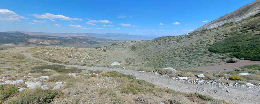
This historic mining road is a challenging but not overwhelming drive with breathtaking scenery. Inexperienced drivers may be intimidated by the potential for wheel slippage. Only sturdiest high-clearance 4x4 vehicles should attempt it. It’s a narrow, steep, and rocky shelf road. The road has severe washouts. Good visibility of the road ahead allows you to anticipate when passing will be necessary. The lower few miles of the path have mid-sized rocks that require a slow pace as the slight climb leaves the shrubland zone. After a while, the trail begins to smooth out as you enter Laurel Canyon. The path eventually leaves the first set of switchbacks and straightens out for a short distance. The portion that descends into the lake area has a few sharp switchbacks that require most long-wheelbase vehicles to do a multi-point turn along steep terrain. This section of the trail follows a shelf path that may be intimidating for some drivers and passengers. Pictures really don’t do the terrain justice. The trail will test the condition of your tires due to the nature of the loose sharp rock that’s found here. Not only can it puncture a tire, but the loose rock also provides limited grip as you travel. Your vehicle will produce a unique sound as it drives over this terrain. Most people hike the last section of the road.
Is the road to Laurel Lake open?
Set high on the east side of the Sierra Nevada mountain range, the road follows the east bank of Laurel Creek and tops out at 3,065m (10,058ft) above sea level. Due to its elevation, the trail is accessible only between April and November, weather permitting. Snow may block the upper portion of the trail well into July.
Is the road to Laurel Lake scenic?
The drive is definitely worth it. The views along the way are superb, making this trail a fine scenic route into the high country. Fall is a great time to visit when the trees are turning color, but springtime with its snow-covered peaks is also a beautiful time to explore this region. Provided you have a vehicle capable of driving this terrain, the short drive to Laurel Lakes is well worth the time and effort. There are primitive campsites near the lake, which contain rainbow trout and rare native goldens. Due to its location and length, this one-way trail can be done easily in a day, but because the lower section is very rocky and slow-going, adjust your schedule to arrive as early as possible. Besides, it’s easy to spend a good portion of the day shooting pictures alone. A day of fishing or just a picnic at Laurel Lakes rounds out the day nicely. At the crest of the trail, one of the few pullouts will provide an excellent view of the lake.
Road suggested by http://autoramblings.com/
Pic: Robert Stellhorn