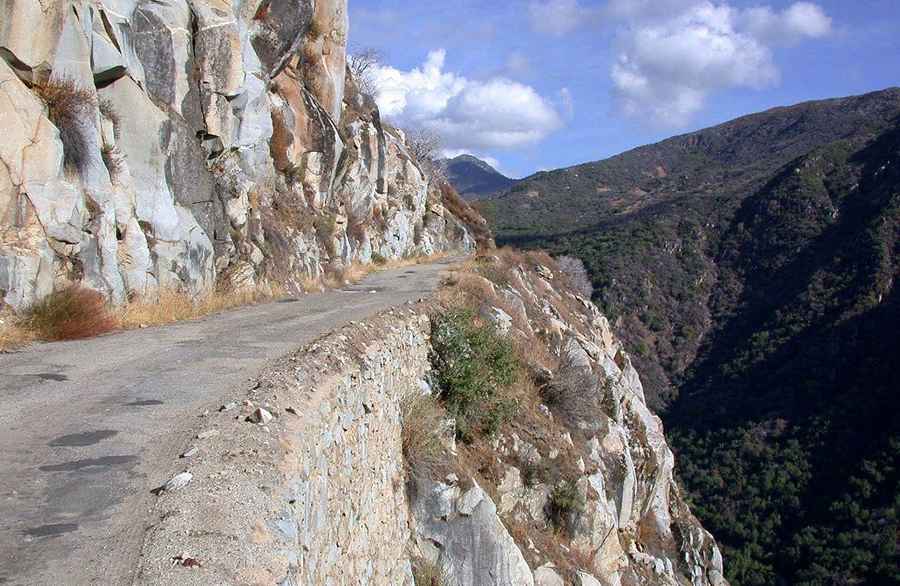
A road with an intimidating sheer cliff to Black Rock Reservoir in California
Black Rock Reservoir is a small remote yet scenic lake at an elevation of 1,260m (4,133 ft) above sea level, located in Fresno County, in the U.S. state of California.

Where is Black Rock Reservoir?
The reservoir is located at the outskirts of Kings Canyon National Park, on the edge of Sierra National Forest, in the central portion of California.
Can you drive to Black Rock Reservoir in California?
The paved road to the reservoir is not recommended for persons with nervous conditions. It’s called Black Rock Road, and it’s 17km (11 miles) long. From Fresno, go 47 miles east on CA 180, to Piedra Road, then 17 miles on Trimmer Springs Road to the split at the bridge that crosses the river to Balch Camp. Follow Black Rock Road through the PG&E facility and continue on to Black Rock Reservoir.
Is the road to Black Rock Reservoir dangerous?
It is a hairy drive, not for the sissies. It’s a one-lane cliff-hugging road, extremely narrow as it winds along cliff faces with 1000' drops with narrow single-lane wooden bridges. Not recommended for RVs. It’s very risky for people afraid of heights. This road is a single narrow pathway and one that would require backing up if another vehicle is approaching from the opposite direction. There are no guardrails, and it's a long trip to the bottom. Another hazard is the possibility of debris or ice breaking off the cliffs and damaging your vehicle. The road climbs along a sheer cliff that might be intimidating to some people.
Is the road to Black Rock Reservoir remote?
The area is very remote. There is no cell phone service at all. This is bear country, and there are raccoon problems. Please store food properly and do not feed the animals. Bring mosquito repellent. Fuel can be purchased east of Fresno along Highway 180 north of Sanger when entering from the Fresno area. Prather and Shaver Lake also have facilities for food and fuel.
When is the best time to drive to Black Rock Reservoir?
By far, one of the most scenic times to travel this road is late winter or early springtime. The flower bloom can be quite beautiful, and there are a couple of waterfalls worth viewing. The paved road ends at the reservoir, where a small campground is located at an altitude of 4,000 feet.
Is the road to Black Rock Reservoir open?
This road is usually open all year round, but it can be closed anytime when access is not cleared of snow. Sierra storms hit this 4,000' elevation lake - mostly in winter months. It's maintained yearly. Although passable during winter, it’s best to avoid traveling if snow is present.
Road suggested by autoramblings.com