Aztec Peak is a road to the highest point of Sierra Anchas
Aztec Peak is a high mountain peak at an elevation of 2,361m (7,746ft) above sea level, located in Gila County, in the U.S. state of Arizona.
Where is Aztec Peak?
The peak is located in the central part of Arizona, within the Tonto National Forest. The summit is the highest point of the Sierra Anchas.
Is the road to Aztec Peak unpaved?
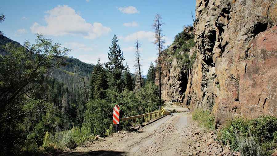
The road to the summit is entirely unpaved. It’s called Forest Service Road 487, also known as Workman Creek Road. It starts off Arizona 288-Globe Young Highway.
Is the road to Aztec Peak open?
This road above the Falls Recreation Site is usually closed annually from December 15 to March 31, depending on snowfall. The open and close dates all depend on snowmelt and snowfall each year.
How challenging is the road to Aztec Peak?
The trail should not be attempted without a high-clearance, four-wheel-drive vehicle. Once past the waterfall, Forest Service Road 487 is steep, narrow, and scary for those afraid of heights. The last part of the climb is a single-track forest road, steep, and a little rocky in segments. If the gate isn’t closed, you can drive all the way to the summit.
Are the mines near Aztec Peak dangerous?
The area contains naturally occurring uranium and radium-266. There’s a danger of low-level radiation poisoning. DO NOT enter any of the mines in the area. Many of these mines have radiation levels that would be enough to recommend that you "evacuate" the area.
Is the road to Aztec Peak scenic?
Tucked away in the Salome Wilderness, the summit hosts a U.S. Forest Service fire lookout erected in 1956. The 360-degree view at the summit is quite dramatic, with a panoramic view that stretches more than 100 miles in every direction.
Pic: Fanie D